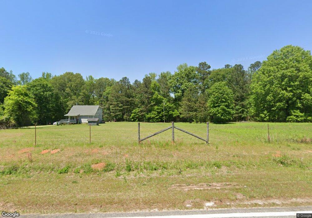
478 Philip Weldon Rd Griffin, GA 30224
Estimated Value: $277,000 - $563,000
2
Beds
2
Baths
1,687
Sq Ft
$249/Sq Ft
Est. Value
About This Home
This home is located at 478 Philip Weldon Rd, Griffin, GA 30224 and is currently estimated at $420,000, approximately $248 per square foot. 478 Philip Weldon Rd is a home with nearby schools including Lamar County Primary School, Lamar County Elementary School, and Lamar County Middle School.
Ownership History
Date
Name
Owned For
Owner Type
Purchase Details
Closed on
Jul 1, 2001
Sold by
Thompson Wade E
Bought by
Johnson Russell H
Current Estimated Value
Purchase Details
Closed on
Nov 1, 1996
Sold by
Cooper Brian D
Bought by
Thompson Wade E
Purchase Details
Closed on
Sep 22, 1994
Bought by
Cooper Brian D
Create a Home Valuation Report for This Property
The Home Valuation Report is an in-depth analysis detailing your home's value as well as a comparison with similar homes in the area
Home Values in the Area
Average Home Value in this Area
Purchase History
| Date | Buyer | Sale Price | Title Company |
|---|---|---|---|
| Johnson Russell H | $80,000 | -- | |
| Thompson Wade E | $80,000 | -- | |
| Cooper Brian D | $77,000 | -- |
Source: Public Records
Tax History Compared to Growth
Tax History
| Year | Tax Paid | Tax Assessment Tax Assessment Total Assessment is a certain percentage of the fair market value that is determined by local assessors to be the total taxable value of land and additions on the property. | Land | Improvement |
|---|---|---|---|---|
| 2025 | $2,109 | $97,625 | $21,346 | $76,279 |
| 2024 | $2,109 | $82,411 | $21,346 | $61,065 |
| 2023 | $2,132 | $77,246 | $21,346 | $55,900 |
| 2022 | $1,783 | $64,586 | $14,016 | $50,570 |
| 2021 | $1,605 | $53,380 | $14,016 | $39,364 |
| 2020 | $1,535 | $43,708 | $11,418 | $32,290 |
| 2019 | $1,242 | $39,135 | $11,418 | $27,717 |
| 2018 | $1,193 | $39,135 | $11,418 | $27,717 |
| 2017 | $1,186 | $39,135 | $11,418 | $27,717 |
| 2016 | $1,186 | $39,135 | $11,418 | $27,717 |
| 2015 | $1,185 | $39,134 | $11,418 | $27,717 |
| 2014 | $1,149 | $39,134 | $11,418 | $27,717 |
| 2013 | -- | $39,736 | $12,020 | $27,716 |
Source: Public Records
Map
Nearby Homes
- 1250 County Line Rd
- 1050 County Line Rd Unit 10.75AC
- 2173 S Mcdonough Rd
- 1887 Green Valley Rd
- 93 Green Acres Rd
- 321 Ridgeway Rd
- 25 Quail Hollow Rd
- 55 Partridge Path
- 676 Lake Park North Dr
- 1226 Knowles Aly
- 1693 S Mcdonough Rd
- 850 County Line Rd
- 1967 Futral Rd
- 0 Trice Rd Unit 10284703
- 1002 Farmington Rd Unit LOT 30
- 305 Liberty Bell Ln
- 275 Liberty Bell Ln
- 402 Tom Bell Rd
- 100 Liberty Bell Ln
- 131 Townsend Ct
- 142 Cain Cir Unit 20
- 142 Cain Cir
- 158 Cain Cir
- 154 Cain Cir
- 166 Cain Cir
- 508 Phillip Weldon Rd
- 136 Cain Cir
- 487 Phillip Weldon Rd
- 120 Cain Cir
- 149 Cain Cir
- 169 Cain Cir
- 139 Cain Cir
- 123 Cain Cir
- 535 Phillip Weldon Rd
- 0 Cain Cir Unit 7553024
- 111 Cain Cir
- 880 Woodard Rd
- 154 Pine Ridge Rd
- 392 Philip Weldon Rd
- 392 Phillip Weldon Rd