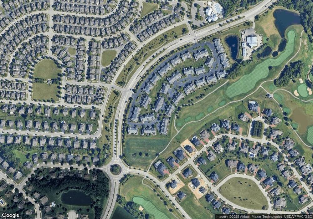
4780 Saint Andrews Dr Unit 224780 Grove City, OH 43123
Estimated Value: $447,000 - $550,000
3
Beds
3
Baths
2,221
Sq Ft
$227/Sq Ft
Est. Value
About This Home
This home is located at 4780 Saint Andrews Dr Unit 224780, Grove City, OH 43123 and is currently estimated at $504,149, approximately $226 per square foot. 4780 Saint Andrews Dr Unit 224780 is a home located in Franklin County with nearby schools including Monterey Elementary School, Park Street Intermediate School, and Jackson Middle School.
Ownership History
Date
Name
Owned For
Owner Type
Purchase Details
Closed on
Aug 12, 2013
Sold by
Leasure Gary L
Bought by
Leasure Gary L and The Gary L Leasure Living Trus
Current Estimated Value
Purchase Details
Closed on
Aug 17, 2010
Sold by
Barnhart Clyde R and Barnhart Carol J
Bought by
Leasure Gary L
Home Financials for this Owner
Home Financials are based on the most recent Mortgage that was taken out on this home.
Original Mortgage
$197,500
Interest Rate
5.62%
Mortgage Type
New Conventional
Purchase Details
Closed on
Jul 7, 2009
Sold by
The Mews At Pinnacle Club Llc
Bought by
Barnhart Clyde R and Barnhart Carol J
Home Financials for this Owner
Home Financials are based on the most recent Mortgage that was taken out on this home.
Original Mortgage
$180,000
Interest Rate
4.94%
Mortgage Type
Purchase Money Mortgage
Create a Home Valuation Report for This Property
The Home Valuation Report is an in-depth analysis detailing your home's value as well as a comparison with similar homes in the area
Home Values in the Area
Average Home Value in this Area
Purchase History
| Date | Buyer | Sale Price | Title Company |
|---|---|---|---|
| Leasure Gary L | -- | None Available | |
| Leasure Gary L | $257,500 | Title First | |
| Barnhart Clyde R | $225,000 | Principle T |
Source: Public Records
Mortgage History
| Date | Status | Borrower | Loan Amount |
|---|---|---|---|
| Previous Owner | Leasure Gary L | $197,500 | |
| Previous Owner | Barnhart Clyde R | $180,000 |
Source: Public Records
Tax History Compared to Growth
Tax History
| Year | Tax Paid | Tax Assessment Tax Assessment Total Assessment is a certain percentage of the fair market value that is determined by local assessors to be the total taxable value of land and additions on the property. | Land | Improvement |
|---|---|---|---|---|
| 2024 | $7,644 | $165,700 | $31,510 | $134,190 |
| 2023 | $7,570 | $165,690 | $31,500 | $134,190 |
| 2022 | $8,223 | $134,410 | $21,780 | $112,630 |
| 2021 | $8,349 | $134,410 | $21,780 | $112,630 |
| 2020 | $8,317 | $134,410 | $21,780 | $112,630 |
| 2019 | $8,104 | $122,160 | $19,780 | $102,380 |
| 2018 | $7,844 | $134,690 | $19,780 | $114,910 |
| 2017 | $7,848 | $134,690 | $19,780 | $114,910 |
| 2016 | $6,820 | $95,560 | $14,780 | $80,780 |
| 2015 | $6,294 | $95,560 | $14,780 | $80,780 |
| 2014 | $6,298 | $95,560 | $14,780 | $80,780 |
| 2013 | $291 | $665 | $665 | $0 |
Source: Public Records
Map
Nearby Homes
- 4706 Saint Andrews Dr Unit 12
- 1744 Pinnacle Club Dr
- 4403 Pebble Beach Dr
- 4487 Pebble Beach Dr
- 1653 Hartig Dr
- 4558 Hirth Hill Rd E
- 1604 Pinnacle Club Dr
- 4562 Newport Loop E
- 1888 Iris Ct
- 4641 Grand Strand Dr
- 4653 Newport Loop W
- 2362 Berry Hill Dr
- 1603 Hampton Way
- 4526 Newport Loop E
- 1895 Sunridge Dr
- 1622 Linkhorn Dr
- 2053 Autumn Wind Dr
- Promenade Plan at The Courtyards at Mulberry Run
- Capri Plan at The Courtyards at Mulberry Run
- Palazzo Plan at The Courtyards at Mulberry Run
- 4780 St Andrews Dr
- 4784 Saint Andrews Dr
- 4784 Saint Andrews Dr Unit 22-478
- 4792 Saint Andrews Dr Unit 22-479
- 4792 Saint Andrews Dr
- 4710 Saint Andrews Dr
- 4758 Saint Andrews Dr
- 4754 Saint Andrews Dr
- 4706 Saint Andrews Dr Unit 12-470
- 4706 Saint Andrews Dr
- 4785 Saint Andrews Dr Unit 7-4785
- 4702 Saint Andrews Dr Unit 12-470
- 4702 Saint Andrews Dr
- 4789 Saint Andrews Dr Unit 74789
- 4777 Saint Andrews Dr Unit 8L
- 4777 Saint Andrews Dr Unit 8L
- 4750 Saint Andrews Dr
- 4720 Saint Andrews Dr
- 4720 St Andrews Dr
- 4773 Saint Andrews Dr
