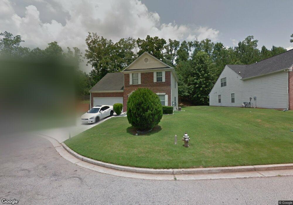
4782 Wilkins Station Dr Unit 1 Decatur, GA 30035
Southwest DeKalb NeighborhoodEstimated Value: $263,031 - $286,000
4
Beds
3
Baths
1,903
Sq Ft
$144/Sq Ft
Est. Value
About This Home
This home is located at 4782 Wilkins Station Dr Unit 1, Decatur, GA 30035 and is currently estimated at $273,258, approximately $143 per square foot. 4782 Wilkins Station Dr Unit 1 is a home located in DeKalb County with nearby schools including Flat Rock Elementary School, Miller Grove Middle School, and Miller Grove High School.
Ownership History
Date
Name
Owned For
Owner Type
Purchase Details
Closed on
Jun 13, 2023
Sold by
Smith Donovan E
Bought by
Capital Hills Investors Llc
Current Estimated Value
Purchase Details
Closed on
Aug 18, 2000
Sold by
Choice Homes Inc
Bought by
Smith Donovan E
Home Financials for this Owner
Home Financials are based on the most recent Mortgage that was taken out on this home.
Original Mortgage
$125,875
Interest Rate
8.11%
Mortgage Type
New Conventional
Create a Home Valuation Report for This Property
The Home Valuation Report is an in-depth analysis detailing your home's value as well as a comparison with similar homes in the area
Home Values in the Area
Average Home Value in this Area
Purchase History
| Date | Buyer | Sale Price | Title Company |
|---|---|---|---|
| Capital Hills Investors Llc | $240,000 | -- | |
| Smith Donovan E | $132,800 | -- |
Source: Public Records
Mortgage History
| Date | Status | Borrower | Loan Amount |
|---|---|---|---|
| Previous Owner | Smith Donovan E | $125,875 |
Source: Public Records
Tax History Compared to Growth
Tax History
| Year | Tax Paid | Tax Assessment Tax Assessment Total Assessment is a certain percentage of the fair market value that is determined by local assessors to be the total taxable value of land and additions on the property. | Land | Improvement |
|---|---|---|---|---|
| 2024 | $5,295 | $111,520 | $16,000 | $95,520 |
| 2023 | $5,295 | $102,680 | $12,000 | $90,680 |
| 2022 | $2,760 | $97,120 | $5,320 | $91,800 |
| 2021 | $2,076 | $67,480 | $5,320 | $62,160 |
| 2020 | $1,922 | $60,600 | $5,320 | $55,280 |
| 2019 | $1,791 | $55,720 | $5,320 | $50,400 |
| 2018 | $1,288 | $50,080 | $5,320 | $44,760 |
| 2017 | $1,257 | $38,040 | $5,326 | $32,714 |
| 2016 | $1,227 | $38,040 | $5,326 | $32,714 |
| 2014 | $932 | $29,440 | $5,320 | $24,120 |
Source: Public Records
Map
Nearby Homes
- 2183 Ramblewood Cir
- 4839 Plymouth Trace Unit 2
- 4890 Wilkins Station Dr
- 2333 Wilkins Cove
- 2329 Wilkins Cove
- 4783 Creekside Place
- 2306 Ramblewood Cir
- 4827 Snap Creek Ln
- 2290 Wilkins Cove
- 4915 Truitt Ln Unit 2
- 2240 Creekside View
- 2332 Wilkins Ct Unit 1
- 2322 Wilkins Ct
- 4907 Windsor Downs Dr
- 4913 Windsor Downs Dr
- 5180 Galleon Crossing
- 2461 Terrace Trail
- 4969 Truitt Ln Unit 1
- 4788 Wilkins Station Dr Unit I
- 4776 Wilkins Station Dr Unit 1
- 4794 Wilkins Station Dr
- 4772 Wilkins Station Dr Unit 1
- 4800 Wilkins Station Dr Unit 1
- 4811 Haymarket Trail Unit 3
- 4807 Haymarket Trail Unit 4
- 4815 Haymarket Trail Unit 3
- 4801 Haymarket Trail Unit 4
- 4781 Wilkins Station Dr
- 4821 Haymarket Trail
- 4806 Wilkins Station Dr
- 4806 Wilkins Station Dr
- 4801 Wilkins Station Dr Unit I
- 4789 Wilkins Station Dr
- 4799 Haymarket Trail
- 4825 Haymarket Trail
- 4812 Wilkins Station Dr
- 4807 Wilkins Station Dr
- 4831 Haymarket Trail