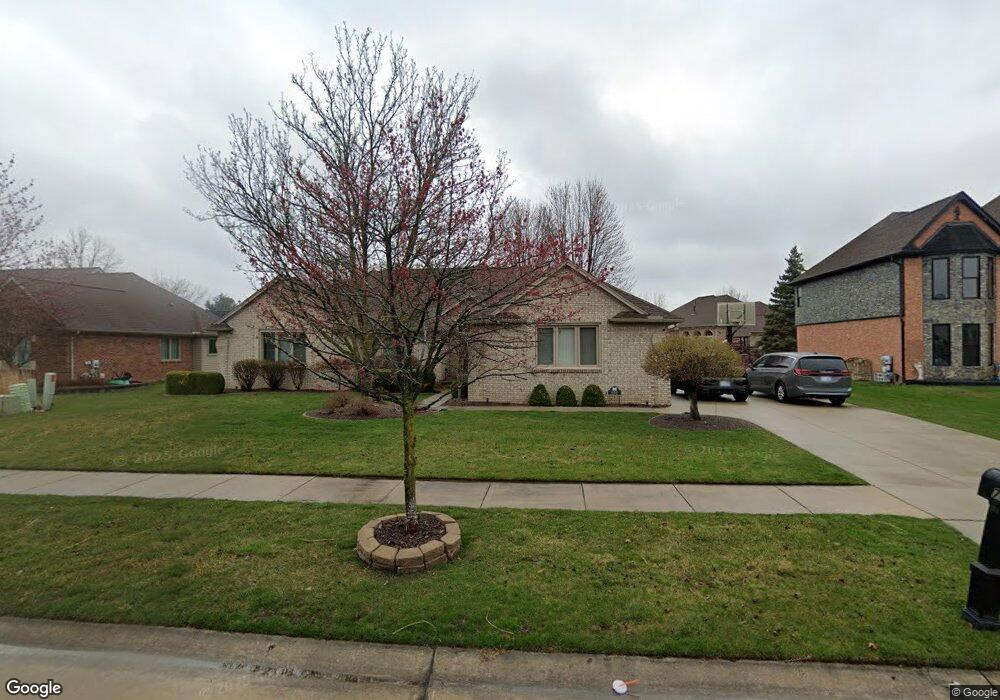
47835 Robins Nest Dr Shelby Township, MI 48315
Estimated Value: $446,585 - $502,000
3
Beds
3
Baths
2,129
Sq Ft
$222/Sq Ft
Est. Value
About This Home
This home is located at 47835 Robins Nest Dr, Shelby Township, MI 48315 and is currently estimated at $473,646, approximately $222 per square foot. 47835 Robins Nest Dr is a home located in Macomb County with nearby schools including Browning Elementary School, Bemis Junior High School, and Henry Ford II High School.
Ownership History
Date
Name
Owned For
Owner Type
Purchase Details
Closed on
Oct 30, 2020
Sold by
Pordon Anthony R and Pordon Heather M
Bought by
Pordon Anthony R and Pordon Heather M
Current Estimated Value
Purchase Details
Closed on
Dec 16, 2010
Sold by
Liv Pordon Anthony R and Liv Anthony R Pordon Revocable
Bought by
Pordon Anthony R
Purchase Details
Closed on
Sep 23, 2002
Sold by
Pordon Anthony R
Bought by
Pordon Anthony R Trust
Purchase Details
Closed on
Nov 30, 1998
Sold by
Victoria Homes Developme
Bought by
Pordon Anthony R
Create a Home Valuation Report for This Property
The Home Valuation Report is an in-depth analysis detailing your home's value as well as a comparison with similar homes in the area
Home Values in the Area
Average Home Value in this Area
Purchase History
| Date | Buyer | Sale Price | Title Company |
|---|---|---|---|
| Pordon Anthony R | -- | None Available | |
| Pordon Anthony R | -- | None Available | |
| Pordon Anthony R | -- | First American Title Insuran | |
| Pordon Anthony R Trust | -- | -- | |
| Pordon Anthony R | $218,000 | -- |
Source: Public Records
Tax History Compared to Growth
Tax History
| Year | Tax Paid | Tax Assessment Tax Assessment Total Assessment is a certain percentage of the fair market value that is determined by local assessors to be the total taxable value of land and additions on the property. | Land | Improvement |
|---|---|---|---|---|
| 2025 | $4,383 | $216,800 | $0 | $0 |
| 2024 | $2,594 | $197,200 | $0 | $0 |
| 2023 | $2,457 | $182,200 | $0 | $0 |
| 2022 | $3,963 | $165,800 | $0 | $0 |
| 2021 | $3,855 | $157,600 | $0 | $0 |
| 2020 | $2,262 | $156,100 | $0 | $0 |
| 2019 | $3,529 | $147,900 | $0 | $0 |
| 2018 | $3,487 | $139,700 | $0 | $0 |
| 2017 | $3,424 | $137,700 | $34,200 | $103,500 |
| 2016 | $3,399 | $137,700 | $0 | $0 |
| 2015 | $3,350 | $127,300 | $0 | $0 |
| 2012 | -- | $0 | $0 | $0 |
Source: Public Records
Map
Nearby Homes
- 47630 Robins Nest Dr
- 14760 Ashton Ln
- 13808 Stone Falcon Dr
- 14930 Crofton Dr
- 14257 Mandarin Dr
- 14229 Mandarin Dr
- 14710 Palmetto Ct
- 14892 Carver Ct
- 47387 Royal Rd
- 15280 Valerie Dr
- 14890 Dover Ct Unit 80
- 15297 Spruce Dr
- 48535 Sugarbush Ct
- 47315 Royal Rd
- 48619 Sugarbush Ct Unit 282
- 48679 Aberdeen Ct
- 48459 Cheyenne Ct
- 47630 Barbara Rd
- 47550 Barbara Rd
- 14728 Kings Mill Dr
- 47857 Robins Nest Dr
- 47819 Robins Nest Dr
- 14748 Sparrow Dr
- 14689 Raven Ct
- 47812 Robins Nest Dr
- 47834 Robins Nest Dr
- 14710 Sparrow Dr
- 47790 Robins Nest Dr
- 14667 Raven Ct
- 14777 Sparrow Dr
- 14688 Sparrow Dr
- 14785 Sparrow Dr
- 47781 Robins Nest Dr
- 47729 Falcon Dr
- 14793 Sparrow Dr
- 47735 Falcon Dr
- 14799 Blue Jay Ct
- 14656 Sparrow Dr
- 47707 Falcon Dr
- 47746 Robins Nest Dr