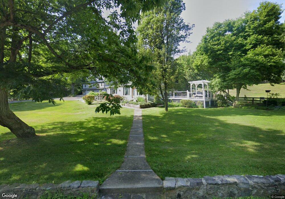
4785 S Mountain Dr Emmaus, PA 18049
Upper Milford Township NeighborhoodEstimated Value: $307,000 - $579,000
3
Beds
1
Bath
2,110
Sq Ft
$217/Sq Ft
Est. Value
About This Home
This home is located at 4785 S Mountain Dr, Emmaus, PA 18049 and is currently estimated at $457,599, approximately $216 per square foot. 4785 S Mountain Dr is a home located in Lehigh County with nearby schools including Lincoln Elementary School, Lower Macungie Middle School, and Emmaus High School.
Ownership History
Date
Name
Owned For
Owner Type
Purchase Details
Closed on
Oct 6, 1993
Sold by
Underkoffler Larry
Bought by
Underkoffler Larry J and Underkoffler Karen A
Current Estimated Value
Purchase Details
Closed on
Jun 11, 1993
Sold by
Gardner David F and Gardner Jacqueline E
Bought by
Underkoffler Larry
Purchase Details
Closed on
Jun 17, 1985
Sold by
Simonds William P and Simonds Rebekah A
Bought by
Gardner David F and Gardner Jacqueline E
Purchase Details
Closed on
Jun 1, 1982
Bought by
Simonds William P and Simonds Rebekah A
Create a Home Valuation Report for This Property
The Home Valuation Report is an in-depth analysis detailing your home's value as well as a comparison with similar homes in the area
Home Values in the Area
Average Home Value in this Area
Purchase History
| Date | Buyer | Sale Price | Title Company |
|---|---|---|---|
| Underkoffler Larry J | $102,000 | -- | |
| Underkoffler Larry | $127,900 | -- | |
| Gardner David F | $95,000 | -- | |
| Simonds William P | $75,000 | -- |
Source: Public Records
Tax History Compared to Growth
Tax History
| Year | Tax Paid | Tax Assessment Tax Assessment Total Assessment is a certain percentage of the fair market value that is determined by local assessors to be the total taxable value of land and additions on the property. | Land | Improvement |
|---|---|---|---|---|
| 2025 | $6,071 | $237,800 | $44,800 | $193,000 |
| 2024 | $5,802 | $237,800 | $44,800 | $193,000 |
| 2023 | $5,685 | $237,800 | $44,800 | $193,000 |
| 2022 | $5,549 | $237,800 | $193,000 | $44,800 |
| 2021 | $5,429 | $237,800 | $44,800 | $193,000 |
| 2020 | $5,377 | $237,800 | $44,800 | $193,000 |
| 2019 | $5,344 | $237,800 | $44,800 | $193,000 |
| 2018 | $5,207 | $237,800 | $44,800 | $193,000 |
| 2017 | $5,115 | $237,800 | $44,800 | $193,000 |
| 2016 | -- | $237,800 | $44,800 | $193,000 |
| 2015 | -- | $237,800 | $44,800 | $193,000 |
| 2014 | -- | $237,800 | $44,800 | $193,000 |
Source: Public Records
Map
Nearby Homes
- 97 Chestnut Hill Rd
- 339 Delong Ave Unit 343
- 521 Wood St
- 618 Broad St
- 659 Broad St
- 569 Chestnut St Unit 571
- 4160 Newport Dr
- 2571 Brunner Rd
- 657 Walnut St
- 4285 Taviston Ct E
- 4290 Taviston Ct E
- 4109 Eveningstar Rd
- 3430 Gentlewind Way Unit IC 109
- 4314 Taviston Ct E
- 4338 Taviston Ct E Unit Homesite 26
- 5065 Maple Ridge Way
- 5095 Maple Ridge Way Unit Homesite 13
- 4441 Taviston Ct E
- Helena Plan at The Estates at Maple Ridge - Estate Series
- Anderson Plan at The Estates at Maple Ridge - Estate Series
- 4784 S Mountain Dr
- 4758 S Mountain Dr
- 4745 S Mountain Dr
- 4802 S Mountain Dr
- 4826 S Mountain Dr
- 4811 S Mountain Dr
- 4732 S Mountain Dr
- 4862 S Mountain Dr
- 4706 S Mountain Dr
- 4701 S Mountain Dr
- 4886 S Mountain Dr
- 4678 S Mountain Dr
- 4650 S Mountain Dr
- 4951 S Mountain Dr
- 4615 S Mountain Dr
- 4894 S Mountain Dr
- 4888 S Mountain Dr
- 4892 S Mountain Dr
- 4981 S Mountain Dr
- 5232 S Mountain Dr