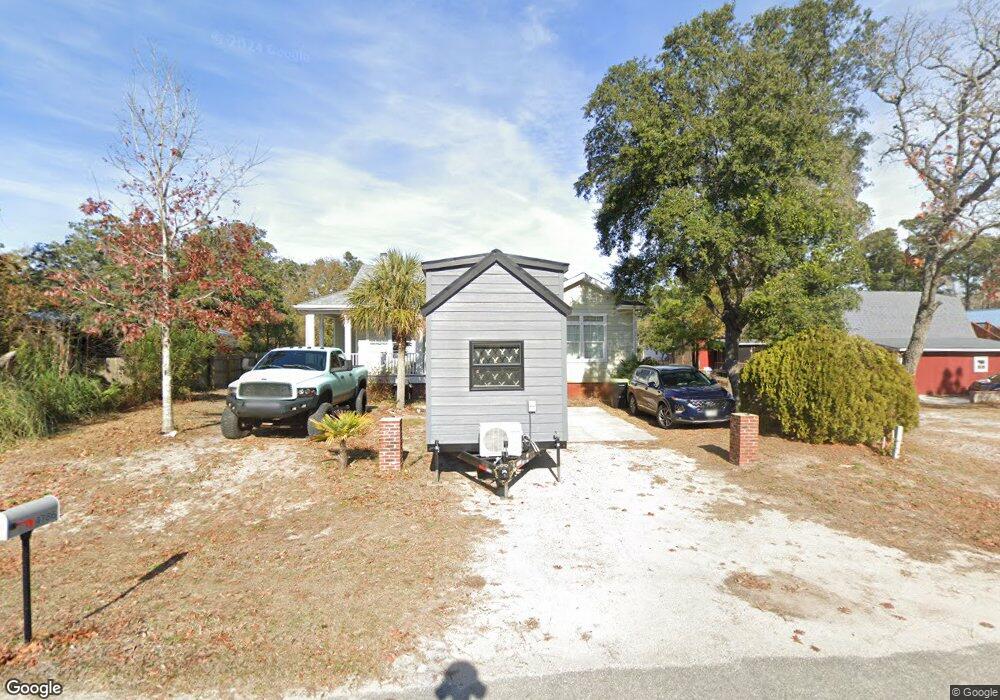
4786 Navigation Rd SE Southport, NC 28461
Estimated Value: $162,000 - $317,000
3
Beds
2
Baths
1,754
Sq Ft
$146/Sq Ft
Est. Value
About This Home
This home is located at 4786 Navigation Rd SE, Southport, NC 28461 and is currently estimated at $255,667, approximately $145 per square foot. 4786 Navigation Rd SE is a home located in Brunswick County with nearby schools including Southport Elementary School, South Brunswick Middle School, and South Brunswick High School.
Ownership History
Date
Name
Owned For
Owner Type
Purchase Details
Closed on
Apr 30, 2010
Sold by
Kirk Wanda R
Bought by
Kirk Wanda R and Mcgeehan James
Current Estimated Value
Home Financials for this Owner
Home Financials are based on the most recent Mortgage that was taken out on this home.
Original Mortgage
$143,467
Outstanding Balance
$97,097
Interest Rate
5.25%
Mortgage Type
FHA
Estimated Equity
$158,570
Purchase Details
Closed on
Oct 16, 2009
Sold by
Mullen Shawn B and Mcgeehan James
Bought by
Kirk Wanda
Purchase Details
Closed on
Jul 30, 2007
Sold by
Kirk Wanda and Mullen Shaw B
Bought by
Mullen Shawn B and Mcgeehan James
Purchase Details
Closed on
May 15, 2006
Sold by
Dannunzio Pamela Jane and Mcgeehan James
Bought by
Kirk Wanda and Mullen Shawn B
Create a Home Valuation Report for This Property
The Home Valuation Report is an in-depth analysis detailing your home's value as well as a comparison with similar homes in the area
Home Values in the Area
Average Home Value in this Area
Purchase History
| Date | Buyer | Sale Price | Title Company |
|---|---|---|---|
| Kirk Wanda R | -- | None Available | |
| Kirk Wanda | -- | None Available | |
| Mullen Shawn B | -- | None Available | |
| Kirk Wanda | -- | None Available |
Source: Public Records
Mortgage History
| Date | Status | Borrower | Loan Amount |
|---|---|---|---|
| Open | Kirk Wanda R | $143,467 |
Source: Public Records
Tax History Compared to Growth
Tax History
| Year | Tax Paid | Tax Assessment Tax Assessment Total Assessment is a certain percentage of the fair market value that is determined by local assessors to be the total taxable value of land and additions on the property. | Land | Improvement |
|---|---|---|---|---|
| 2025 | -- | $276,250 | $27,000 | $249,250 |
| 2024 | $1,255 | $276,250 | $27,000 | $249,250 |
| 2023 | $1,088 | $276,250 | $27,000 | $249,250 |
| 2022 | $1,088 | $169,120 | $20,000 | $149,120 |
| 2021 | $1,025 | $169,120 | $20,000 | $149,120 |
| 2020 | $1,025 | $169,120 | $20,000 | $149,120 |
| 2019 | $1,025 | $21,630 | $20,000 | $1,630 |
| 2018 | $923 | $9,910 | $8,000 | $1,910 |
| 2017 | $911 | $9,910 | $8,000 | $1,910 |
| 2016 | $886 | $9,910 | $8,000 | $1,910 |
| 2015 | $886 | $149,690 | $8,000 | $141,690 |
| 2014 | $837 | $152,804 | $16,000 | $136,804 |
Source: Public Records
Map
Nearby Homes
- 4243 Mainsail St SE
- 4353 Frying Pan Rd SE
- 4463 Maritime Oak Dr SE
- 4391 Frying Pan Rd SE
- 4231 Cherry Laurel Dr SE
- 4224 Cherry Laurel Ln SE
- 4226 Cherry Laurel Ln SE
- 4277 Cherry Laurel Ln SE
- 4238 Cherry Laurel Dr
- 4613 Oakcrest Dr SE
- 4135 9th St SE
- 4175 9th St SE
- 4148 S Harbor Cir SE Unit 1
- 4482 Frying Pan Rd SE
- 4504 Sea Pines Dr SE
- 4171 Cambridge Cove Cir SE Unit 2
- 4172 Cambridge Cove Cir SE Unit 1
- 4178 Cambridge Cove Cir SE Unit 2
- 4164 Cambridge Cove Cir Unit 1
- 4158 Cambridge Cove Cir SE Unit 4
- 4782 Navigation
- 4215 SE Jib St SE
- 4260 Flagship Ave SE
- 4787 Navigation Rd SE
- 4210 Jib St SE
- 4214 Jib St SE
- 4269 Flagship Ave SE
- 4767 Navigation Rd SE
- 4283 Flagship Ave SE
- 4238 Mainsail St SE
- 4239 Main Sail SE
- 4759 Navigation Rd SE
- 4225 Main Sail Dr SE
- 4755 Navigation Rd SE
- 4229 Main Sail SE
- 4310 Frying Pan Rd SE
- 4314 Frying Pan Rd SE
- 4234 S Wax Myrtle Dr
- 4234 Wax Myrtle Ct SE
- 4228 S Wax Myrtle Dr
