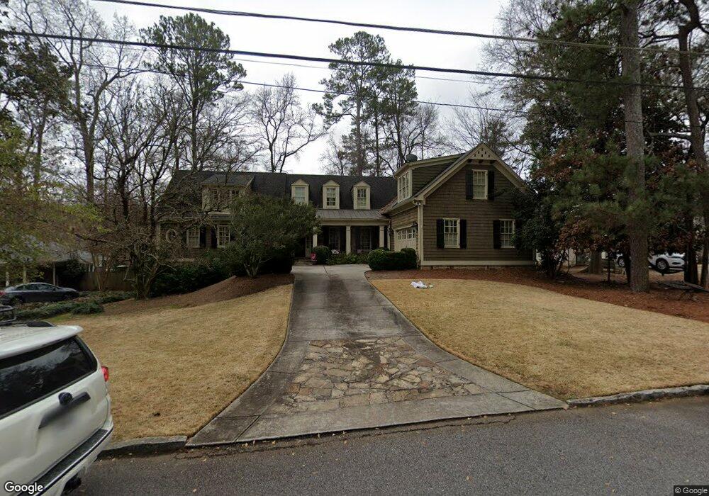
479 Brookfield Dr NE Atlanta, GA 30342
Sandy Springs ITP NeighborhoodEstimated Value: $1,491,000 - $1,848,000
5
Beds
6
Baths
3,531
Sq Ft
$476/Sq Ft
Est. Value
About This Home
This home is located at 479 Brookfield Dr NE, Atlanta, GA 30342 and is currently estimated at $1,681,020, approximately $476 per square foot. 479 Brookfield Dr NE is a home located in Fulton County with nearby schools including High Point Elementary School, Ridgeview Charter School, and Riverwood International Charter School.
Ownership History
Date
Name
Owned For
Owner Type
Purchase Details
Closed on
May 27, 1998
Sold by
Dun Rankin Jane W
Bought by
Ingham Kevin M and Ingham Michelle A
Current Estimated Value
Home Financials for this Owner
Home Financials are based on the most recent Mortgage that was taken out on this home.
Original Mortgage
$196,150
Outstanding Balance
$39,548
Interest Rate
7.14%
Mortgage Type
New Conventional
Estimated Equity
$1,641,472
Create a Home Valuation Report for This Property
The Home Valuation Report is an in-depth analysis detailing your home's value as well as a comparison with similar homes in the area
Home Values in the Area
Average Home Value in this Area
Purchase History
| Date | Buyer | Sale Price | Title Company |
|---|---|---|---|
| Ingham Kevin M | $245,200 | -- |
Source: Public Records
Mortgage History
| Date | Status | Borrower | Loan Amount |
|---|---|---|---|
| Open | Ingham Kevin M | $196,150 |
Source: Public Records
Tax History Compared to Growth
Tax History
| Year | Tax Paid | Tax Assessment Tax Assessment Total Assessment is a certain percentage of the fair market value that is determined by local assessors to be the total taxable value of land and additions on the property. | Land | Improvement |
|---|---|---|---|---|
| 2025 | $14,847 | $700,240 | $95,240 | $605,000 |
| 2023 | $17,648 | $602,400 | $87,360 | $515,040 |
| 2022 | $13,659 | $564,640 | $72,640 | $492,000 |
| 2021 | $13,932 | $452,000 | $88,360 | $363,640 |
| 2020 | $14,080 | $452,000 | $88,360 | $363,640 |
| 2019 | $13,859 | $452,000 | $88,360 | $363,640 |
| 2018 | $13,937 | $440,000 | $80,640 | $359,360 |
| 2017 | $14,339 | $422,880 | $85,800 | $337,080 |
| 2016 | $14,342 | $422,880 | $85,800 | $337,080 |
| 2015 | $13,888 | $408,080 | $85,800 | $322,280 |
| 2014 | $13,324 | $376,560 | $79,160 | $297,400 |
Source: Public Records
Map
Nearby Homes
- 4715 Westfield Dr NE
- 560 Windsor Pkwy NE
- 590 Windsor Pkwy NE
- 4550 Jolyn Place NE
- 4455 Dandelion Ln
- 320 W Wieuca Rd NE
- 4810 Cherrywood Ln NE
- 329 W Wieuca Rd NE
- 333 W Wieuca Rd NE
- 4335 Parkside Place
- 4217 Wieuca Overlook NE
- 4330 Parkside Place
- 4219 Deming Cir
- 4103 Township Pkwy
- 4620 Wieuca Rd NE Unit 57
- 4620 Wieuca Rd NE Unit 23
- 121 Chestnut Cir
- 183 Chestnut Cir
- 350 Mystic Ridge Ln
- 193 Chestnut Cir NE Unit 38
- 489 Brookfield Dr NE
- 469 Brookfield Dr NE
- 490 Pine Forest Rd NE Unit 4
- 480 Pine Forest Rd NE
- 463 Brookfield Dr NE
- 549 Broadview Place NE Unit 39
- 463 Brookfield Dr
- 500 Pine Forest Rd NE
- 501 Brookfield Dr NE
- 459 Brookfield Dr NE Unit 6292
- 459 Brookfield Dr NE
- 459 Brookfield Dr NE Unit 459
- 480 Brookfield Dr NE
- 490 Brookfield Dr NE
- 470 Brookfield Dr NE
- 455 Brookfield Dr NE
- 470 Pine Forest Rd NE
- 510 Pine Forest Rd NE Unit 7
- 500 Brookfield Dr NE
- 460 Brookfield Dr NE