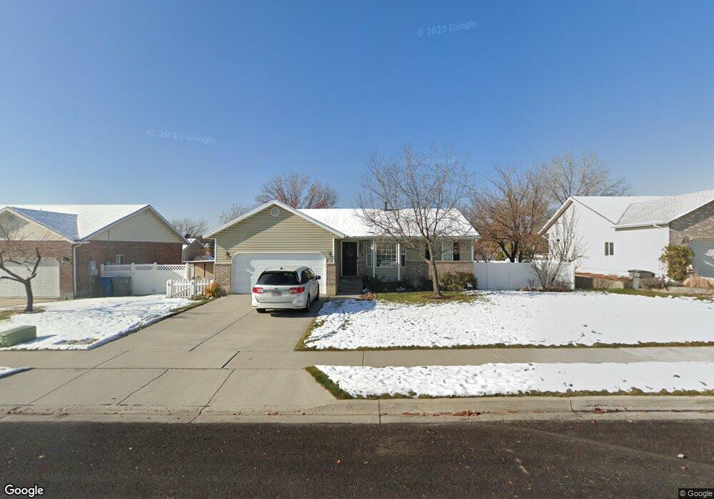
479 N 400 W American Fork, UT 84003
Estimated Value: $531,000 - $622,000
6
Beds
3
Baths
2,228
Sq Ft
$258/Sq Ft
Est. Value
About This Home
This home is located at 479 N 400 W, American Fork, UT 84003 and is currently estimated at $574,998, approximately $258 per square foot. 479 N 400 W is a home located in Utah County with nearby schools including Shelley Elementary School, American Fork Junior High School, and American Fork High School.
Ownership History
Date
Name
Owned For
Owner Type
Purchase Details
Closed on
Jun 25, 2024
Sold by
Morgan Michael D and Morgan Bridget L
Bought by
J Lc
Current Estimated Value
Purchase Details
Closed on
Feb 16, 2012
Sold by
Cornia Spence E and Cornia Kristen
Bought by
Morgan Michael D and Morgan Bridget L
Home Financials for this Owner
Home Financials are based on the most recent Mortgage that was taken out on this home.
Original Mortgage
$159,900
Interest Rate
3.83%
Mortgage Type
New Conventional
Purchase Details
Closed on
Jun 24, 2005
Sold by
Patterson Chris L and Patterson Tamara L
Bought by
Cornia Spence E and Cornia Kristen
Home Financials for this Owner
Home Financials are based on the most recent Mortgage that was taken out on this home.
Original Mortgage
$19,100
Interest Rate
5.58%
Mortgage Type
Stand Alone Second
Purchase Details
Closed on
Oct 25, 2001
Sold by
Evans F Ferral
Bought by
Evans F Ferral and Evans Beverly Taylor
Home Financials for this Owner
Home Financials are based on the most recent Mortgage that was taken out on this home.
Original Mortgage
$129,000
Interest Rate
6.87%
Purchase Details
Closed on
Mar 20, 1997
Sold by
Patterson Construction
Bought by
Patterson Chris L and Patterson Tamara L
Home Financials for this Owner
Home Financials are based on the most recent Mortgage that was taken out on this home.
Original Mortgage
$119,019
Interest Rate
7.74%
Mortgage Type
FHA
Create a Home Valuation Report for This Property
The Home Valuation Report is an in-depth analysis detailing your home's value as well as a comparison with similar homes in the area
Home Values in the Area
Average Home Value in this Area
Purchase History
| Date | Buyer | Sale Price | Title Company |
|---|---|---|---|
| J Lc | -- | None Listed On Document | |
| Morgan Michael D | -- | Bonneville Superior Title Co | |
| Cornia Spence E | -- | First American Title Co | |
| Evans F Ferral | -- | Title West Title Co | |
| Patterson Chris L | -- | -- |
Source: Public Records
Mortgage History
| Date | Status | Borrower | Loan Amount |
|---|---|---|---|
| Previous Owner | Morgan Michael D | $159,900 | |
| Previous Owner | Cornia Spence E | $19,100 | |
| Previous Owner | Cornia Spence E | $153,350 | |
| Previous Owner | Evans F Ferral | $129,000 | |
| Previous Owner | Patterson Chris L | $119,019 |
Source: Public Records
Tax History Compared to Growth
Tax History
| Year | Tax Paid | Tax Assessment Tax Assessment Total Assessment is a certain percentage of the fair market value that is determined by local assessors to be the total taxable value of land and additions on the property. | Land | Improvement |
|---|---|---|---|---|
| 2025 | $2,349 | $285,450 | $211,900 | $307,100 |
| 2024 | $2,349 | $261,030 | $0 | $0 |
| 2023 | $2,203 | $259,545 | $0 | $0 |
| 2022 | $2,340 | $272,085 | $0 | $0 |
| 2021 | $2,005 | $364,000 | $152,100 | $211,900 |
| 2020 | $1,875 | $330,200 | $135,800 | $194,400 |
| 2019 | $1,690 | $307,800 | $125,600 | $182,200 |
| 2018 | $1,618 | $281,700 | $118,800 | $162,900 |
| 2017 | $1,514 | $142,285 | $0 | $0 |
| 2016 | $1,526 | $133,265 | $0 | $0 |
| 2015 | $1,512 | $125,290 | $0 | $0 |
| 2014 | $1,415 | $115,665 | $0 | $0 |
Source: Public Records
Map
Nearby Homes
- 356 N 480 W
- 540 N 300 W
- 641 N 420 W
- 370 W Pacific Dr Unit 1
- 399 W Pacific Dr
- 365 N 100 W
- 621 N 100 W
- 120 N 350 W Unit 127
- 120 N 350 W Unit 133
- 120 N 350 W Unit 130
- 777 W State Rd
- 782 N 200 W
- 796 N 200 W
- 374 N Center St
- 129 W Pacific Dr
- 105 N 100 W
- 962 N 780 St W Unit 508
- 974 N 780 St W Unit 509
- 916 N 780 St W Unit 501
- 914 N 400 W Unit A