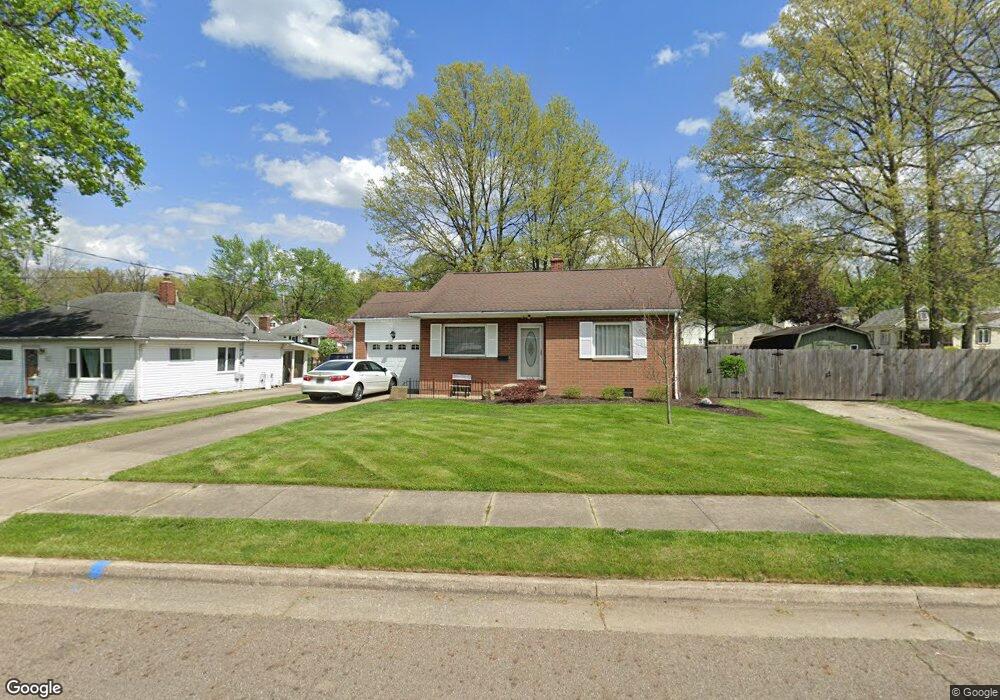
479 Pauline Ave Akron, OH 44312
Ellet NeighborhoodEstimated Value: $111,000 - $154,000
2
Beds
1
Bath
798
Sq Ft
$165/Sq Ft
Est. Value
About This Home
This home is located at 479 Pauline Ave, Akron, OH 44312 and is currently estimated at $131,559, approximately $164 per square foot. 479 Pauline Ave is a home located in Summit County with nearby schools including Ellet High School, Summit Academy Akron Elementary School, and Hatton Community Learning Center.
Ownership History
Date
Name
Owned For
Owner Type
Purchase Details
Closed on
Jan 9, 2017
Sold by
Gragg Jeffrey W and Gragg Ii Robert P
Bought by
Sutphin Robert L
Current Estimated Value
Purchase Details
Closed on
Jun 28, 2016
Sold by
Forney Karen S and Forney William
Bought by
Sutphin Nancy M
Purchase Details
Closed on
Mar 3, 2007
Sold by
Estate Of Cora C Wyatt
Bought by
Wyatt Martin C
Create a Home Valuation Report for This Property
The Home Valuation Report is an in-depth analysis detailing your home's value as well as a comparison with similar homes in the area
Home Values in the Area
Average Home Value in this Area
Purchase History
| Date | Buyer | Sale Price | Title Company |
|---|---|---|---|
| Sutphin Robert L | $30,000 | None Available | |
| Sutphin Nancy M | -- | None Available | |
| Wyatt Martin C | -- | None Available |
Source: Public Records
Tax History Compared to Growth
Tax History
| Year | Tax Paid | Tax Assessment Tax Assessment Total Assessment is a certain percentage of the fair market value that is determined by local assessors to be the total taxable value of land and additions on the property. | Land | Improvement |
|---|---|---|---|---|
| 2025 | $3,750 | $45,168 | $13,986 | $31,182 |
| 2024 | $1,957 | $45,168 | $13,986 | $31,182 |
| 2023 | $3,750 | $45,168 | $13,986 | $31,182 |
| 2022 | $1,559 | $30,937 | $9,580 | $21,357 |
| 2021 | $1,560 | $30,937 | $9,580 | $21,357 |
| 2020 | $1,538 | $30,940 | $9,580 | $21,360 |
| 2019 | $1,869 | $24,850 | $9,580 | $15,270 |
| 2018 | $1,235 | $24,850 | $9,580 | $15,270 |
| 2017 | $1,133 | $24,850 | $9,580 | $15,270 |
| 2016 | $1,800 | $23,140 | $9,580 | $13,560 |
| 2015 | $1,133 | $23,140 | $9,580 | $13,560 |
| 2014 | $1,124 | $23,140 | $9,580 | $13,560 |
| 2013 | $1,282 | $25,750 | $9,580 | $16,170 |
Source: Public Records
Map
Nearby Homes
- 544 Dennison Ave
- 379 Stull Ave
- 2948 Trenton Rd
- 648 Alta Vista Ave
- 307 Pauline Ave
- 490 Stevenson Ave
- 480 Wirth Ave
- 412 Stevenson Ave
- 440 Wirth Ave
- 0 Kreiner Ave
- 200 Stull Ave
- 2835 Farmdale Rd
- 905 1/2 Shadybrook Dr
- 117 Kreiner Ave
- 2487 Delaware Ave
- 423 Stetler Ave
- 256 High Grove Blvd
- 2809 McElwain Rd
- 1200 Abington Rd
- 2528 Ogden Ave
- 471 Pauline Ave
- 2906 Albrecht Ave
- 2924 Albrecht Ave
- 491 Pauline Ave
- 2918 Albrecht Ave
- 2930 Albrecht Ave
- 497 Pauline Ave
- 466 Stull Ave
- 480 Pauline Ave
- 472 Stull Ave
- 2931 Priscilla Ave
- 2936 Albrecht Ave
- 496 Pauline Ave
- 478 Stull Ave
- 2942 Albrecht Ave
- 2891 Priscilla Ave
- 2894 Albrecht Ave
- 484 Stull Ave
- 507 Pauline Ave
- 2927 Albrecht Ave