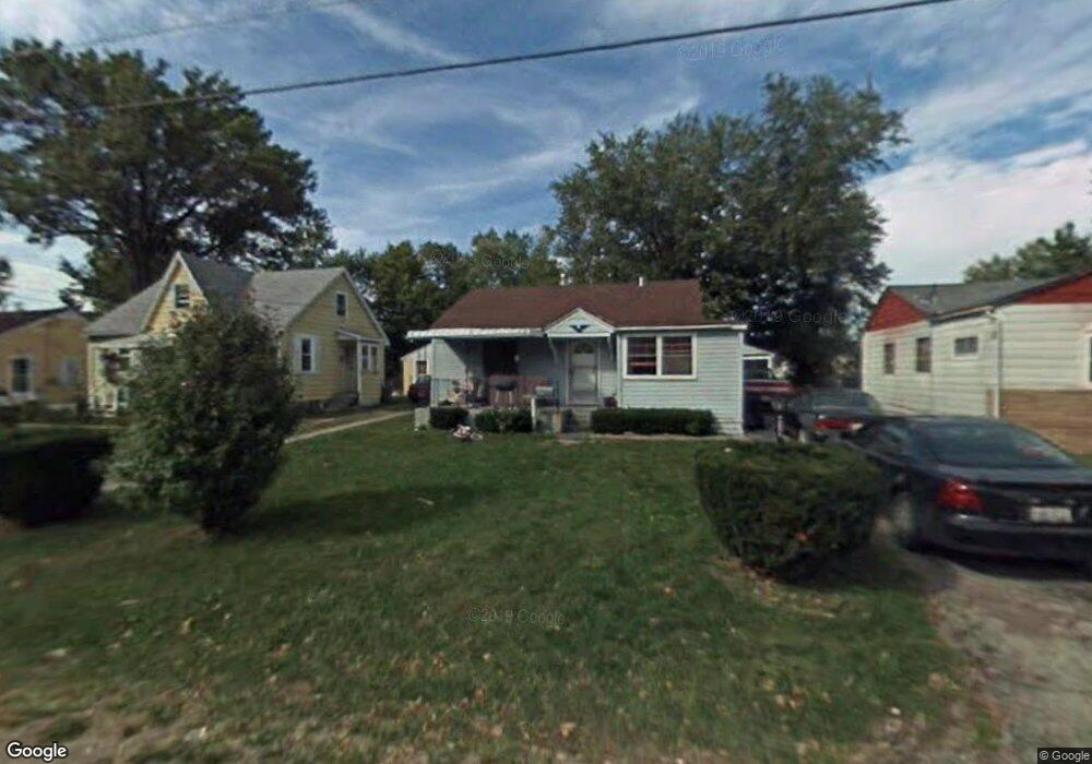
479 Stark St Mansfield, OH 44903
Estimated Value: $70,000 - $83,000
2
Beds
2
Baths
736
Sq Ft
$101/Sq Ft
Est. Value
About This Home
This home is located at 479 Stark St, Mansfield, OH 44903 and is currently estimated at $74,669, approximately $101 per square foot. 479 Stark St is a home located in Richland County with nearby schools including Foundation Academy, Mansfield Elective Academy, and Goal Digital Academy.
Ownership History
Date
Name
Owned For
Owner Type
Purchase Details
Closed on
Apr 26, 2022
Sold by
Ignacio Gaytan
Bought by
Martinez Cirilo
Current Estimated Value
Purchase Details
Closed on
Mar 3, 2022
Sold by
Claus Scott A
Bought by
Gaytan Ignacio
Purchase Details
Closed on
Sep 4, 2002
Sold by
Riddlebaugh Jeffery A
Bought by
Claus Scott A
Home Financials for this Owner
Home Financials are based on the most recent Mortgage that was taken out on this home.
Original Mortgage
$27,200
Interest Rate
6.41%
Mortgage Type
New Conventional
Purchase Details
Closed on
Dec 11, 1996
Sold by
Mills Marvin D
Bought by
Riddlebaugh Jeffery A
Home Financials for this Owner
Home Financials are based on the most recent Mortgage that was taken out on this home.
Original Mortgage
$22,800
Interest Rate
7.85%
Mortgage Type
New Conventional
Create a Home Valuation Report for This Property
The Home Valuation Report is an in-depth analysis detailing your home's value as well as a comparison with similar homes in the area
Home Values in the Area
Average Home Value in this Area
Purchase History
| Date | Buyer | Sale Price | Title Company |
|---|---|---|---|
| Martinez Cirilo | -- | Thompson C Richard | |
| Gaytan Ignacio | $7,600 | Linhart Brian E | |
| Claus Scott A | $34,000 | -- | |
| Riddlebaugh Jeffery A | $24,000 | -- |
Source: Public Records
Mortgage History
| Date | Status | Borrower | Loan Amount |
|---|---|---|---|
| Previous Owner | Claus Scott A | $27,200 | |
| Previous Owner | Riddlebaugh Jeffery A | $22,800 |
Source: Public Records
Tax History
| Year | Tax Paid | Tax Assessment Tax Assessment Total Assessment is a certain percentage of the fair market value that is determined by local assessors to be the total taxable value of land and additions on the property. | Land | Improvement |
|---|---|---|---|---|
| 2024 | $619 | $12,930 | $1,700 | $11,230 |
| 2023 | $619 | $12,930 | $1,700 | $11,230 |
| 2022 | $564 | $10,100 | $1,540 | $8,560 |
| 2021 | $568 | $10,100 | $1,540 | $8,560 |
| 2020 | $581 | $10,100 | $1,540 | $8,560 |
| 2019 | $644 | $10,100 | $1,540 | $8,560 |
| 2018 | $635 | $10,100 | $1,540 | $8,560 |
| 2017 | $643 | $10,100 | $1,540 | $8,560 |
| 2016 | $668 | $10,590 | $2,440 | $8,150 |
| 2015 | $639 | $10,590 | $2,440 | $8,150 |
| 2014 | $630 | $10,590 | $2,440 | $8,150 |
| 2012 | $240 | $10,590 | $2,570 | $8,020 |
Source: Public Records
Map
Nearby Homes
- 0 State Route 314 Unit 9069650
- 688 Mcpherson St
- 492 Stark St
- 572 France St
- 0 Lemley Ave Unit 9070540
- 480 Mcpherson St
- 0 Highway 30
- 641 Averill Ave
- 701 Springmill St
- 230 Rae Ave
- 739 Armstrong St
- 212 Penn Ave
- 0 Voegele Ave Unit Lot 6048, 6049, 6
- 362-364 W 6th St
- 368 W 6th St
- 458 W West Dickson Ave
- 81 Penn Ave
- 891 Springmill Rd
- 340 Boston Ave
- 728 N Trimble Rd
- 483 Stark St
- 473 Stark St
- 469 Stark St
- 489 Stark St
- 474 Collins Dr
- 480 Collins Dr
- 468 Collins Dr
- 486 Collins Dr
- 482 Stark St
- 478 Stark St
- 0 State Route 314 Unit 9066294
- 0 Sturges Ave Unit 403041
- 0 State Route 314 Unit 9057767
- 0 State Route 314 Unit 9032037
- 0 State Route 314 Unit 9032261
- 0 State Route 314 Unit 9033932
- 0 State Route 314 Unit 9034466
- 0 State Route 314 Unit 9037901
- 0 State Route 314 Unit 9041096
- 0 State Route 314 Unit 9044733
Your Personal Tour Guide
Ask me questions while you tour the home.