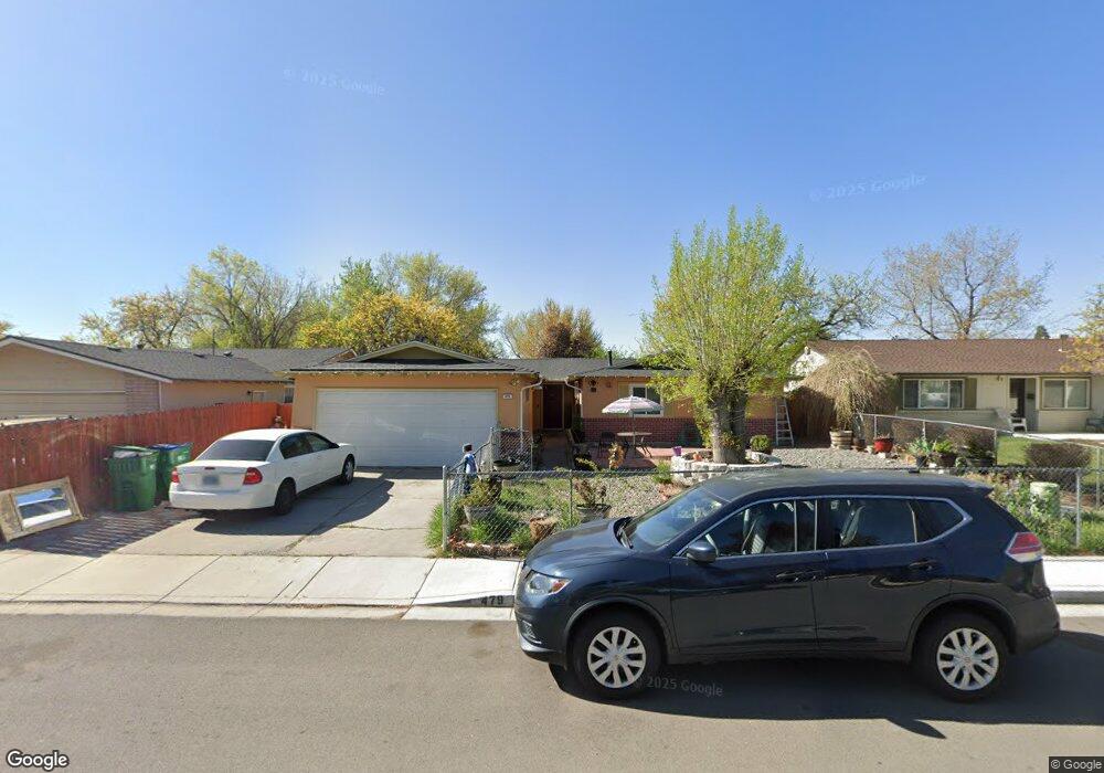
479 Steffanie Way Sparks, NV 89431
McCarran Boulevard-Probasco NeighborhoodEstimated Value: $417,382 - $450,000
4
Beds
2
Baths
1,624
Sq Ft
$267/Sq Ft
Est. Value
About This Home
This home is located at 479 Steffanie Way, Sparks, NV 89431 and is currently estimated at $433,846, approximately $267 per square foot. 479 Steffanie Way is a home located in Washoe County with nearby schools including Lena Juniper Elementary School, Lou Mendive Middle School, and Edward C Reed High School.
Ownership History
Date
Name
Owned For
Owner Type
Purchase Details
Closed on
Aug 11, 2003
Sold by
Lopez Agustin
Bought by
Lopez Agustin and Lopez Norberta
Current Estimated Value
Home Financials for this Owner
Home Financials are based on the most recent Mortgage that was taken out on this home.
Original Mortgage
$125,000
Interest Rate
5.29%
Mortgage Type
Unknown
Purchase Details
Closed on
Sep 2, 1996
Sold by
Hernandez Carlos A Flores and Carcamo Maria Sara Diaz
Bought by
Lopez Agustin and Lopez Norberta
Home Financials for this Owner
Home Financials are based on the most recent Mortgage that was taken out on this home.
Original Mortgage
$126,032
Interest Rate
7.87%
Mortgage Type
FHA
Create a Home Valuation Report for This Property
The Home Valuation Report is an in-depth analysis detailing your home's value as well as a comparison with similar homes in the area
Home Values in the Area
Average Home Value in this Area
Purchase History
| Date | Buyer | Sale Price | Title Company |
|---|---|---|---|
| Lopez Agustin | -- | Stewart Title Of Northern Nv | |
| Lopez Agustin | $129,000 | First American Title Co |
Source: Public Records
Mortgage History
| Date | Status | Borrower | Loan Amount |
|---|---|---|---|
| Closed | Lopez Agustin | $125,000 | |
| Closed | Lopez Agustin | $126,032 |
Source: Public Records
Tax History
| Year | Tax Paid | Tax Assessment Tax Assessment Total Assessment is a certain percentage of the fair market value that is determined by local assessors to be the total taxable value of land and additions on the property. | Land | Improvement |
|---|---|---|---|---|
| 2026 | -- | $60,130 | $36,540 | $23,590 |
| 2024 | $1,212 | $57,835 | $34,755 | $23,080 |
| 2023 | $1,179 | $56,302 | $34,930 | $21,372 |
| 2022 | $1,146 | $45,883 | $28,455 | $17,428 |
| 2021 | $1,111 | $36,630 | $19,635 | $16,995 |
| 2020 | $1,077 | $34,523 | $17,850 | $16,673 |
| 2019 | $1,046 | $35,438 | $18,725 | $16,713 |
| 2018 | $1,015 | $30,485 | $13,545 | $16,940 |
| 2017 | $986 | $29,596 | $12,075 | $17,521 |
| 2016 | $968 | $29,994 | $11,550 | $18,444 |
| 2015 | $968 | $28,361 | $9,415 | $18,946 |
| 2014 | $940 | $26,664 | $7,980 | $18,684 |
| 2013 | -- | $24,881 | $5,985 | $18,896 |
Source: Public Records
Map
Nearby Homes
- 456 Michele Way
- 281 Devere Way
- 3376 Lagomarsino Ct
- 119 Devere Way
- 3305 Probasco Way
- 3222 Bunker Hill Ln
- 3627 Keogh Dr
- 2475 Stine Way
- 3653 Koskela Dr
- 2781 Tiffany Cir
- 2630 Probasco Way
- 5530 High Rock Way
- 465 Richards Way
- 5520 High Rock Way
- 1125 Dodson Way
- 3020 Malapi Way
- 1940 4th St Unit 20
- 1940 4th St Unit 51
- 1940 4th St Unit 46
- 1940 4th St
- 463 Steffanie Way
- 487 Steffanie Way
- 432 Abbay Way
- 424 Abbay Way Unit 6
- 491 Steffanie Way
- 461 Steffanie Way
- 462 Abbay Way
- 414 Abbay Way
- 478 Steffanie Way
- 470 Steffanie Way
- 490 Steffanie Way
- 492 Abbay Way
- 503 Steffanie Way
- 408 Abbay Way
- 494 Steffanie Way
- 504 Steffanie Way
- 457 Steffanie Way
- 462 Steffanie Way
- 504 Abbay Way
- 515 Steffanie Way
Your Personal Tour Guide
Ask me questions while you tour the home.