Estimated Value: $527,000 - $627,000
6
Beds
3
Baths
2,332
Sq Ft
$250/Sq Ft
Est. Value
About This Home
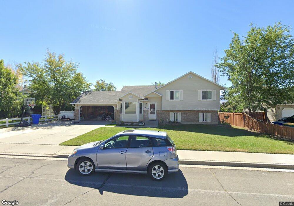
This home is located at 479 W 2325 N, Lehi, UT 84043 and is currently estimated at $583,955, approximately $250 per square foot. 479 W 2325 N is a home located in Utah County with nearby schools including Eaglecrest Elementary School, Lehi Junior High School, and Skyridge High School.
Ownership History
Date
Name
Owned For
Owner Type
Purchase Details
Closed on
Jun 21, 2024
Sold by
Paat Alvin and Paat Kara J
Bought by
Mansker John Paul and Mansker Susan Ellen
Current Estimated Value
Home Financials for this Owner
Home Financials are based on the most recent Mortgage that was taken out on this home.
Original Mortgage
$30,000
Outstanding Balance
$29,644
Interest Rate
7.02%
Estimated Equity
$554,311
Purchase Details
Closed on
Mar 30, 2023
Sold by
Paat Alvin E and Paat Kara J
Bought by
Paat Alvin and Paat Kara J
Home Financials for this Owner
Home Financials are based on the most recent Mortgage that was taken out on this home.
Original Mortgage
$190,000
Interest Rate
6.32%
Mortgage Type
New Conventional
Purchase Details
Closed on
Aug 16, 2012
Sold by
Westvoer Jonathan H and Westvoer Jacque P
Bought by
Paat Alvin E and Paat Kara J
Home Financials for this Owner
Home Financials are based on the most recent Mortgage that was taken out on this home.
Original Mortgage
$164,800
Interest Rate
3.56%
Mortgage Type
New Conventional
Purchase Details
Closed on
Sep 5, 2007
Sold by
Jolley Russell R and Jolley Kathryn J
Bought by
Westover Jonathan H and Westover Jacque P
Home Financials for this Owner
Home Financials are based on the most recent Mortgage that was taken out on this home.
Original Mortgage
$363,000
Interest Rate
6.67%
Mortgage Type
Balloon
Purchase Details
Closed on
Jun 8, 2005
Sold by
Jolley Russell R
Bought by
Jolley Russell R and Jolley Kathryn J
Home Financials for this Owner
Home Financials are based on the most recent Mortgage that was taken out on this home.
Original Mortgage
$60,000
Interest Rate
6.62%
Mortgage Type
New Conventional
Purchase Details
Closed on
May 26, 1998
Sold by
Halversen Brian L and Halversen Roxanne L
Bought by
Erickson Loren J and Erickson Traci R
Home Financials for this Owner
Home Financials are based on the most recent Mortgage that was taken out on this home.
Original Mortgage
$140,125
Interest Rate
7.13%
Create a Home Valuation Report for This Property
The Home Valuation Report is an in-depth analysis detailing your home's value as well as a comparison with similar homes in the area
Home Values in the Area
Average Home Value in this Area
Purchase History
| Date | Buyer | Sale Price | Title Company |
|---|---|---|---|
| Mansker John Paul | -- | Old Republic Title | |
| Paat Alvin | -- | Meridian Title Company | |
| Paat Alvin E | -- | First American Title Company | |
| Westover Jonathan H | -- | Equity Title Orem Blvd | |
| Jolley Russell R | -- | Equity Title | |
| Jolley Russell R | -- | Equity Title | |
| Erickson Loren J | -- | -- |
Source: Public Records
Mortgage History
| Date | Status | Borrower | Loan Amount |
|---|---|---|---|
| Open | Mansker John Paul | $30,000 | |
| Open | Mansker John Paul | $574,404 | |
| Previous Owner | Paat Alvin | $190,000 | |
| Previous Owner | Paat Alvin E | $164,800 | |
| Previous Owner | Westover Jonathan H | $363,000 | |
| Previous Owner | Jolley Russell R | $60,000 | |
| Previous Owner | Erickson Loren J | $140,125 |
Source: Public Records
Tax History Compared to Growth
Tax History
| Year | Tax Paid | Tax Assessment Tax Assessment Total Assessment is a certain percentage of the fair market value that is determined by local assessors to be the total taxable value of land and additions on the property. | Land | Improvement |
|---|---|---|---|---|
| 2025 | $2,122 | $283,745 | $191,300 | $324,600 |
| 2024 | $2,122 | $248,380 | $0 | $0 |
| 2023 | $1,971 | $250,415 | $0 | $0 |
| 2022 | $2,117 | $260,810 | $0 | $0 |
| 2021 | $1,894 | $352,800 | $110,700 | $242,100 |
| 2020 | $1,786 | $328,800 | $102,500 | $226,300 |
| 2019 | $1,598 | $305,800 | $102,500 | $203,300 |
| 2018 | $1,532 | $277,200 | $93,500 | $183,700 |
| 2017 | $1,436 | $138,105 | $0 | $0 |
| 2016 | $1,432 | $127,820 | $0 | $0 |
| 2015 | $1,437 | $121,715 | $0 | $0 |
| 2014 | $1,424 | $119,955 | $0 | $0 |
Source: Public Records
Map
Nearby Homes
- 497 W 2280 N
- 497 W 2200 N
- 2287 N 750 W
- 804 W 2700 N
- 2687 N 900 W
- 1755 N 250 W
- 1011 W Mountain Way Unit 316
- 1817 W Bad Rock Cir
- 192 E 2200 N
- 2539 N 300 E
- 3105 N 250 W
- 3117 N 325 W
- 2946 N 1080 W
- 4333 N Baiken Ridge Dr Unit 1020
- 389 W 3200 N
- 337 W 3200 N
- 902 W 1500 N
- 1155 W 2980 N
- 1167 W 2980 N
- 1179 W 2980 N