Estimated Value: $286,000 - $386,000
3
Beds
2
Baths
1,500
Sq Ft
$233/Sq Ft
Est. Value
About This Home
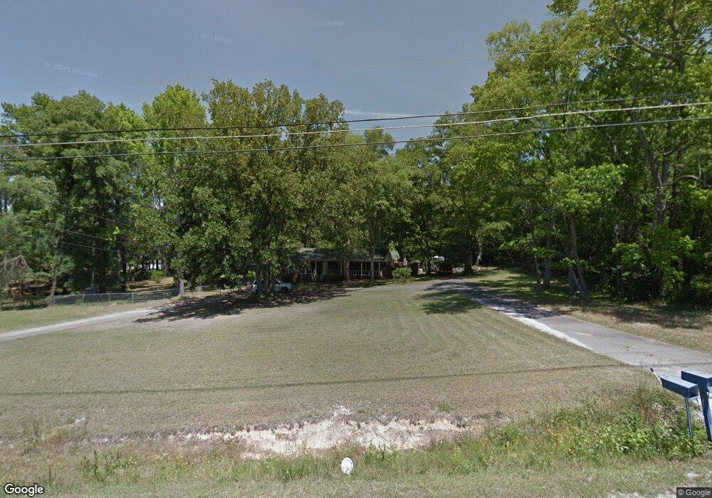
This home is located at 4793 McGahee Rd, Evans, GA 30809 and is currently estimated at $348,960, approximately $232 per square foot. 4793 McGahee Rd is a home located in Columbia County with nearby schools including Evans Elementary School, Evans Middle School, and Evans High School.
Ownership History
Date
Name
Owned For
Owner Type
Purchase Details
Closed on
Aug 15, 2016
Sold by
Sowers Nastaran A and Sowers David A
Bought by
Britt Christopher J
Current Estimated Value
Home Financials for this Owner
Home Financials are based on the most recent Mortgage that was taken out on this home.
Original Mortgage
$235,000
Outstanding Balance
$187,139
Interest Rate
3.42%
Estimated Equity
$161,821
Purchase Details
Closed on
Dec 18, 2009
Sold by
Sharpe Bobbie Jean
Bought by
Sowers Nastaran A
Home Financials for this Owner
Home Financials are based on the most recent Mortgage that was taken out on this home.
Original Mortgage
$143,000
Interest Rate
4.82%
Create a Home Valuation Report for This Property
The Home Valuation Report is an in-depth analysis detailing your home's value as well as a comparison with similar homes in the area
Home Values in the Area
Average Home Value in this Area
Purchase History
| Date | Buyer | Sale Price | Title Company |
|---|---|---|---|
| Britt Christopher J | $235,000 | -- | |
| Sowers Nastaran A | $143,000 | -- |
Source: Public Records
Mortgage History
| Date | Status | Borrower | Loan Amount |
|---|---|---|---|
| Open | Britt Christopher J | $235,000 | |
| Previous Owner | Sowers Nastaran A | $143,000 |
Source: Public Records
Tax History
| Year | Tax Paid | Tax Assessment Tax Assessment Total Assessment is a certain percentage of the fair market value that is determined by local assessors to be the total taxable value of land and additions on the property. | Land | Improvement |
|---|---|---|---|---|
| 2025 | $3,460 | $145,170 | $58,434 | $86,736 |
| 2024 | $3,519 | $140,930 | $58,434 | $82,496 |
| 2023 | $3,519 | $131,147 | $50,597 | $80,550 |
| 2022 | $3,192 | $122,935 | $44,897 | $78,038 |
| 2021 | $2,954 | $108,737 | $39,909 | $68,828 |
| 2020 | $2,639 | $95,121 | $34,830 | $60,291 |
| 2019 | $2,569 | $92,574 | $34,830 | $57,744 |
| 2018 | $2,446 | $87,861 | $31,354 | $56,507 |
| 2017 | $2,423 | $86,716 | $31,354 | $55,362 |
| 2016 | $2,466 | $91,543 | $33,792 | $57,751 |
| 2015 | $2,417 | $89,560 | $33,792 | $55,768 |
| 2014 | $2,371 | $86,782 | $32,401 | $54,381 |
Source: Public Records
Map
Nearby Homes
- 385 Canterbury Dr
- 4712 Walnut Hill Dr
- 5068 Hereford Farm Rd
- 4622 Brittany Dr
- 604 Kimberley Place
- 1764 Davenport Dr
- 599 Windward Ct
- 703 Low Meadow Dr
- 703 Harrison Dr
- 209 Mineral Ct
- 642 Kimberley Place
- 665 Steeplechase Way
- 349 Farmington Dr E
- 208 Mineral Ct
- 4724 Canterbury Ln
- 510 Farmington Cir
- 305 Sumac Trail
- 3542 Hilltop Trail
- 3527 Hilltop Trail
- 3538 Hilltop Trail
- 554 Blanchard Rd
- 556 Blanchard Rd
- 4799 McGahee Rd
- 4801 McGahee Rd
- 625 Blanchard Rd
- 4794 McGahee Rd
- 4792 McGahee Rd
- 4798 McGahee Rd
- 4798 McGahee Rd
- 4790 McGahee Rd
- 4788 McGahee Rd
- 4809 McGahee Rd
- 584 Blanchard Rd
- 4758 Mahoney Dr
- 4754 Mahoney Dr
- 4806 McGahee Rd
- 579 Blanchard Rd
- 4752 Mahoney Dr
- 4808 McGahee Rd
- 4760 Mahoney Dr
Your Personal Tour Guide
Ask me questions while you tour the home.