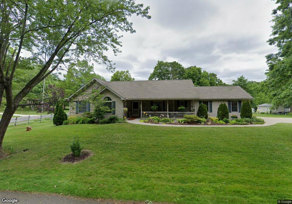
4795 Gower Rd Rootstown, OH 44272
Estimated Value: $324,000 - $353,000
2
Beds
3
Baths
1,660
Sq Ft
$206/Sq Ft
Est. Value
About This Home
This home is located at 4795 Gower Rd, Rootstown, OH 44272 and is currently estimated at $342,248, approximately $206 per square foot. 4795 Gower Rd is a home located in Portage County with nearby schools including Rootstown Middle School - Schnee Building and Rootstown High School.
Ownership History
Date
Name
Owned For
Owner Type
Purchase Details
Closed on
Sep 5, 2018
Sold by
Riemenschneider Elmer L
Bought by
Riemenschneider Shirley A
Current Estimated Value
Purchase Details
Closed on
Oct 31, 2007
Sold by
Riemenschneider Elmer L and Riemenschneider Shirley Ann
Bought by
Riemenschneider Elmer L and Riemenschneider Shirley A
Purchase Details
Closed on
Jan 1, 1990
Bought by
Riemenschneider
Create a Home Valuation Report for This Property
The Home Valuation Report is an in-depth analysis detailing your home's value as well as a comparison with similar homes in the area
Purchase History
| Date | Buyer | Sale Price | Title Company |
|---|---|---|---|
| Riemenschneider Shirley A | -- | -- | |
| Riemenschneider Elmer L | -- | Approved Statewide Title | |
| Riemenschneider | -- | -- |
Source: Public Records
Tax History
| Year | Tax Paid | Tax Assessment Tax Assessment Total Assessment is a certain percentage of the fair market value that is determined by local assessors to be the total taxable value of land and additions on the property. | Land | Improvement |
|---|---|---|---|---|
| 2024 | $3,857 | $106,900 | $9,070 | $97,830 |
| 2023 | $3,403 | $85,720 | $8,020 | $77,700 |
| 2022 | $3,389 | $85,720 | $8,020 | $77,700 |
| 2021 | $3,396 | $85,720 | $8,020 | $77,700 |
| 2020 | $2,965 | $73,470 | $7,630 | $65,840 |
| 2019 | $2,975 | $73,470 | $7,630 | $65,840 |
| 2017 | $2,624 | $63,040 | $8,120 | $54,920 |
| 2016 | $2,595 | $63,040 | $8,120 | $54,920 |
Source: Public Records
Map
Nearby Homes
- 4225 Hattrick Rd
- 0 Lynn Rd Unit 5110102
- 4691 Scenic Dr
- 4415 Farmette Dr
- 3689 Cherry Hill
- 4312 Apple Orchard
- 3701 State Route 44
- sub lot Lane Ave
- V/L 2 Lynn Rd
- V/L Lynn Rd
- 4087 Industry
- 4058 Bayberry Knoll Ln
- 4140 Sandy Lake Rd
- 3637 Old Forge Rd
- 3925 Summit Rd
- 3021 Hartville Rd
- 534 Ohio Ave
- 694 Summit Rd
- 4958 Bassett Rd
- 2547 Industry Rd
- 4809 Gower Rd
- 4144 New Milford Rd
- 4109 New Milford Rd
- 4827 Gower Rd
- 4816 Gower Rd
- 4153 New Milford Rd
- 4158 New Milford Rd
- 4092 New Milford Rd
- 4099 New Milford Rd
- 4119 New Milford Rd
- 4109 Reiss Rd
- 4089 New Milford Rd
- 4839 Gower Rd
- 4103 Reiss Rd
- 4076 New Milford Rd
- 4176 New Milford Rd
- 4091 Reiss Rd
- 4173 New Milford Rd
- 4850 Gower Rd
- 4083 Reiss Rd
Your Personal Tour Guide
Ask me questions while you tour the home.