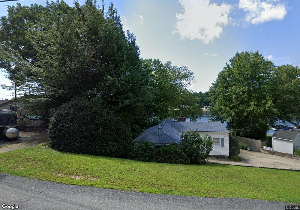
48 Acres of Pine Rd Coventry, RI 02816
Estimated Value: $376,288 - $487,000
2
Beds
1
Bath
960
Sq Ft
$459/Sq Ft
Est. Value
About This Home
This home is located at 48 Acres of Pine Rd, Coventry, RI 02816 and is currently estimated at $440,572, approximately $458 per square foot. 48 Acres of Pine Rd is a home located in Kent County with nearby schools including Alan Shawn Feinstein Ms Of Cov, Coventry High School, and Father John V. Doyle School.
Ownership History
Date
Name
Owned For
Owner Type
Purchase Details
Closed on
Apr 4, 2017
Sold by
Nicolopoulos Harry
Bought by
Meshanicut T
Current Estimated Value
Purchase Details
Closed on
Aug 5, 2011
Sold by
Nicolopoulos Christine and Nicolopoulos Harry
Bought by
Nicolopoulos Harry
Purchase Details
Closed on
Apr 12, 2007
Sold by
Harrington Paula J
Bought by
Nicolopoulos Harry and Nicolopoulo Christine
Home Financials for this Owner
Home Financials are based on the most recent Mortgage that was taken out on this home.
Original Mortgage
$219,000
Interest Rate
6.24%
Mortgage Type
Purchase Money Mortgage
Purchase Details
Closed on
Dec 11, 1997
Sold by
Est Turner Phillip T and Hakanson Jeffrey B
Bought by
Bousquet Daniel and Bousquet Norma
Create a Home Valuation Report for This Property
The Home Valuation Report is an in-depth analysis detailing your home's value as well as a comparison with similar homes in the area
Home Values in the Area
Average Home Value in this Area
Purchase History
| Date | Buyer | Sale Price | Title Company |
|---|---|---|---|
| Meshanicut T | -- | -- | |
| Nicolopoulos Harry | -- | -- | |
| Nicolopoulos Harry | $290,000 | -- | |
| Bousquet Daniel | $49,000 | -- |
Source: Public Records
Mortgage History
| Date | Status | Borrower | Loan Amount |
|---|---|---|---|
| Previous Owner | Bousquet Daniel | $205,085 | |
| Previous Owner | Bousquet Daniel | $219,000 |
Source: Public Records
Tax History Compared to Growth
Tax History
| Year | Tax Paid | Tax Assessment Tax Assessment Total Assessment is a certain percentage of the fair market value that is determined by local assessors to be the total taxable value of land and additions on the property. | Land | Improvement |
|---|---|---|---|---|
| 2024 | $5,417 | $342,000 | $196,600 | $145,400 |
| 2023 | $5,243 | $342,000 | $196,600 | $145,400 |
| 2022 | $5,180 | $264,700 | $165,400 | $99,300 |
| 2021 | $5,135 | $264,700 | $165,400 | $99,300 |
| 2020 | $5,887 | $264,700 | $165,400 | $99,300 |
| 2019 | $4,526 | $203,500 | $117,300 | $86,200 |
| 2018 | $4,398 | $203,500 | $117,300 | $86,200 |
| 2017 | $4,269 | $203,500 | $117,300 | $86,200 |
| 2016 | $5,271 | $246,200 | $165,200 | $81,000 |
| 2015 | $5,128 | $246,200 | $165,200 | $81,000 |
| 2014 | $5,021 | $246,200 | $165,200 | $81,000 |
| 2013 | $5,525 | $296,100 | $206,700 | $89,400 |
Source: Public Records
Map
Nearby Homes
- 0 Poor Farm Lot 67 Rd
- 413 Hill Farm Rd
- 422 Shady Valley Rd
- 207 Shady Valley Rd
- 93 Provident Place
- 145 Phillips Hill Rd
- 83 Sunset Lake Cir
- 88 Sunset Lake Cir Unit 88
- 0 Whitehead Rd Unit 1395877
- 81 Sunset Lake Cir
- 6 Boyd Brook Cir
- 33 Sunset Lake Cir
- 3 Regalwood Dr
- 7 June Ct
- 10 Devon Place
- 1 Tammy Jean Dr
- 5 June Ct
- 25 Hill Farm Camp Rd
- 20 Cassidy Trail
- 22 Cassidy Trail
- 44 Acres of Pine Rd
- 25 Acres of Pine Rd
- 54 Acres of Pine Rd
- 49 Acres of Pine Rd
- 56 Acres of Pine Rd
- 42 Acres of Pine Rd
- 58 Acres of Pine Rd
- 37 Acres of Pine Rd
- 51 Acres of Pine Rd
- 40 Acres of Pine Rd
- 60 Acres of Pine Rd
- 38 Acres of Pine Rd
- 63 Acres of Pine Rd
- 55 Acres of Pine Rd
- 36 Acres of Pine Rd
- 29 Acres of Pine Rd
- 64 Acres of Pine Rd
- 66 Acres of Pine Rd
- 32 Acres of Pine Rd
- 68 Acres of Pine Rd