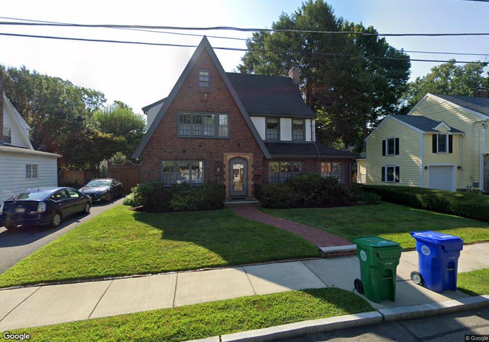
48 Arapahoe Rd West Newton, MA 02465
Auburndale NeighborhoodEstimated Value: $1,270,000 - $1,460,000
3
Beds
4
Baths
1,968
Sq Ft
$695/Sq Ft
Est. Value
About This Home
This home is located at 48 Arapahoe Rd, West Newton, MA 02465 and is currently estimated at $1,368,642, approximately $695 per square foot. 48 Arapahoe Rd is a home located in Middlesex County with nearby schools including Peirce Elementary School, Williams Elementary School, and F.A. Day Middle School.
Ownership History
Date
Name
Owned For
Owner Type
Purchase Details
Closed on
Aug 13, 2025
Sold by
Cook Lindsay
Bought by
Lindsay Cook 2000 Ret and Cook
Current Estimated Value
Purchase Details
Closed on
Jul 1, 1984
Bought by
Cook Lindsay and Cook Ellen B
Create a Home Valuation Report for This Property
The Home Valuation Report is an in-depth analysis detailing your home's value as well as a comparison with similar homes in the area
Home Values in the Area
Average Home Value in this Area
Purchase History
| Date | Buyer | Sale Price | Title Company |
|---|---|---|---|
| Lindsay Cook 2000 Ret | -- | -- | |
| Lindsay Cook 2000 Ret | -- | -- | |
| Cook Lindsay | $202,000 | -- |
Source: Public Records
Mortgage History
| Date | Status | Borrower | Loan Amount |
|---|---|---|---|
| Previous Owner | Cook Lindsay | $100,000 | |
| Previous Owner | Cook Lindsay | $91,000 |
Source: Public Records
Tax History Compared to Growth
Tax History
| Year | Tax Paid | Tax Assessment Tax Assessment Total Assessment is a certain percentage of the fair market value that is determined by local assessors to be the total taxable value of land and additions on the property. | Land | Improvement |
|---|---|---|---|---|
| 2025 | $11,503 | $1,173,800 | $869,400 | $304,400 |
| 2024 | $11,122 | $1,139,600 | $844,100 | $295,500 |
| 2023 | $10,619 | $1,043,100 | $637,800 | $405,300 |
| 2022 | $10,160 | $965,800 | $590,600 | $375,200 |
| 2021 | $4,282 | $911,100 | $557,200 | $353,900 |
| 2020 | $4,263 | $911,100 | $557,200 | $353,900 |
| 2019 | $9,244 | $884,600 | $541,000 | $343,600 |
| 2018 | $3,871 | $826,800 | $491,900 | $334,900 |
| 2017 | $8,674 | $780,000 | $464,100 | $315,900 |
| 2016 | $7,771 | $682,900 | $433,700 | $249,200 |
| 2015 | $7,410 | $638,200 | $405,300 | $232,900 |
Source: Public Records
Map
Nearby Homes
- 1639 Washington St
- 17 Gilbert St
- 283 Woodland Rd
- 51 Bourne St
- 1754 Washington St
- 13 Weir St
- 0 Duncan Rd Unit 72925240
- 179 Auburn St
- 68 Mignon Rd
- 194 Auburn St
- 163 Day St
- 224 Auburn St Unit 224
- 226 Auburn St Unit 226
- 39 Hawthorne Ave
- 1488 Washington St Unit 1488
- 62-64 Rowe St Unit B
- 17 Crescent St
- 10 Crescent St Unit 2
- 10 Ruane Rd
- 228 Auburn St Unit B
- 44 Arapahoe Rd
- 54 Arapahoe Rd
- 1663 Washington St
- 1669 Washington St
- 1659 Washington St
- 47 Arapahoe Rd
- 60 Arapahoe Rd
- 38 Arapahoe Rd
- 43 Arapahoe Rd
- 43 Arapahoe Rd
- 53 Arapahoe Rd
- 1675 Washington St
- 1653 Washington St
- 37 Arapahoe Rd
- 32 Arapahoe Rd
- 1781 Commonwealth Ave
- 1763 Commonwealth Ave
- 1647 Washington St
- 31 Arapahoe Rd
- 62 Windermere Rd