


48 Banks St Unit 2 Somerville, MA 02144
Porter Square Neighborhood
2
Beds
1
Bath
1,100
Sq Ft
1900
Built
About This Home
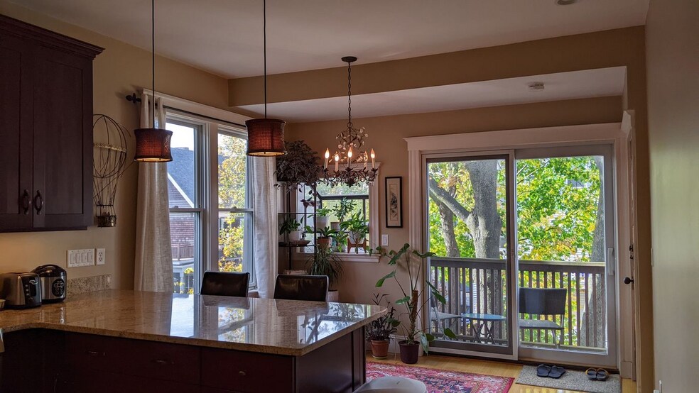
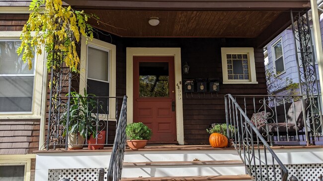
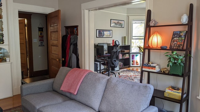
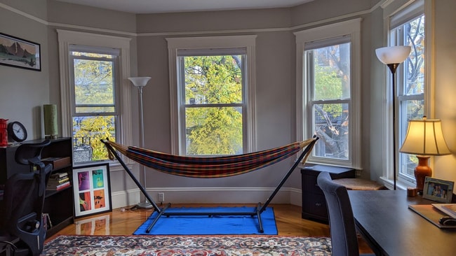
No Fee! Beautiful bright and spacious 2-bedroom apartment in between Porter and Davis Square and less than a mile to Harvard Square. Five-minute walk to redline train station which gives you access to Kendall square/MIT, teaching hospitals and greater Boston. This spacious apartment on quiet tree lined street features newly finished hardwood floors front and back porch and greenhouse window, central AC, laundry in basement and shared back patio. 9-month lease to start with option for renewal.
Listing Provided By

Map
Nearby Homes
- 12 Windsor Rd Unit 1
- 79 Willow Ave
- 353 Summer St Unit 310
- 3 Fairlee St
- 18 Windom St
- 371 Highland Ave
- 7 Beech St Unit 319
- 7 Beech St Unit 211
- 32-40 White St
- 114 Cedar St
- 23 Highland Rd
- 14 Mossland St
- 12 Mossland St
- 1 Richdale Ave Unit 2
- 31 Rogers Ave
- 156 Albion St Unit A
- 156 Albion St Unit B
- 8 Cogswell Ave
- 39 Rogers Ave
- 13 Warwick St
- 36 Windsor Rd Unit 2
- 19 Banks St Unit 1
- 19 Banks St Unit 2
- 19 Banks St Unit 19 Banks Street
- 64 Willow Ave
- 64 Willow Ave Unit 2
- 68 Willow Ave
- 68 Willow Ave
- 48 Hancock St Unit 3
- 24 Burnside Ave Unit 24 Burnside
- 76 Willow Ave Unit 2
- 9 Windsor Rd
- 9 Windsor Rd
- 39 Hancock St Unit 1
- 35 Hancock St Unit 2
- 35 Hancock St Unit 1
- 35 Hancock St Unit 3
- 37 Hancock St Unit 3