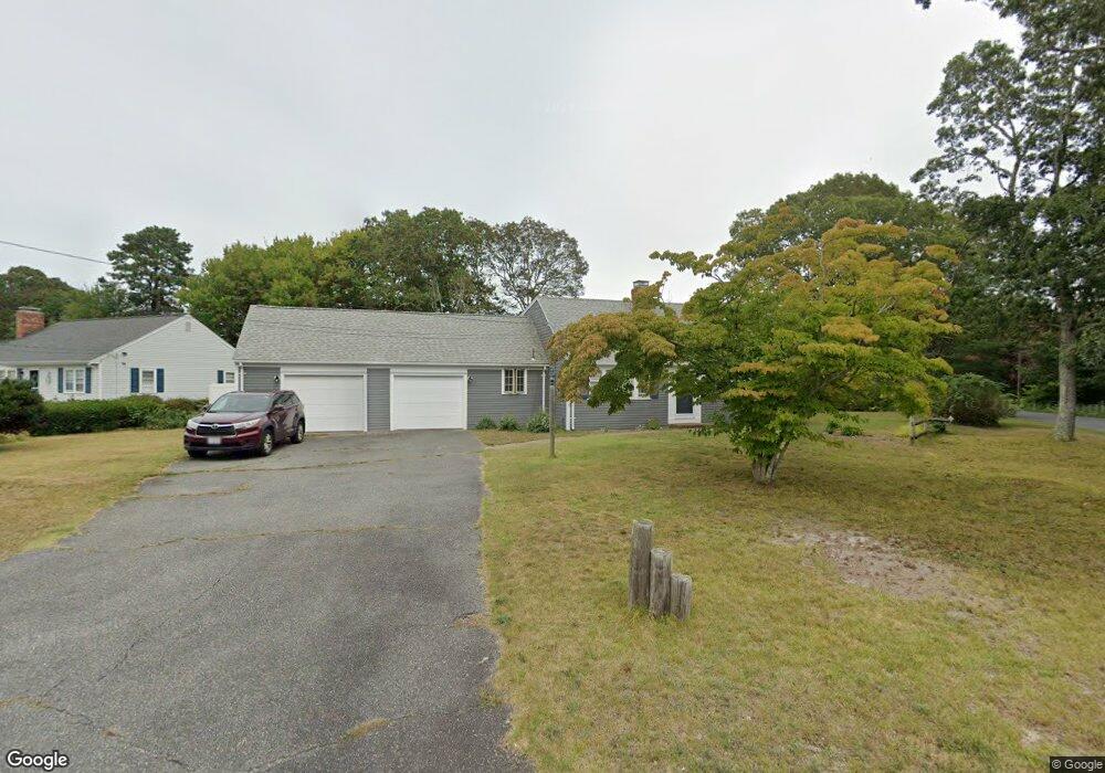
48 Captain Daniel Rd South Yarmouth, MA 02664
South Yarmouth NeighborhoodEstimated Value: $576,000 - $673,000
4
Beds
2
Baths
1,400
Sq Ft
$440/Sq Ft
Est. Value
About This Home
This home is located at 48 Captain Daniel Rd, South Yarmouth, MA 02664 and is currently estimated at $615,815, approximately $439 per square foot. 48 Captain Daniel Rd is a home located in Barnstable County with nearby schools including Dennis-Yarmouth Regional High School and St. Pius X. School.
Ownership History
Date
Name
Owned For
Owner Type
Purchase Details
Closed on
Aug 1, 2011
Sold by
Swansey Bernard T
Bought by
Vilcin Silvio
Current Estimated Value
Home Financials for this Owner
Home Financials are based on the most recent Mortgage that was taken out on this home.
Original Mortgage
$160,000
Outstanding Balance
$13,182
Interest Rate
4.52%
Mortgage Type
Purchase Money Mortgage
Estimated Equity
$602,633
Purchase Details
Closed on
Jun 4, 1998
Sold by
Watson James and Watson Florence L
Bought by
Swansey Bernard T
Home Financials for this Owner
Home Financials are based on the most recent Mortgage that was taken out on this home.
Original Mortgage
$30,000
Interest Rate
7.05%
Mortgage Type
Purchase Money Mortgage
Create a Home Valuation Report for This Property
The Home Valuation Report is an in-depth analysis detailing your home's value as well as a comparison with similar homes in the area
Home Values in the Area
Average Home Value in this Area
Purchase History
| Date | Buyer | Sale Price | Title Company |
|---|---|---|---|
| Vilcin Silvio | $260,000 | -- | |
| Swansey Bernard T | $156,000 | -- |
Source: Public Records
Mortgage History
| Date | Status | Borrower | Loan Amount |
|---|---|---|---|
| Open | Vilcin Silvio | $160,000 | |
| Previous Owner | Swansey Bernard T | $60,000 | |
| Previous Owner | Swansey Bernard T | $30,000 |
Source: Public Records
Tax History Compared to Growth
Tax History
| Year | Tax Paid | Tax Assessment Tax Assessment Total Assessment is a certain percentage of the fair market value that is determined by local assessors to be the total taxable value of land and additions on the property. | Land | Improvement |
|---|---|---|---|---|
| 2025 | $3,946 | $557,300 | $180,700 | $376,600 |
| 2024 | $3,621 | $490,600 | $152,800 | $337,800 |
| 2023 | $3,569 | $440,100 | $132,300 | $307,800 |
| 2022 | $3,234 | $352,300 | $120,200 | $232,100 |
| 2021 | $3,181 | $332,700 | $120,200 | $212,500 |
| 2020 | $3,068 | $306,800 | $120,100 | $186,700 |
| 2019 | $2,661 | $284,100 | $120,100 | $164,000 |
| 2018 | $2,740 | $266,300 | $102,300 | $164,000 |
| 2017 | $5,518 | $261,900 | $97,900 | $164,000 |
| 2016 | $2,525 | $253,000 | $89,000 | $164,000 |
| 2015 | $2,627 | $261,700 | $89,000 | $172,700 |
Source: Public Records
Map
Nearby Homes
- 35 Captain Percival Rd
- 48 Captain Dore Rd
- 18 Captain Stanley Rd
- 49 Captain Besse Rd
- 147 Captain Bacon Rd
- 21 Hazelmoor Rd
- 72 Quartermaster Row
- 33 Sparrow Way
- 24 Fast Brook Rd
- 3 Saturn Ln
- 11 Bob-O-link Ln
- 0 Forsyth Ave
- 68 Bob-O-link Ln
- 22 Powhatan Rd
- 15 Sharon Rd
- 7 Sunset Pines Rd
- 299 Winslow Gray Rd
- 299-301 Winslow Gray Rd
- 4 Raymond Ave
- 33 Lake Rd
- 44 Captain Daniel Rd
- 49 Captain Crocker Rd
- 49 Capt Crocker Rd
- 45 Captain Crocker Rd
- 47 Captain Daniel Rd
- 43 Captain Daniel Rd
- 84 Captain Noyes Rd
- 38 Captain Daniel Rd
- 39 Captain Crocker Rd
- 37 Captain Daniel Rd
- 50 Captain Crocker Rd
- 48 Captain Percival Rd
- 44 Captain Percival Rd
- 34 Captain Daniel Rd
- 129 Winding Brook Rd
- 89 Captain Noyes Rd
- 44 Captain Crocker Rd
- 44 Capt Crocker Rd
- 33 Captain Daniel Rd
- 38 Capt Percival Rd