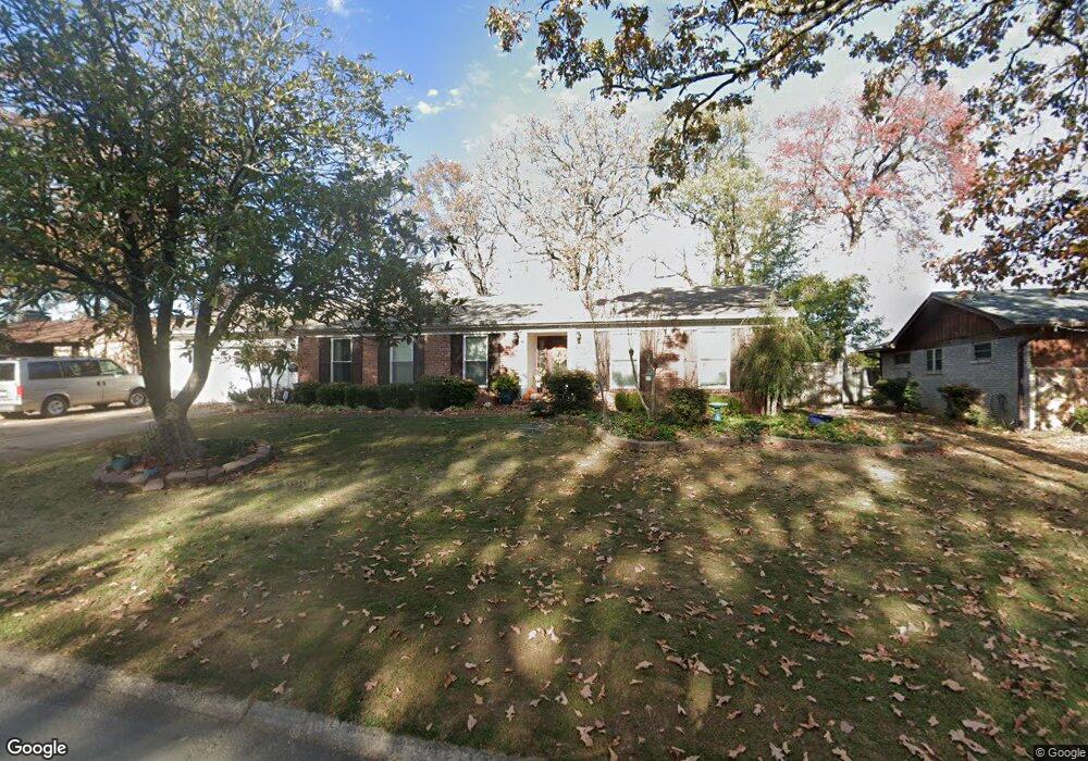
48 Desoto Cir North Little Rock, AR 72116
Lakewood NeighborhoodEstimated Value: $279,672 - $315,000
--
Bed
2
Baths
2,168
Sq Ft
$135/Sq Ft
Est. Value
About This Home
This home is located at 48 Desoto Cir, North Little Rock, AR 72116 and is currently estimated at $292,668, approximately $134 per square foot. 48 Desoto Cir is a home located in Pulaski County with nearby schools including Lakewood Elementary School, North Little Rock Middle School 6th Grade Campus, and North Little Rock High School.
Ownership History
Date
Name
Owned For
Owner Type
Purchase Details
Closed on
May 11, 2023
Sold by
Mickey Linda Katherine
Bought by
Linda Kay Mickey Trust and Mickey
Current Estimated Value
Purchase Details
Closed on
Feb 29, 2008
Sold by
Smiley William Lea and Smiley Janna Lee
Bought by
Mickey Linda Kay
Home Financials for this Owner
Home Financials are based on the most recent Mortgage that was taken out on this home.
Original Mortgage
$142,400
Interest Rate
5.47%
Mortgage Type
Purchase Money Mortgage
Create a Home Valuation Report for This Property
The Home Valuation Report is an in-depth analysis detailing your home's value as well as a comparison with similar homes in the area
Home Values in the Area
Average Home Value in this Area
Purchase History
| Date | Buyer | Sale Price | Title Company |
|---|---|---|---|
| Linda Kay Mickey Trust | -- | None Listed On Document | |
| Mickey Linda Kay | $178,000 | American Abstract & Title Co |
Source: Public Records
Mortgage History
| Date | Status | Borrower | Loan Amount |
|---|---|---|---|
| Previous Owner | Mickey Linda Kay | $142,400 |
Source: Public Records
Tax History Compared to Growth
Tax History
| Year | Tax Paid | Tax Assessment Tax Assessment Total Assessment is a certain percentage of the fair market value that is determined by local assessors to be the total taxable value of land and additions on the property. | Land | Improvement |
|---|---|---|---|---|
| 2025 | $2,440 | $50,600 | $15,200 | $35,400 |
| 2024 | $2,440 | $50,600 | $15,200 | $35,400 |
| 2023 | $2,440 | $50,600 | $15,200 | $35,400 |
| 2022 | $2,745 | $50,600 | $15,200 | $35,400 |
| 2021 | $2,619 | $36,530 | $5,100 | $31,430 |
| 2020 | $2,241 | $36,530 | $5,100 | $31,430 |
| 2019 | $2,237 | $36,530 | $5,100 | $31,430 |
| 2018 | $2,259 | $36,530 | $5,100 | $31,430 |
| 2017 | $2,259 | $36,530 | $5,100 | $31,430 |
| 2016 | $2,191 | $35,510 | $6,000 | $29,510 |
| 2015 | $2,372 | $35,510 | $6,000 | $29,510 |
| 2014 | $2,372 | $35,510 | $6,000 | $29,510 |
Source: Public Records
Map
Nearby Homes
- 38 Desoto Cir
- 36 Desoto Cir
- 32 Desoto Cir
- 3109 Donaghey Dr
- 7 Laffite Cir
- 2701 Donaghey Dr
- 3404 Bunker Hill Dr
- 3808 Pope Ave
- 3405 Bunker Hill Dr
- 4100 Monticello Dr
- 3801 Pope Ave
- 3417 Pope Ave
- 5804 N Hills Blvd
- 4105 N Hills Blvd
- 3605 N Hills Blvd
- 5000 Fairway Ave
- 21 E Lake Dr
- 4204 Fox Hill Rd
- 4105 Dunkeld Dr
- 4501 Dawson Dr
- 50 Desoto Cir
- 46 Desoto Cir
- 3116 Cleburne Place
- 52 Desoto Cir
- 3113 Martineau Place
- 3112 Cleburne Place
- 3117 Cleburne Place
- 54 Desoto Cir
- 3109 Martineau Place
- 27 Desoto Cir
- 35 Desoto Cir
- 3108 Cleburne Place
- 3113 Cleburne Place
- 25 Desoto Cir
- 56 Desoto Cir
- 3105 Martineau Place
- 3104 Martineau Place
- 3104 Cleburne Place
- 39 Desoto Cir
- 3109 Cleburne Place