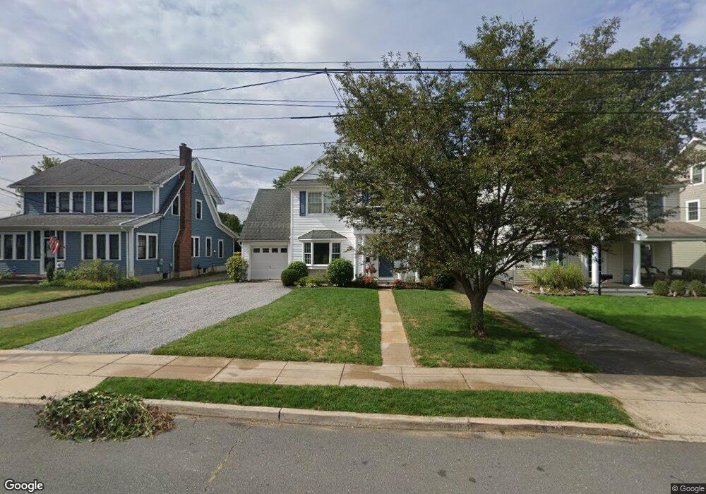
48 Forrest Ave Rumson, NJ 07760
Estimated Value: $1,569,000 - $1,865,000
4
Beds
4
Baths
2,630
Sq Ft
$663/Sq Ft
Est. Value
About This Home
This home is located at 48 Forrest Ave, Rumson, NJ 07760 and is currently estimated at $1,743,759, approximately $663 per square foot. 48 Forrest Ave is a home located in Monmouth County with nearby schools including Deane Porter School, Forrestdale School, and Rumson Fair Haven Regional High School.
Ownership History
Date
Name
Owned For
Owner Type
Purchase Details
Closed on
Sep 13, 2021
Sold by
Geoghegan Michael L and Geoghegan Mary Loux
Bought by
Geoghegan Mary Loux
Current Estimated Value
Home Financials for this Owner
Home Financials are based on the most recent Mortgage that was taken out on this home.
Original Mortgage
$767,000
Outstanding Balance
$697,913
Interest Rate
2.8%
Mortgage Type
New Conventional
Estimated Equity
$1,045,846
Purchase Details
Closed on
Aug 2, 2006
Sold by
Ford Richard W
Bought by
Geopghegan Michael L and Geopghegan Mary Loux
Home Financials for this Owner
Home Financials are based on the most recent Mortgage that was taken out on this home.
Original Mortgage
$660,000
Interest Rate
6.37%
Mortgage Type
Adjustable Rate Mortgage/ARM
Purchase Details
Closed on
Oct 10, 2000
Sold by
Petrucelli Nancy
Bought by
Demaio Neal and Demaio Margaret
Create a Home Valuation Report for This Property
The Home Valuation Report is an in-depth analysis detailing your home's value as well as a comparison with similar homes in the area
Home Values in the Area
Average Home Value in this Area
Purchase History
| Date | Buyer | Sale Price | Title Company |
|---|---|---|---|
| Geoghegan Mary Loux | -- | Break Water Title Agency Llc | |
| Geoghegan Mary Loux | -- | Break Water Title | |
| Geopghegan Michael L | $825,000 | -- | |
| Demaio Neal | $220,000 | -- |
Source: Public Records
Mortgage History
| Date | Status | Borrower | Loan Amount |
|---|---|---|---|
| Open | Geoghegan Mary Loux | $767,000 | |
| Closed | Geoghegan Mary Loux | $767,000 | |
| Previous Owner | Geopghegan Michael L | $660,000 |
Source: Public Records
Tax History
| Year | Tax Paid | Tax Assessment Tax Assessment Total Assessment is a certain percentage of the fair market value that is determined by local assessors to be the total taxable value of land and additions on the property. | Land | Improvement |
|---|---|---|---|---|
| 2025 | $13,611 | $1,312,900 | $811,600 | $501,300 |
| 2024 | $13,262 | $1,237,400 | $781,200 | $456,200 |
| 2023 | $13,262 | $1,134,500 | $720,900 | $413,600 |
| 2022 | $12,882 | $1,028,600 | $640,100 | $388,500 |
| 2021 | $12,072 | $905,300 | $554,400 | $350,900 |
| 2020 | $12,072 | $842,400 | $504,000 | $338,400 |
| 2019 | $12,296 | $837,000 | $347,200 | $489,800 |
| 2018 | $12,066 | $814,200 | $347,200 | $467,000 |
| 2017 | $11,257 | $766,300 | $313,600 | $452,700 |
| 2016 | $10,818 | $754,900 | $313,600 | $441,300 |
| 2015 | $10,680 | $735,000 | $313,600 | $421,400 |
| 2014 | $10,461 | $718,000 | $308,000 | $410,000 |
Source: Public Records
Map
Nearby Homes
Your Personal Tour Guide
Ask me questions while you tour the home.