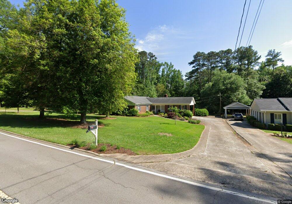
48 Forrest Dr Carrollton, GA 30117
Estimated Value: $327,464 - $401,000
3
Beds
2
Baths
1,702
Sq Ft
$209/Sq Ft
Est. Value
About This Home
This home is located at 48 Forrest Dr, Carrollton, GA 30117 and is currently estimated at $356,366, approximately $209 per square foot. 48 Forrest Dr is a home located in Carroll County with nearby schools including Carrollton Elementary School, Carrollton Upper Elementary School, and Carrollton Middle School.
Ownership History
Date
Name
Owned For
Owner Type
Purchase Details
Closed on
Dec 21, 2020
Sold by
Latimer Judith C
Bought by
Price Wendy M
Current Estimated Value
Purchase Details
Closed on
May 20, 2016
Sold by
Griffith Ronee S
Bought by
Latimer Judith C
Home Financials for this Owner
Home Financials are based on the most recent Mortgage that was taken out on this home.
Original Mortgage
$168,000
Interest Rate
3.59%
Mortgage Type
New Conventional
Purchase Details
Closed on
Oct 20, 1997
Bought by
Griffith Ronee S
Create a Home Valuation Report for This Property
The Home Valuation Report is an in-depth analysis detailing your home's value as well as a comparison with similar homes in the area
Home Values in the Area
Average Home Value in this Area
Purchase History
| Date | Buyer | Sale Price | Title Company |
|---|---|---|---|
| Price Wendy M | $262,000 | -- | |
| Latimer Judith C | $210,000 | -- | |
| Griffith Ronee S | $122,500 | -- |
Source: Public Records
Mortgage History
| Date | Status | Borrower | Loan Amount |
|---|---|---|---|
| Previous Owner | Latimer Judith C | $168,000 |
Source: Public Records
Tax History Compared to Growth
Tax History
| Year | Tax Paid | Tax Assessment Tax Assessment Total Assessment is a certain percentage of the fair market value that is determined by local assessors to be the total taxable value of land and additions on the property. | Land | Improvement |
|---|---|---|---|---|
| 2025 | $903 | $123,885 | $18,344 | $105,541 |
| 2024 | $919 | $123,885 | $18,344 | $105,541 |
| 2023 | $902 | $114,276 | $18,344 | $95,932 |
| 2022 | $2,448 | $87,867 | $18,344 | $69,523 |
| 2021 | $2,276 | $77,984 | $18,344 | $59,640 |
| 2020 | $2,097 | $71,752 | $18,344 | $53,408 |
| 2019 | $1,968 | $66,721 | $18,344 | $48,377 |
| 2018 | $1,805 | $60,317 | $18,344 | $41,973 |
| 2017 | $1,815 | $60,317 | $18,344 | $41,973 |
| 2016 | $1,616 | $60,317 | $18,344 | $41,973 |
| 2015 | $1,353 | $47,810 | $15,890 | $31,920 |
| 2014 | $1,359 | $47,810 | $15,890 | $31,920 |
Source: Public Records
Map
Nearby Homes
- 30 Lynda Cir
- 107 Magnolia Ln
- 334 Maple View Dr
- 127 S Ole Hickory Trail
- 127 S Ole Hickory Trail Unit 101
- 130 Maple Crossing Unit 1
- 130 Maple Crossing Unit LOT 2
- 388 Maple View Dr
- 390 Maple View Dr
- 1818 Maple St
- 223 Sunset Blvd
- 202 Hickory Chase
- 107 Hickory Chase Unit 102
- 107 Hickory Chase
- 115 Greenwood Ln
- 166 Maple St
- 142 Griffin Dr
- 141 Bowen St
- 142 Riversong Rd Unit 56
- 104 Summerfield Place Dr