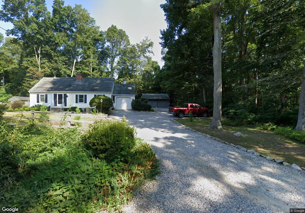
48 Glen Grove Rd Deep River, CT 06417
Estimated Value: $353,000 - $369,000
3
Beds
1
Bath
1,230
Sq Ft
$293/Sq Ft
Est. Value
About This Home
This home is located at 48 Glen Grove Rd, Deep River, CT 06417 and is currently estimated at $360,253, approximately $292 per square foot. 48 Glen Grove Rd is a home located in Middlesex County with nearby schools including Valley Regional High School.
Ownership History
Date
Name
Owned For
Owner Type
Purchase Details
Closed on
Nov 1, 2011
Sold by
Laming Alan L
Bought by
Cote William R and Cote Karen E
Current Estimated Value
Purchase Details
Closed on
Mar 11, 2003
Sold by
Schneider Robert W
Bought by
Laming Alan L
Home Financials for this Owner
Home Financials are based on the most recent Mortgage that was taken out on this home.
Original Mortgage
$172,000
Interest Rate
5.95%
Mortgage Type
Purchase Money Mortgage
Create a Home Valuation Report for This Property
The Home Valuation Report is an in-depth analysis detailing your home's value as well as a comparison with similar homes in the area
Home Values in the Area
Average Home Value in this Area
Purchase History
| Date | Buyer | Sale Price | Title Company |
|---|---|---|---|
| Cote William R | $210,000 | -- | |
| Laming Alan L | $215,000 | -- |
Source: Public Records
Mortgage History
| Date | Status | Borrower | Loan Amount |
|---|---|---|---|
| Previous Owner | Laming Alan L | $172,000 |
Source: Public Records
Tax History Compared to Growth
Tax History
| Year | Tax Paid | Tax Assessment Tax Assessment Total Assessment is a certain percentage of the fair market value that is determined by local assessors to be the total taxable value of land and additions on the property. | Land | Improvement |
|---|---|---|---|---|
| 2025 | $5,288 | $165,340 | $56,420 | $108,920 |
| 2024 | $5,188 | $165,340 | $56,420 | $108,920 |
| 2023 | $4,940 | $165,340 | $56,420 | $108,920 |
| 2022 | $4,792 | $165,340 | $56,420 | $108,920 |
| 2021 | $4,891 | $165,340 | $56,420 | $108,920 |
| 2020 | $4,518 | $150,640 | $50,330 | $100,310 |
| 2019 | $4,432 | $150,640 | $50,330 | $100,310 |
| 2018 | $4,432 | $150,640 | $50,330 | $100,310 |
| 2017 | $4,357 | $150,640 | $50,330 | $100,310 |
| 2016 | $4,147 | $150,640 | $50,330 | $100,310 |
| 2015 | $4,211 | $160,230 | $55,930 | $104,300 |
| 2014 | $4,147 | $160,230 | $55,930 | $104,300 |
Source: Public Records
Map
Nearby Homes
- 0 Glen Grove Rd
- 200 Westbrook Rd
- 538 Winthrop Rd
- 112 Cedar Swamp Rd
- 180 Malabar Dr
- 41 Bushy Hill Rd
- 86 Bushy Hill Rd
- 47 Plains Rd
- 88 Winthrop Rd
- 92 Warsaw St
- 100 N Tower Hill Rd
- 13 Cross Rd
- 129 Falls Landing Rd
- 8 Butter Jones Rd
- 31 Whittlesey Brook Rd
- 46 Hemlock Dr
- 20 Comstock Ave Unit 3D
- 20 Comstock Ave Unit 4C
- 0 Kelseytown Bridge Rd
- 25 Kelseytown Bridge Rd
- 70 Glen Grove Rd
- 22 Glen Grove Rd
- 52 Glen Grove Rd
- 42 Glen Grove Rd
- Lot B Glen Grove Rd
- 21A Glen Grove Rd
- 69 Glen Grove Rd
- 63 Glen Grove Rd
- 49 Glen Grove Rd
- 35 Glen Grove Rd
- 55 Glen Grove Rd
- 41 Glen Grove Rd
- 17 Glen Grove Rd
- 59 Glen Grove Rd
- 16 Glen Grove Road Extension
- 16 Glen Grove Road Extension
- 425 Winthrop Rd
- 7 Glen Grove Road Extension
- 20 Glen Grove Road Extension
- 20 Glen Grove Rd