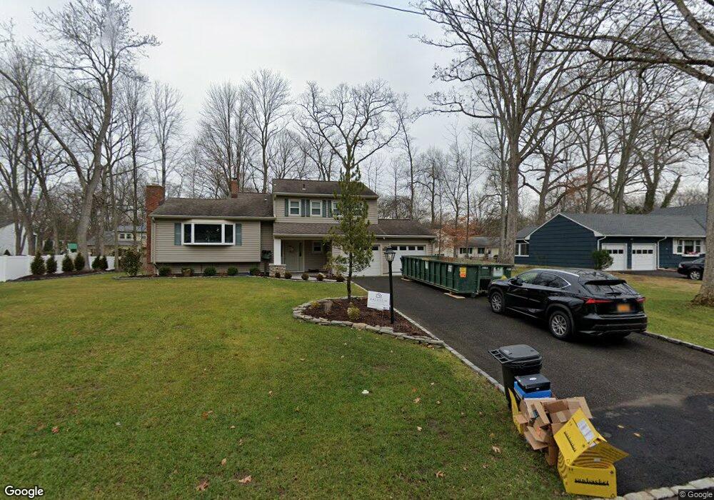
48 Hastings Rd Berkeley Heights, NJ 07922
Estimated Value: $794,850 - $941,000
Studio
--
Bath
1,747
Sq Ft
$513/Sq Ft
Est. Value
About This Home
This home is located at 48 Hastings Rd, Berkeley Heights, NJ 07922 and is currently estimated at $896,963, approximately $513 per square foot. 48 Hastings Rd is a home located in Union County with nearby schools including Columbia Middle School, Governor Livingston High School, and The Academy of Our Lady of Peace.
Ownership History
Date
Name
Owned For
Owner Type
Purchase Details
Closed on
May 24, 2010
Sold by
Campos Kevin Richard and Campos Karen M
Bought by
Campos Kevin Richard
Current Estimated Value
Home Financials for this Owner
Home Financials are based on the most recent Mortgage that was taken out on this home.
Original Mortgage
$405,000
Outstanding Balance
$272,384
Interest Rate
5.12%
Mortgage Type
New Conventional
Estimated Equity
$624,579
Purchase Details
Closed on
Jun 29, 2000
Sold by
Collard Ross T and Collard Joan Rosen
Bought by
Campos Kevin Richard
Home Financials for this Owner
Home Financials are based on the most recent Mortgage that was taken out on this home.
Original Mortgage
$20,000
Interest Rate
8.5%
Mortgage Type
Unknown
Purchase Details
Closed on
Dec 16, 1994
Sold by
Collard Ross T and Collard Joan Rosen
Bought by
Collard Ross T and Collard Joan Rosen
Create a Home Valuation Report for This Property
The Home Valuation Report is an in-depth analysis detailing your home's value as well as a comparison with similar homes in the area
Home Values in the Area
Average Home Value in this Area
Purchase History
| Date | Buyer | Sale Price | Title Company |
|---|---|---|---|
| Campos Kevin Richard | -- | None Available | |
| Campos Kevin Richard | $360,000 | -- | |
| Collard Ross T | -- | -- |
Source: Public Records
Mortgage History
| Date | Status | Borrower | Loan Amount |
|---|---|---|---|
| Open | Campos Kevin Richard | $405,000 | |
| Closed | Campos Kevin Richard | $20,000 | |
| Closed | Campos Kevin Richard | $300,000 |
Source: Public Records
Tax History
| Year | Tax Paid | Tax Assessment Tax Assessment Total Assessment is a certain percentage of the fair market value that is determined by local assessors to be the total taxable value of land and additions on the property. | Land | Improvement |
|---|---|---|---|---|
| 2025 | $15,699 | $366,200 | $146,200 | $220,000 |
| 2024 | $15,472 | $366,200 | $146,200 | $220,000 |
| 2023 | $15,472 | $366,200 | $146,200 | $220,000 |
| 2022 | $15,377 | $366,200 | $146,200 | $220,000 |
| 2021 | $15,293 | $366,200 | $146,200 | $220,000 |
| 2020 | $15,373 | $366,200 | $146,200 | $220,000 |
| 2019 | $15,296 | $366,200 | $146,200 | $220,000 |
| 2018 | $14,978 | $366,200 | $146,200 | $220,000 |
| 2017 | $14,794 | $366,200 | $146,200 | $220,000 |
| 2016 | $14,534 | $366,200 | $146,200 | $220,000 |
| 2015 | $14,454 | $366,200 | $146,200 | $220,000 |
| 2014 | $14,077 | $366,200 | $146,200 | $220,000 |
Source: Public Records
Map
Nearby Homes
- 126 Snyder Ave
- 3 Park Edge Ondo
- 57 Daria Ln
- 45 Park Edge Unit 45
- 93 Park Edge Unit 3H
- 19 Honeyman Place
- 46 Snyder Ave
- 181 Maple Ave
- 41 Brambling Rd
- 27 Brambling Rd
- 7 Meadow View Lane Ondo
- 19 Guenevere Way Ondo
- 157 Pearl St
- 239 Washington St
- 235 Plainfield Ave
- 317 Plainfield Ave
- 112 Crane Cir
- 755 River Rd
- 46 Coolidge Dr
- 52 Coolidge Dr
- 58 Hastings Rd
- 42 Hastings Rd
- 137 Briarwood Dr W
- 129 Briarwood Dr W
- 145 Briarwood Dr W
- 39 Hastings Rd
- 51 Hastings Rd
- 36 Hastings Rd
- 15 Greenbriar Dr
- 121 Briarwood Dr W
- 29 Greenbriar Dr
- 3 Greenbriar Dr
- 25 Hastings Rd
- 30 Hastings Rd
- 113 Briarwood Dr W
- 39 Greenbriar Dr
- 97 Ferndale Dr
- 138 Briarwood Dr W
- 130 Briarwood Dr W
- 146 Briarwood Dr W
Your Personal Tour Guide
Ask me questions while you tour the home.