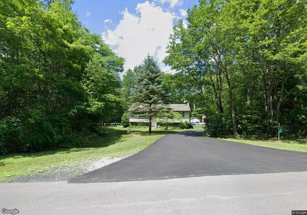
48 High Point Dr Kunkletown, PA 18058
Estimated Value: $277,059 - $323,000
3
Beds
2
Baths
1,132
Sq Ft
$262/Sq Ft
Est. Value
About This Home
This home is located at 48 High Point Dr, Kunkletown, PA 18058 and is currently estimated at $297,015, approximately $262 per square foot. 48 High Point Dr is a home located in Monroe County with nearby schools including Pleasant Valley Elementary School, Pleasant Valley Intermediate School, and Pleasant Valley Middle School.
Ownership History
Date
Name
Owned For
Owner Type
Purchase Details
Closed on
Jan 11, 2016
Sold by
Cooper Carol A and Schra Carol A
Bought by
Cooper Ronnie L
Current Estimated Value
Home Financials for this Owner
Home Financials are based on the most recent Mortgage that was taken out on this home.
Original Mortgage
$104,000
Outstanding Balance
$44,233
Interest Rate
3.98%
Mortgage Type
New Conventional
Estimated Equity
$252,782
Purchase Details
Closed on
Sep 27, 1989
Bought by
Cooper Ronnie L and Cooper Carol A
Create a Home Valuation Report for This Property
The Home Valuation Report is an in-depth analysis detailing your home's value as well as a comparison with similar homes in the area
Home Values in the Area
Average Home Value in this Area
Purchase History
| Date | Buyer | Sale Price | Title Company |
|---|---|---|---|
| Cooper Ronnie L | -- | None Available | |
| Cooper Ronnie L | $28,500 | -- |
Source: Public Records
Mortgage History
| Date | Status | Borrower | Loan Amount |
|---|---|---|---|
| Open | Cooper Ronnie L | $104,000 |
Source: Public Records
Tax History Compared to Growth
Tax History
| Year | Tax Paid | Tax Assessment Tax Assessment Total Assessment is a certain percentage of the fair market value that is determined by local assessors to be the total taxable value of land and additions on the property. | Land | Improvement |
|---|---|---|---|---|
| 2025 | $817 | $126,300 | $36,430 | $89,870 |
| 2024 | $581 | $126,300 | $36,430 | $89,870 |
| 2023 | $3,597 | $126,300 | $36,430 | $89,870 |
| 2022 | $3,493 | $126,300 | $36,430 | $89,870 |
| 2021 | $3,414 | $126,300 | $36,430 | $89,870 |
| 2020 | $2,982 | $126,300 | $36,430 | $89,870 |
| 2019 | $4,008 | $22,860 | $6,140 | $16,720 |
| 2018 | $3,962 | $22,860 | $6,140 | $16,720 |
| 2017 | $3,962 | $22,860 | $6,140 | $16,720 |
| 2016 | $584 | $22,860 | $6,140 | $16,720 |
| 2015 | -- | $22,860 | $6,140 | $16,720 |
| 2014 | -- | $22,860 | $6,140 | $16,720 |
Source: Public Records
Map
Nearby Homes
- 118 Sterner Run Rd
- 101 Sterner Run Rd
- 154 Sterner Run Rd
- 924 Hell Hollow Rd
- 4193 Forest Dr
- 4167 Forest Dr
- 2125 Sassafras Ln
- 2121 Sassafras Ln
- 0 Poplar Ln 33 Ln
- 0 Poplar Ln 29 Ln
- 134 Poplar Ln
- 217 Lower Valley Dr
- 1619 Sugar Ln
- 9081 Sherwood Dr
- W14 Greenwood Dr
- Lot K15 Lincoln Green Dr K15
- 1116 Dr
- 687 Dotters Corner Rd
- 178 Ash Ln
- 0 Rd
- Lot 35 High Point Dr
- 12 High Point Dr
- 60 Frantz Rd
- 32 High Point Dr
- Lot 49 High Pt Dr
- 47 High Point Dr
- 28 High Point Dr
- 161 High Point Dr
- 27 High Point Dr
- 0 High Point Dr
- Lot 49 High Point Dr Unit 49
- 46 High Point Dr
- 180 High Point Dr
- 26 High Point Dr
- 62 Frantz Rd
- 117 Kyle Dr
- 183 High Point Dr
- 31 High Point Dr
- 45 High Point Dr
- 50 High Point Dr