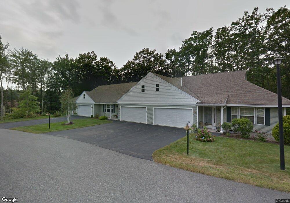
48 Macintosh Ln Unit M48 Old Orchard Beach, ME 04064
Estimated Value: $508,000 - $544,000
2
Beds
2
Baths
1,987
Sq Ft
$266/Sq Ft
Est. Value
About This Home
This home is located at 48 Macintosh Ln Unit M48, Old Orchard Beach, ME 04064 and is currently estimated at $527,656, approximately $265 per square foot. 48 Macintosh Ln Unit M48 is a home located in York County with nearby schools including Jameson Elementary School, Loranger Memorial School, and Old Orchard Beach High School.
Ownership History
Date
Name
Owned For
Owner Type
Purchase Details
Closed on
Nov 28, 2018
Sold by
Curtis Dorothy A and Curtis Philip B
Bought by
Curtis Philip B and Curtis Dorothy A
Current Estimated Value
Purchase Details
Closed on
Jan 18, 2018
Sold by
Martin Susan A and Martin Paul L
Bought by
Curtis Philip B and Anagnostis Dorothy A
Purchase Details
Closed on
Dec 30, 2010
Sold by
Massey Reid T and Massey April B
Bought by
Martin Susan A and Martin Paul L
Home Financials for this Owner
Home Financials are based on the most recent Mortgage that was taken out on this home.
Original Mortgage
$75,000
Interest Rate
4.37%
Mortgage Type
Purchase Money Mortgage
Create a Home Valuation Report for This Property
The Home Valuation Report is an in-depth analysis detailing your home's value as well as a comparison with similar homes in the area
Home Values in the Area
Average Home Value in this Area
Purchase History
| Date | Buyer | Sale Price | Title Company |
|---|---|---|---|
| Curtis Philip B | -- | -- | |
| Curtis Philip B | -- | -- | |
| Martin Susan A | -- | -- |
Source: Public Records
Mortgage History
| Date | Status | Borrower | Loan Amount |
|---|---|---|---|
| Previous Owner | Martin Susan A | $75,000 | |
| Previous Owner | Martin Susan A | $56,000 |
Source: Public Records
Tax History Compared to Growth
Tax History
| Year | Tax Paid | Tax Assessment Tax Assessment Total Assessment is a certain percentage of the fair market value that is determined by local assessors to be the total taxable value of land and additions on the property. | Land | Improvement |
|---|---|---|---|---|
| 2024 | $5,950 | $546,900 | $73,200 | $473,700 |
| 2023 | $5,723 | $502,000 | $73,200 | $428,800 |
| 2022 | $5,148 | $420,600 | $48,800 | $371,800 |
| 2021 | $4,840 | $341,800 | $48,800 | $293,000 |
| 2020 | $4,501 | $316,900 | $48,800 | $268,100 |
| 2019 | $4,912 | $316,900 | $48,800 | $268,100 |
| 2018 | $3,833 | $312,300 | $48,800 | $263,500 |
| 2017 | $4,038 | $257,200 | $48,800 | $208,400 |
| 2016 | $3,867 | $250,100 | $48,800 | $201,300 |
| 2015 | $3,797 | $250,100 | $48,800 | $201,300 |
| 2014 | $3,721 | $250,100 | $48,800 | $201,300 |
| 2013 | $3,353 | $243,000 | $48,800 | $194,200 |
Source: Public Records
Map
Nearby Homes
- 26 Kavanaugh Rd
- 4 Kavanaugh Rd
- 5 Wilson Dr
- 78 Ryefield Dr
- 3 Bayberry Dr
- 161 Saco Ave Unit 113
- 7 Stanley St
- 2 Stanley St
- 18 Ryefield Dr
- 5 Oregon Ave Unit 210
- 17 & 19 Olympia Ave
- 19 Olympia Ave
- 113-115 Saco Ave
- 8 Village Ln
- 106 Ocean Ave
- 29 15th St
- 105 Union Ave
- 28 Smithwheel Rd
- 3 Central Ave
- 52 Wild Dunes Way Unit 1A
- 48 Macintosh Ln
- 50 Macintosh Ln
- 46 Macintosh Ln
- 52 Macintosh Ln
- 52 Macintosh Ln Unit F-8
- 41 Macintosh Ln
- 64 Macintosh Ln
- 66 Macintosh Ln
- 70 Macintosh Ln
- 68 Macintosh Ln
- 68 Macintosh Ln Unit 68
- 72 Macintosh Ln
- 45 Macintosh Ln
- 74 Macintosh Ln
- 47 Macintosh Ln
- 76 Macintosh Ln
- 44 Macintosh Ln
- 61 Macintosh Ln
- 78 Macintosh Ln
- 67 Macintosh Ln