
Landlord's Agent in 2025
James Brown
Coldwell Banker Realty - Manchester
(978) 810-1332
10 Total Sales
Estimated Value: $557,000 - $619,000
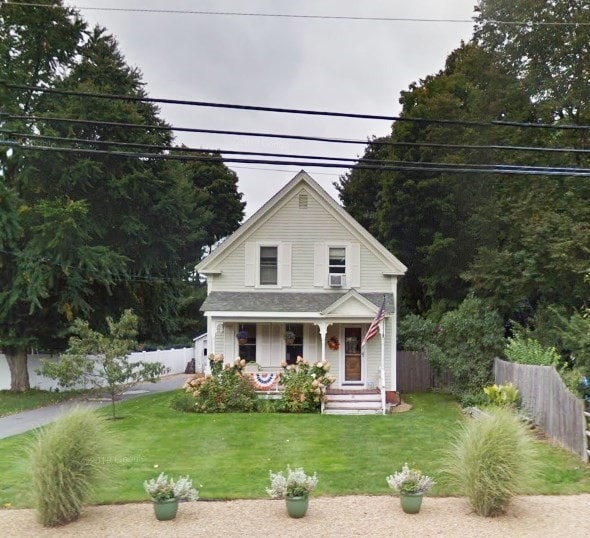
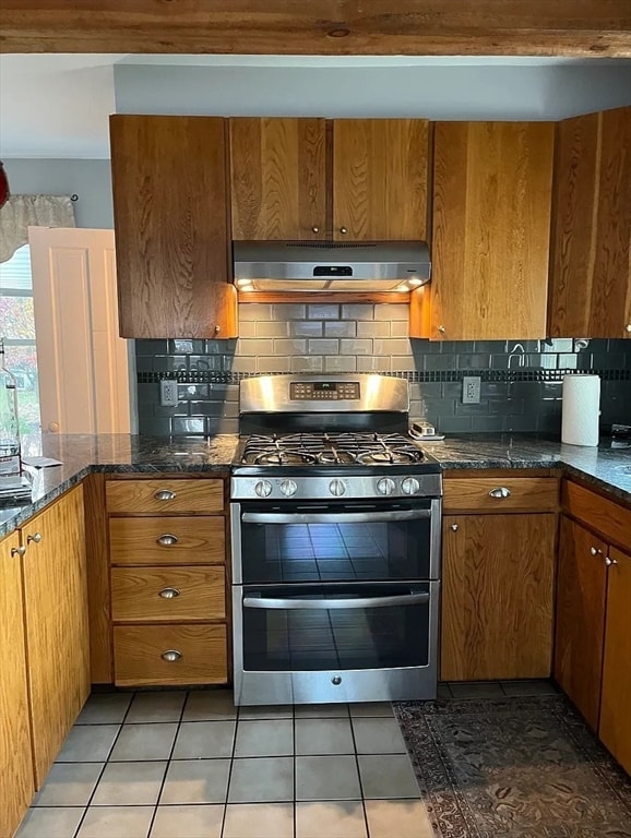
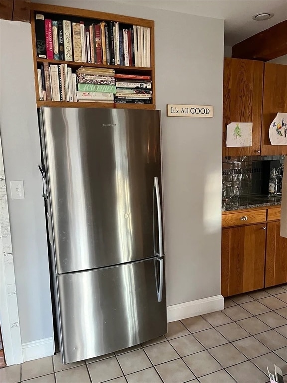
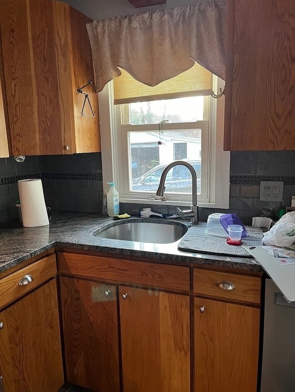
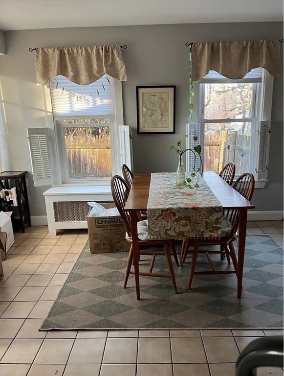
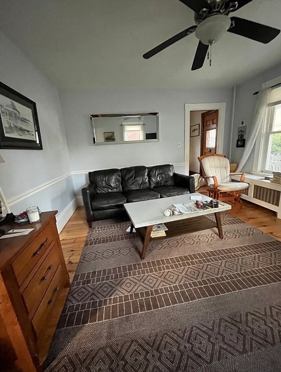
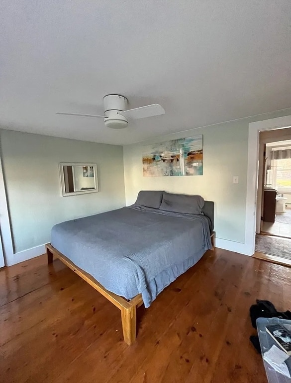
Quaint, two-bedroom single-family home on Main Street in the historic town of Rowley, Massachusetts. Rental includes appliances, in-house laundry, new gas furnace, a large back yard and swimming pool. Train station one mile from house, close to Boston, Newburyport, Cranes Beach etc. Rowley is a charming New England town located on the scenic North Shore. Known for its historic character, quiet neighborhoods, and proximity to beaches, parks, and nature reserves, Rowley offers a peaceful, small-town atmosphere with easy access to Route 1 and I-95 for commuting. It’s ideal for those seeking a blend of rural beauty and convenient amenities. Tenant is responsible for cost of all utilities including gas, electric, cable, and water. Owner is seeking a long term tenant.
Last Agent to Rent the Property
Coldwell Banker Realty - Manchester Listed on: 06/06/2025
| Date | Buyer | Sale Price | Title Company |
|---|---|---|---|
| Anthony Jeffrey | $280,000 | -- | |
| Anthony Jeffrey | $280,000 | -- | |
| Winfrey Ii Stuart E | $275,000 | -- | |
| Winfrey Stuart E | $275,000 | -- | |
| Jean Peter A | $148,500 | -- | |
| Jean Peter A | $148,500 | -- |
| Date | Status | Borrower | Loan Amount |
|---|---|---|---|
| Open | Jean Peter A | $224,000 | |
| Closed | Jean Peter A | $224,000 |
| Date | Event | Price | List to Sale | Price per Sq Ft |
|---|---|---|---|---|
| 07/02/2025 07/02/25 | Rented | $3,050 | -4.7% | -- |
| 06/06/2025 06/06/25 | For Rent | $3,200 | -- | -- |
| Year | Tax Paid | Tax Assessment Tax Assessment Total Assessment is a certain percentage of the fair market value that is determined by local assessors to be the total taxable value of land and additions on the property. | Land | Improvement |
|---|---|---|---|---|
| 2025 | $5,611 | $476,700 | $257,900 | $218,800 |
| 2024 | $5,443 | $449,800 | $245,600 | $204,200 |
| 2023 | $5,118 | $393,100 | $213,600 | $179,500 |
| 2022 | $5,227 | $357,500 | $178,000 | $179,500 |
| 2021 | $4,892 | $314,000 | $154,700 | $159,300 |
| 2020 | $4,987 | $320,100 | $147,400 | $172,700 |
| 2019 | $4,601 | $313,400 | $147,400 | $166,000 |
| 2018 | $4,193 | $287,600 | $147,400 | $140,200 |
| 2017 | $3,853 | $272,500 | $137,900 | $134,600 |
| 2016 | $3,685 | $256,600 | $114,200 | $142,400 |
| 2015 | $3,258 | $228,800 | $114,200 | $114,600 |
Landlord's Agent in 2025
James Brown
Coldwell Banker Realty - Manchester
(978) 810-1332
10 Total Sales
Source: MLS Property Information Network (MLS PIN)
MLS Number: 73386868
APN: ROWL-000015-000039
Disclaimer: Certain information contained herein is derived from information provided by parties other than Homes.com. All information provided is deemed reliable, but is not guaranteed to be accurate and should be independently verified.
![]() The property listing data and information, or the Images, set forth herein were provided to MLS Property Information Network, Inc. from third party sources, including sellers, lessors and public records, and were compiled by MLS Property Information Network, Inc. The property listing data and information, and the Images, are for the personal, non-commercial use of consumers having a good faith interest in purchasing or leasing listed properties of the type displayed to them and may not be used for any purpose other than to identify prospective properties which such consumers may have a good faith interest in purchasing or leasing. MLS Property Information Network, Inc. and its subscribers disclaim any and all representations and warranties as to the accuracy of the property listing data and information, or as to the accuracy of any of the Images, set forth herein.
The property listing data and information, or the Images, set forth herein were provided to MLS Property Information Network, Inc. from third party sources, including sellers, lessors and public records, and were compiled by MLS Property Information Network, Inc. The property listing data and information, and the Images, are for the personal, non-commercial use of consumers having a good faith interest in purchasing or leasing listed properties of the type displayed to them and may not be used for any purpose other than to identify prospective properties which such consumers may have a good faith interest in purchasing or leasing. MLS Property Information Network, Inc. and its subscribers disclaim any and all representations and warranties as to the accuracy of the property listing data and information, or as to the accuracy of any of the Images, set forth herein.
Ask me questions while you tour the home.