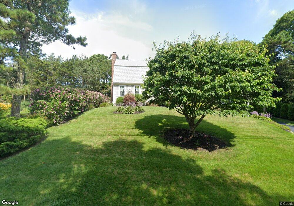
48 Mashnee Rd Buzzards Bay, MA 02532
Estimated Value: $652,262 - $796,000
3
Beds
2
Baths
1,501
Sq Ft
$487/Sq Ft
Est. Value
About This Home
This home is located at 48 Mashnee Rd, Buzzards Bay, MA 02532 and is currently estimated at $730,816, approximately $486 per square foot. 48 Mashnee Rd is a home located in Barnstable County with nearby schools including Bourne High School, St Margaret Regional School, and Cadence Academy Preschool - Bourne.
Ownership History
Date
Name
Owned For
Owner Type
Purchase Details
Closed on
Dec 19, 1994
Sold by
Oneil Richard D and Oneil Maureen B
Bought by
Gushue Edward S and Gushue Marion H
Current Estimated Value
Home Financials for this Owner
Home Financials are based on the most recent Mortgage that was taken out on this home.
Original Mortgage
$131,200
Interest Rate
9.03%
Mortgage Type
Purchase Money Mortgage
Create a Home Valuation Report for This Property
The Home Valuation Report is an in-depth analysis detailing your home's value as well as a comparison with similar homes in the area
Purchase History
| Date | Buyer | Sale Price | Title Company |
|---|---|---|---|
| Gushue Edward S | $164,000 | -- | |
| Gushue Edward S | $164,000 | -- |
Source: Public Records
Mortgage History
| Date | Status | Borrower | Loan Amount |
|---|---|---|---|
| Closed | Gushue Edward S | $131,200 | |
| Previous Owner | Gushue Edward S | $95,000 |
Source: Public Records
Tax History
| Year | Tax Paid | Tax Assessment Tax Assessment Total Assessment is a certain percentage of the fair market value that is determined by local assessors to be the total taxable value of land and additions on the property. | Land | Improvement |
|---|---|---|---|---|
| 2025 | $4,281 | $548,100 | $241,200 | $306,900 |
| 2024 | $4,186 | $521,900 | $229,700 | $292,200 |
| 2023 | $4,098 | $465,100 | $203,300 | $261,800 |
| 2022 | $3,912 | $387,700 | $179,900 | $207,800 |
| 2021 | $3,801 | $352,900 | $163,700 | $189,200 |
| 2020 | $3,710 | $345,400 | $162,200 | $183,200 |
| 2019 | $3,733 | $355,200 | $180,200 | $175,000 |
| 2018 | $3,566 | $338,300 | $171,600 | $166,700 |
| 2017 | $3,430 | $333,000 | $170,000 | $163,000 |
| 2016 | $3,172 | $312,200 | $153,000 | $159,200 |
| 2015 | $2,916 | $289,600 | $130,400 | $159,200 |
Source: Public Records
Map
Nearby Homes
- 35 Benedict Rd
- 60 Bourne Neck Dr
- 203 County Rd
- 5 Zoli Ln
- 13 Laurel Hill Ct
- 46 Holt Rd Unit B
- 46 Holt Rd
- 40-A Lafayette Ave
- 566 Shore Rd
- 5 Sea Knoll Ct
- 4 Van Bummel Rd
- 12 Turnberry Rd Unit 12
- 56 Rip Van Winkle Way
- 3 Fairway Dr Unit F
- 44 Cotuit Rd
- 16 Amberwood Ct
- 36B Starboard Dr Unit 36E
- 36B Starboard Dr Unit 36G
- 36B Starboard Dr Unit 36C
- 36B Starboard Dr Unit 36A
Your Personal Tour Guide
Ask me questions while you tour the home.