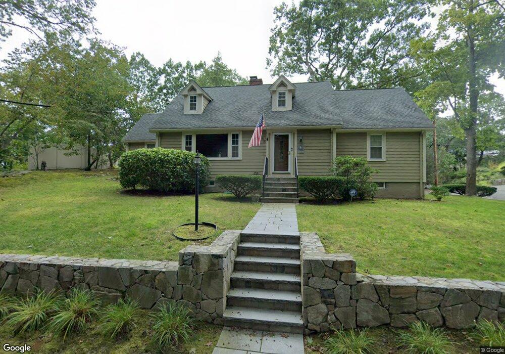
48 N Border Rd Winchester, MA 01890
Winchester Highlands NeighborhoodEstimated Value: $1,110,000 - $1,552,000
3
Beds
2
Baths
1,958
Sq Ft
$681/Sq Ft
Est. Value
About This Home
This home is located at 48 N Border Rd, Winchester, MA 01890 and is currently estimated at $1,334,229, approximately $681 per square foot. 48 N Border Rd is a home located in Middlesex County with nearby schools including Muraco Elementary School, McCall Middle School, and Winchester High School.
Ownership History
Date
Name
Owned For
Owner Type
Purchase Details
Closed on
Oct 23, 2006
Sold by
Fitzgerald Children Rt
Bought by
Ellis Kurt F and Ellis Evangelina
Current Estimated Value
Home Financials for this Owner
Home Financials are based on the most recent Mortgage that was taken out on this home.
Original Mortgage
$417,000
Outstanding Balance
$249,244
Interest Rate
6.49%
Mortgage Type
Purchase Money Mortgage
Estimated Equity
$1,084,985
Create a Home Valuation Report for This Property
The Home Valuation Report is an in-depth analysis detailing your home's value as well as a comparison with similar homes in the area
Home Values in the Area
Average Home Value in this Area
Purchase History
| Date | Buyer | Sale Price | Title Company |
|---|---|---|---|
| Ellis Kurt F | $530,000 | -- |
Source: Public Records
Mortgage History
| Date | Status | Borrower | Loan Amount |
|---|---|---|---|
| Open | Ellis Kurt F | $417,000 |
Source: Public Records
Tax History
| Year | Tax Paid | Tax Assessment Tax Assessment Total Assessment is a certain percentage of the fair market value that is determined by local assessors to be the total taxable value of land and additions on the property. | Land | Improvement |
|---|---|---|---|---|
| 2025 | $13,610 | $1,227,200 | $922,100 | $305,100 |
| 2024 | $13,159 | $1,161,400 | $856,300 | $305,100 |
| 2023 | $12,382 | $1,049,300 | $757,500 | $291,800 |
| 2022 | $12,304 | $983,500 | $691,600 | $291,900 |
| 2021 | $11,139 | $868,200 | $576,300 | $291,900 |
| 2020 | $10,349 | $835,300 | $543,400 | $291,900 |
| 2019 | $9,317 | $769,400 | $477,500 | $291,900 |
| 2018 | $8,933 | $732,800 | $450,400 | $282,400 |
| 2017 | $8,349 | $679,900 | $424,000 | $255,900 |
| 2016 | $7,829 | $670,300 | $424,000 | $246,300 |
| 2015 | $7,500 | $617,800 | $385,300 | $232,500 |
| 2014 | $6,914 | $546,100 | $321,100 | $225,000 |
Source: Public Records
Map
Nearby Homes
- 2 Abby Rd
- 6 Mason Way Unit 63
- 146 Marble St Unit 507
- 193 Park St
- 15 Englewood Rd
- 6 Stratton Dr Unit 3303
- 6 Stratton Dr Unit 208
- 6 Stratton Dr Unit 3307
- 6 Everett St
- 57 Park St
- 7 Carol St
- 31 Tremont St
- 320 Washington St
- 15 East St
- 13 Wright St
- 18 Central St
- 100 Ledgewood Dr Unit 410
- 426 Main St Unit 205
- 20 Charles Rd
- 171 Swanton St Unit 21
Your Personal Tour Guide
Ask me questions while you tour the home.