Estimated Value: $476,000 - $526,000
5
Beds
4
Baths
2,554
Sq Ft
$197/Sq Ft
Est. Value
About This Home
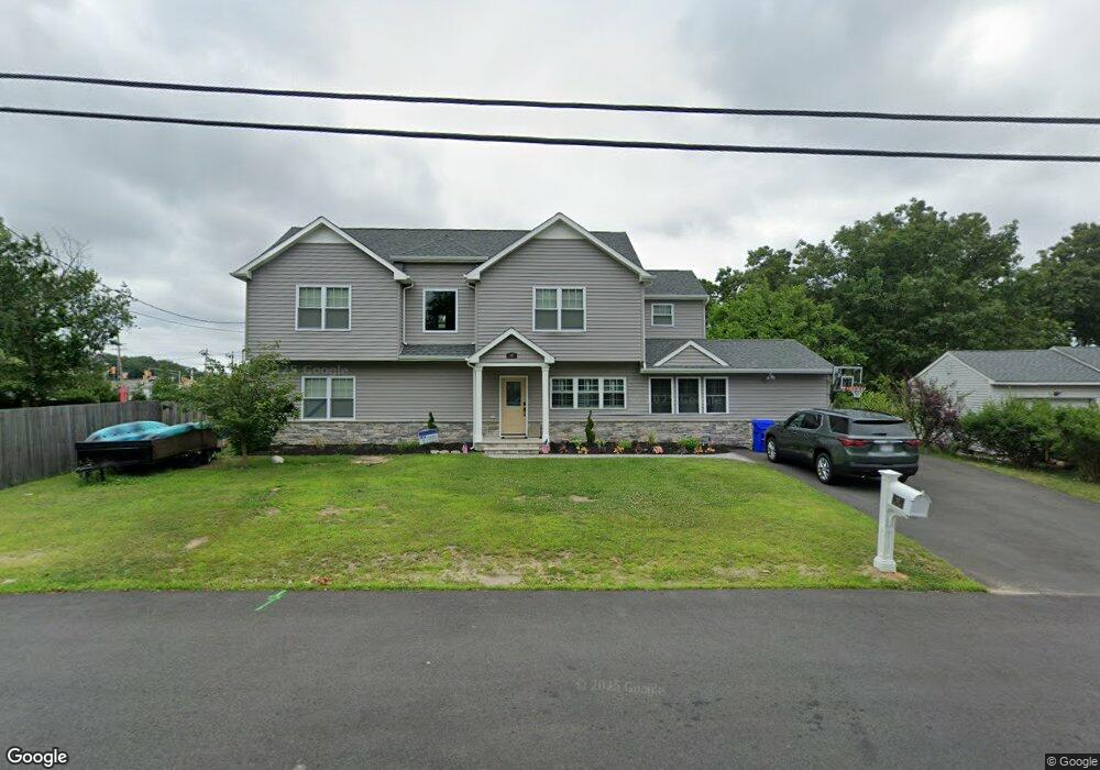
This home is located at 48 Neil Ave, Brick, NJ 08724 and is currently estimated at $504,284, approximately $197 per square foot. 48 Neil Ave is a home located in Ocean County with nearby schools including Lanes Mill Elementary School, Veterans Memorial Middle School, and Brick Township Memorial High School.
Ownership History
Date
Name
Owned For
Owner Type
Purchase Details
Closed on
Jul 22, 2005
Sold by
Destories Timothy and Destories Kelly Jean
Bought by
Meyer Andrew and Meyer Christy
Current Estimated Value
Home Financials for this Owner
Home Financials are based on the most recent Mortgage that was taken out on this home.
Original Mortgage
$53,000
Outstanding Balance
$27,627
Interest Rate
5.54%
Mortgage Type
Stand Alone Second
Estimated Equity
$476,657
Purchase Details
Closed on
Dec 12, 1997
Sold by
Pollard Kathy M
Bought by
Destories Timothy and Destories Kelly Jean
Home Financials for this Owner
Home Financials are based on the most recent Mortgage that was taken out on this home.
Original Mortgage
$84,550
Interest Rate
7.14%
Create a Home Valuation Report for This Property
The Home Valuation Report is an in-depth analysis detailing your home's value as well as a comparison with similar homes in the area
Home Values in the Area
Average Home Value in this Area
Purchase History
| Date | Buyer | Sale Price | Title Company |
|---|---|---|---|
| Meyer Andrew | $265,000 | First American Title Ins Co | |
| Destories Timothy | $89,000 | -- |
Source: Public Records
Mortgage History
| Date | Status | Borrower | Loan Amount |
|---|---|---|---|
| Open | Meyer Andrew | $53,000 | |
| Open | Meyer Andrew | $212,000 | |
| Previous Owner | Destories Timothy | $84,550 |
Source: Public Records
Tax History
| Year | Tax Paid | Tax Assessment Tax Assessment Total Assessment is a certain percentage of the fair market value that is determined by local assessors to be the total taxable value of land and additions on the property. | Land | Improvement |
|---|---|---|---|---|
| 2025 | $8,836 | $321,300 | $134,600 | $186,700 |
| 2024 | $7,988 | $321,300 | $134,600 | $186,700 |
| 2023 | $7,881 | $321,300 | $134,600 | $186,700 |
| 2022 | $5,814 | $237,000 | $134,600 | $102,400 |
| 2021 | $5,649 | $235,100 | $134,600 | $100,500 |
| 2020 | $5,572 | $235,100 | $134,600 | $100,500 |
| 2019 | $5,464 | $235,100 | $134,600 | $100,500 |
| 2018 | $5,339 | $235,100 | $134,600 | $100,500 |
| 2017 | $5,196 | $235,100 | $134,600 | $100,500 |
| 2016 | $5,158 | $235,100 | $134,600 | $100,500 |
| 2015 | $5,022 | $235,100 | $134,600 | $100,500 |
| 2014 | $4,972 | $235,100 | $134,600 | $100,500 |
Source: Public Records
Map
Nearby Homes
- 49 Markham Rd
- 1416 Isabella Ct Unit D3
- 00 Larchmont Ave
- 6 Hardy Ct
- 202 Samantha Ct
- 17 Clark Dr
- 1728 Burrsville Rd
- 47 Cherrywood Cir Unit 147
- 5 Cherrywood Cir Unit 105
- 17 Markham Rd
- 24 Clay Cir
- 173 Primrose Ln
- 802 Sandra Place
- 203 Blake Cir
- 60 Sunset Dr
- 506 Linda Ct Unit 47H
- 201 Blake Cir
- 35 Vivian Ct
- 20 Lamb Rd
- 538 Linda Ct
- 50 Neil Ave
- 46 Burnt Tavern Rd
- 52 Neil Ave
- 48 Burnt Tavern Rd
- 49 Neil Ave
- 54 Neil Ave
- 51 Neil Ave
- 49 Burnt Tavern Rd
- 47 Burnt Tavern Rd
- 50 Burnt Tavern Rd
- 51 Burnt Tavern Rd
- 45 Burnt Tavern Rd
- 43 Burnt Tavern Rd
- 56 Neil Ave
- 53 Neil Ave
- 55 Burnt Tavern Rd
- 52 Burnt Tavern Rd
- 12 Rosalind Rd
- 10 Rosalind Rd
- 57 Burnt Tavern Rd
Your Personal Tour Guide
Ask me questions while you tour the home.