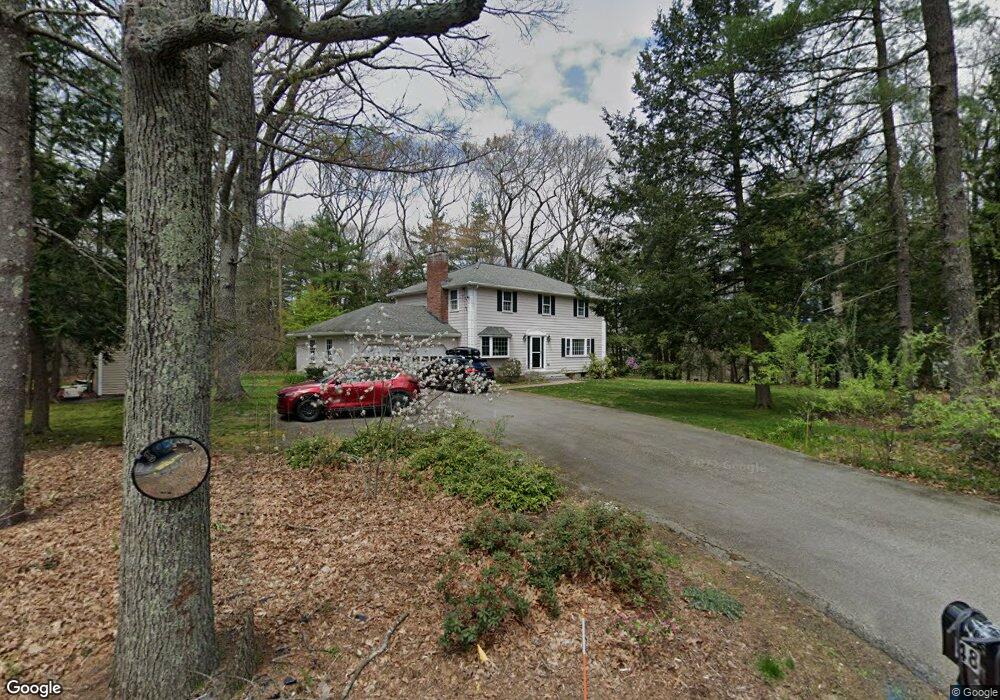
48 Pelham Island Rd Sudbury, MA 01776
Estimated Value: $1,013,411 - $1,261,000
4
Beds
3
Baths
2,184
Sq Ft
$520/Sq Ft
Est. Value
About This Home
This home is located at 48 Pelham Island Rd, Sudbury, MA 01776 and is currently estimated at $1,135,853, approximately $520 per square foot. 48 Pelham Island Rd is a home located in Middlesex County with nearby schools including Israel Loring Elementary School, Ephraim Curtis Middle School, and Lincoln-Sudbury Regional High School.
Ownership History
Date
Name
Owned For
Owner Type
Purchase Details
Closed on
Jul 17, 1996
Sold by
Aschettino Stephen M and Aschettino Elaine M
Bought by
Koster Robert S and Bell Katherine O
Current Estimated Value
Home Financials for this Owner
Home Financials are based on the most recent Mortgage that was taken out on this home.
Original Mortgage
$2,560,000
Outstanding Balance
$185,743
Interest Rate
8.28%
Mortgage Type
Purchase Money Mortgage
Estimated Equity
$950,110
Create a Home Valuation Report for This Property
The Home Valuation Report is an in-depth analysis detailing your home's value as well as a comparison with similar homes in the area
Home Values in the Area
Average Home Value in this Area
Purchase History
| Date | Buyer | Sale Price | Title Company |
|---|---|---|---|
| Koster Robert S | $320,000 | -- | |
| Koster Robert S | $320,000 | -- |
Source: Public Records
Mortgage History
| Date | Status | Borrower | Loan Amount |
|---|---|---|---|
| Open | Koster Robert S | $197,600 | |
| Closed | Koster Robert S | $240,000 | |
| Open | Koster Robert S | $2,560,000 |
Source: Public Records
Tax History Compared to Growth
Tax History
| Year | Tax Paid | Tax Assessment Tax Assessment Total Assessment is a certain percentage of the fair market value that is determined by local assessors to be the total taxable value of land and additions on the property. | Land | Improvement |
|---|---|---|---|---|
| 2025 | $14,123 | $964,700 | $461,300 | $503,400 |
| 2024 | $13,583 | $929,700 | $447,700 | $482,000 |
| 2023 | $12,908 | $818,500 | $414,500 | $404,000 |
| 2022 | $12,628 | $699,600 | $380,100 | $319,500 |
| 2021 | $12,211 | $648,500 | $380,100 | $268,400 |
| 2020 | $11,965 | $648,500 | $380,100 | $268,400 |
| 2019 | $11,615 | $648,500 | $380,100 | $268,400 |
| 2018 | $11,570 | $645,300 | $400,100 | $245,200 |
| 2017 | $11,382 | $641,600 | $395,300 | $246,300 |
| 2016 | $11,025 | $619,400 | $380,100 | $239,300 |
| 2015 | $10,560 | $600,000 | $365,300 | $234,700 |
| 2014 | $10,539 | $584,500 | $354,500 | $230,000 |
Source: Public Records
Map
Nearby Homes
- 216 Landham Rd
- 63 Landham Rd
- 0 Wagonwheel Rd
- 6 Old County Rd Unit 16
- 94 Goodmans Hill Rd
- 84 Hopestill Brown Rd
- 23 Massasoit Ave
- 36 Concord Rd
- 1011 Boston Post Rd
- 353 Old Connecticut Path
- 17 Hastings Way Unit 17
- 30 Edith Rd
- 8 Clara Rd
- 24 Pinewood Dr
- 14 Eisenhower Rd
- 29 Derby St
- 454 Old Connecticut Path
- 81 Nicholas Rd Unit B
- 128 Nobscot Rd
- 17 Glezen Ln
- 15 Hawthorne Rd
- 49 Pelham Island Rd
- 39 Pelham Island Rd
- 8 Hawthorne Rd
- 36 Pelham Island Rd
- 12 Hawthorne Rd
- 19 Hawthorne Rd
- 18 Hawthorne Rd
- 66 Pelham Island Rd
- 65 Pelham Island Rd
- 11 Beckwith St
- 8 Beckwith St
- 30 Pelham Island Rd
- 25 Hawthorne Rd
- 24 Pelham Island Rd
- 18 Beckwith St
- 4 Guzzle Brook Dr
- 71 Pelham Island Rd
- 20 Guzzle Brook Dr
- 78 Pelham Island Rd