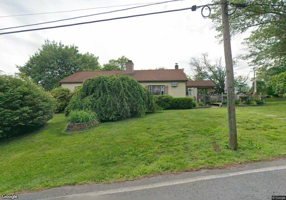
48 Penn Rd Pottstown, PA 19464
Limerick Township NeighborhoodEstimated Value: $304,000 - $371,000
4
Beds
2
Baths
1,332
Sq Ft
$260/Sq Ft
Est. Value
About This Home
This home is located at 48 Penn Rd, Pottstown, PA 19464 and is currently estimated at $346,028, approximately $259 per square foot. 48 Penn Rd is a home located in Montgomery County with nearby schools including Evans Elementary School, Spring-Ford Middle School 8th Grade Center, and Spring-Ford Middle School 5/6/7 Grade Center.
Ownership History
Date
Name
Owned For
Owner Type
Purchase Details
Closed on
Sep 27, 2007
Sold by
Hsbc Mortgage Ser Inc
Bought by
Law Kathy and Law David
Current Estimated Value
Home Financials for this Owner
Home Financials are based on the most recent Mortgage that was taken out on this home.
Original Mortgage
$175,975
Outstanding Balance
$111,122
Interest Rate
6.43%
Estimated Equity
$234,906
Purchase Details
Closed on
Jul 12, 2007
Sold by
Lenzi Jacqueline M and Lenzi Richard
Bought by
Hsbc Mortgage Services Inc
Create a Home Valuation Report for This Property
The Home Valuation Report is an in-depth analysis detailing your home's value as well as a comparison with similar homes in the area
Home Values in the Area
Average Home Value in this Area
Purchase History
| Date | Buyer | Sale Price | Title Company |
|---|---|---|---|
| Law Kathy | $182,500 | None Available | |
| Hsbc Mortgage Services Inc | $1,746 | None Available |
Source: Public Records
Mortgage History
| Date | Status | Borrower | Loan Amount |
|---|---|---|---|
| Open | Law Kathy | $175,975 |
Source: Public Records
Tax History Compared to Growth
Tax History
| Year | Tax Paid | Tax Assessment Tax Assessment Total Assessment is a certain percentage of the fair market value that is determined by local assessors to be the total taxable value of land and additions on the property. | Land | Improvement |
|---|---|---|---|---|
| 2025 | $4,437 | $114,750 | $34,070 | $80,680 |
| 2024 | $4,437 | $114,750 | $34,070 | $80,680 |
| 2023 | $4,234 | $114,750 | $34,070 | $80,680 |
| 2022 | $4,090 | $114,750 | $34,070 | $80,680 |
| 2021 | $3,994 | $114,750 | $34,070 | $80,680 |
| 2020 | $3,892 | $114,750 | $34,070 | $80,680 |
| 2019 | $3,821 | $114,750 | $34,070 | $80,680 |
| 2018 | $2,881 | $114,750 | $34,070 | $80,680 |
| 2017 | $3,751 | $114,750 | $34,070 | $80,680 |
| 2016 | $3,707 | $114,750 | $34,070 | $80,680 |
| 2015 | $3,546 | $114,750 | $34,070 | $80,680 |
| 2014 | $3,546 | $114,750 | $34,070 | $80,680 |
Source: Public Records
Map
Nearby Homes
- 0 Industrial Pkwy Unit PAMC2142810
- 20 Bunker Way
- 1180 Rupert Rd
- 1629 Rupert Rd
- 1687 Rupert Rd
- 1060 Oakdale Dr
- 847 Rivendell Ln
- 3000 E High St Unit 1
- 2933 E High St
- 172 Oak Creek Dr
- 90 Kurtz Rd
- 17 Lightcap Rd
- 0 Steinmetz Rd
- 2672 Crownview Rd
- 94 Presidential Dr
- 217 S Park Rd
- 300 Deer Run Ct
- 0 Sanatoga Rd Unit PAMC2163996
- 180 Deer Run Ct
- 160 Deer Run Ct