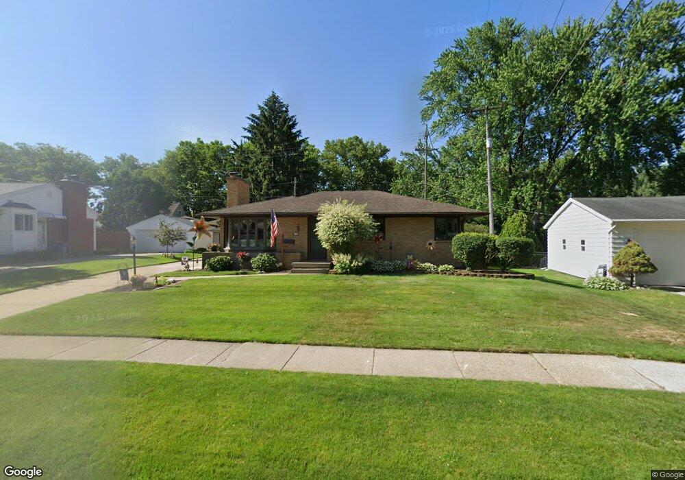
48 Pershing Dr NE Grand Rapids, MI 49505
Creston NeighborhoodEstimated Value: $320,000 - $377,000
3
Beds
2
Baths
1,424
Sq Ft
$246/Sq Ft
Est. Value
About This Home
This home is located at 48 Pershing Dr NE, Grand Rapids, MI 49505 and is currently estimated at $350,834, approximately $246 per square foot. 48 Pershing Dr NE is a home located in Kent County with nearby schools including Riverside Middle School, Union High School, and ISJ Academy.
Ownership History
Date
Name
Owned For
Owner Type
Purchase Details
Closed on
Apr 13, 2017
Sold by
Lilly Beverly Louise and Chalmers Craig S
Bought by
Lilly Beverly Louise
Current Estimated Value
Purchase Details
Closed on
Apr 7, 2000
Sold by
Lilly Lilly
Bought by
Lilly and Lilly Chalmers
Purchase Details
Closed on
Jun 24, 1992
Sold by
Lilly Lilly C C and Lilly C
Bought by
Lilly Beverly L Chalmers Craig S
Purchase Details
Closed on
Sep 12, 1983
Bought by
Lilly Beverly L Chalmers Craig S
Create a Home Valuation Report for This Property
The Home Valuation Report is an in-depth analysis detailing your home's value as well as a comparison with similar homes in the area
Home Values in the Area
Average Home Value in this Area
Purchase History
| Date | Buyer | Sale Price | Title Company |
|---|---|---|---|
| Lilly Beverly Louise | -- | None Available | |
| Lilly | -- | -- | |
| Lilly Beverly L Chalmers Craig S | -- | -- | |
| Lilly Beverly L Chalmers Craig S | $55,500 | -- |
Source: Public Records
Tax History Compared to Growth
Tax History
| Year | Tax Paid | Tax Assessment Tax Assessment Total Assessment is a certain percentage of the fair market value that is determined by local assessors to be the total taxable value of land and additions on the property. | Land | Improvement |
|---|---|---|---|---|
| 2025 | $2,666 | $159,400 | $0 | $0 |
| 2024 | $2,666 | $149,400 | $0 | $0 |
| 2023 | $2,705 | $128,300 | $0 | $0 |
| 2022 | $2,568 | $117,200 | $0 | $0 |
| 2021 | $2,511 | $101,000 | $0 | $0 |
| 2020 | $2,401 | $94,000 | $0 | $0 |
| 2019 | $2,428 | $87,700 | $0 | $0 |
| 2018 | $2,428 | $83,300 | $0 | $0 |
| 2017 | $2,364 | $74,700 | $0 | $0 |
| 2016 | $2,392 | $76,500 | $0 | $0 |
| 2015 | $2,190 | $76,500 | $0 | $0 |
| 2013 | -- | $68,100 | $0 | $0 |
Source: Public Records
Map
Nearby Homes
- 2624 Monroe Ave NE
- 2480 Lafayette Ave NE
- 68 Bowne St NE
- 122 Bowne St NE
- 2630 Oakwood Ave NE
- 240 Eleanor St NE
- 16 Graceland St NE
- 2107 Prospect Ave NE
- 2060 Swensberg Ave NE
- 518 Russwood St NE
- 465 Kenwood St NE
- 483 Kenwood St NE
- 22 Elmwood St NE
- 1922 Coit Ave NE
- 648 Russwood St NE
- 225 Burr Oak St NE
- 661 Conger St NE
- 142 Burr Oak St NE
- 143 Dean St NE
- 2550 Borglum Ave NE
- 102 Pershing Dr NE
- 38 Pershing Dr NE
- 45 Katherine Dr NE
- 101 Katherine Dr NE
- 2440 Monroe Ave NW
- 105 Katherine Dr NE
- 37 Katherine Dr NE
- 110 Pershing Dr NE
- 45 Pershing Dr NE
- 101 Pershing Dr NE
- 111 Katherine Dr NE
- 105 Pershing Dr NE
- 118 Pershing Dr NE
- 2466 Monroe Ave NE
- 117 Katherine Dr NE
- 117 Pershing Dr NE
- 44 Katherine Dr NE
- 100 Katherine Dr NE
- 38 Katherine Dr NE
- 100 S Parklane Dr NE