Estimated Value: $4,992,000 - $6,892,000
4
Beds
5
Baths
3,645
Sq Ft
$1,580/Sq Ft
Est. Value
About This Home
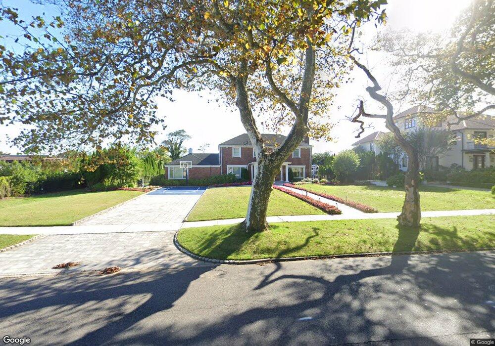
This home is located at 48 Phillips Ave, Deal, NJ 07723 and is currently estimated at $5,757,842, approximately $1,579 per square foot. 48 Phillips Ave is a home located in Monmouth County with nearby schools including Deal Elementary School, Hope Academy Charter School, and St. Mary of the Assumption School.
Ownership History
Date
Name
Owned For
Owner Type
Purchase Details
Closed on
Aug 2, 2017
Sold by
Qualified Rersonal Residence Trust
Bought by
Alahham Youseff and Fouerti Lilyan
Current Estimated Value
Home Financials for this Owner
Home Financials are based on the most recent Mortgage that was taken out on this home.
Original Mortgage
$1,000,000
Interest Rate
3.94%
Mortgage Type
Seller Take Back
Create a Home Valuation Report for This Property
The Home Valuation Report is an in-depth analysis detailing your home's value as well as a comparison with similar homes in the area
Home Values in the Area
Average Home Value in this Area
Purchase History
| Date | Buyer | Sale Price | Title Company |
|---|---|---|---|
| Alahham Youseff | $2,200,000 | Coastal Title |
Source: Public Records
Mortgage History
| Date | Status | Borrower | Loan Amount |
|---|---|---|---|
| Previous Owner | Alahham Youseff | $800,000 | |
| Previous Owner | Alahham Youseff | $1,000,000 |
Source: Public Records
Tax History
| Year | Tax Paid | Tax Assessment Tax Assessment Total Assessment is a certain percentage of the fair market value that is determined by local assessors to be the total taxable value of land and additions on the property. | Land | Improvement |
|---|---|---|---|---|
| 2025 | $26,390 | $7,067,500 | $5,618,500 | $1,449,000 |
| 2024 | $25,210 | $6,180,400 | $4,880,600 | $1,299,800 |
| 2023 | $25,210 | $5,480,400 | $4,349,100 | $1,131,300 |
| 2022 | $21,904 | $4,159,200 | $3,364,900 | $794,300 |
| 2021 | $21,904 | $3,369,800 | $2,623,600 | $746,200 |
| 2020 | $20,365 | $2,852,200 | $2,515,600 | $336,600 |
| 2019 | $19,199 | $2,707,900 | $2,373,200 | $334,700 |
| 2018 | $18,931 | $2,727,800 | $2,225,400 | $502,400 |
| 2017 | $18,903 | $2,712,100 | $2,225,400 | $486,700 |
| 2016 | $17,706 | $2,533,000 | $2,079,900 | $453,100 |
| 2015 | $17,965 | $2,512,600 | $2,079,900 | $432,700 |
| 2014 | $16,798 | $2,352,700 | $2,025,300 | $327,400 |
Source: Public Records
Map
Nearby Homes
- 160 Ocean Ave
- 26 Wyckoff St
- 57 Darlington Rd
- 339 Elberon Blvd
- 15 Joanna Ct
- 328 Elberon Blvd
- 243 Overbrook Ave
- 244 Overbrook Ave
- 3 S Elberon Square
- 0 Overbrook Ave
- 267 Roosevelt Ave
- 101 Lincoln Ave
- 206 S Lincoln Ave
- 1 Country Club Dr
- 24 Berger Ave
- 274 Michael Ave
- 1049 Norwood Ave
- 1 Private Dr
- 271 Jerome Ave
- 1039 Norwood Ave
- 54 Phillips Ave
- 112 Ocean Ave
- 116 Ocean Ave
- 43 Phillips Ave
- 49 Phillips Ave
- 58 Phillips Ave
- 39 Phillips Ave
- 124 Ocean Ave
- 49 Brighton Ave
- 4 Seaview Ln
- 57 Phillips Ave
- 8 Seaview Ln
- 62 Phillips Ave
- 98 Ocean Ave
- 51 Brighton Ave
- 53 Brighton Ave
- 61 Phillips Ave
- 68 Phillips Ave
- 103 Ocean Ave
- 48 Brighton Ave
Your Personal Tour Guide
Ask me questions while you tour the home.