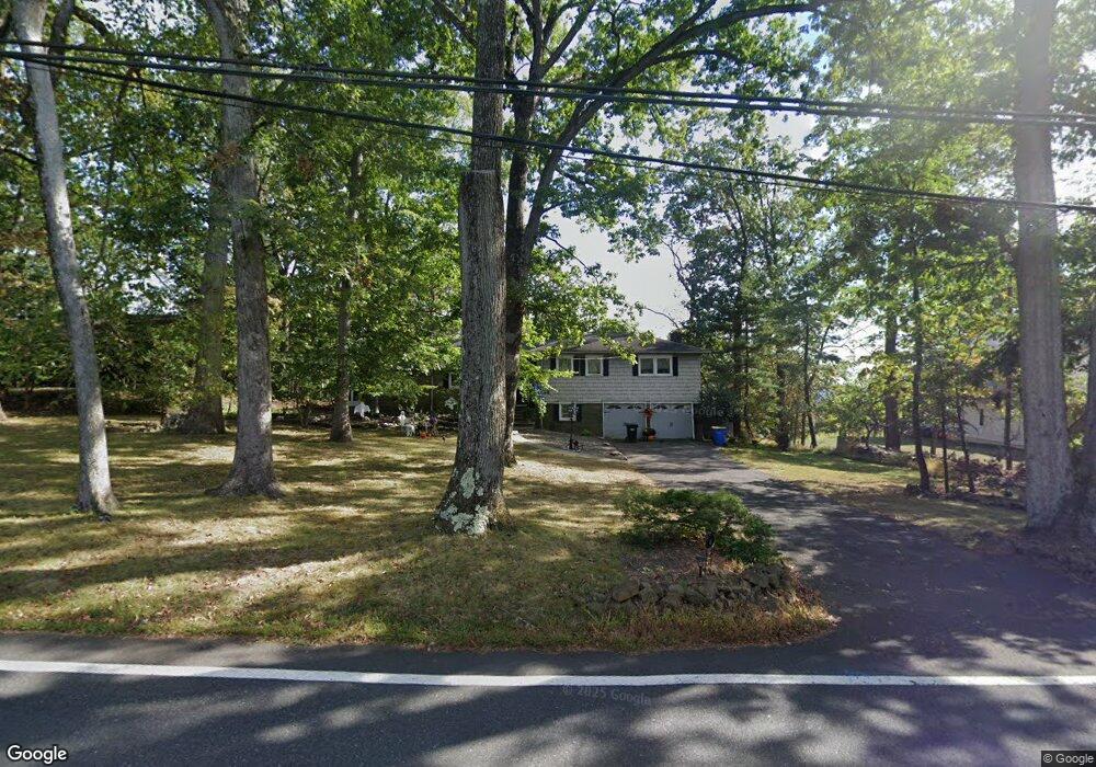
48 Rock Rd W Green Brook, NJ 08812
Estimated Value: $829,000 - $974,981
--
Bed
--
Bath
2,564
Sq Ft
$355/Sq Ft
Est. Value
About This Home
This home is located at 48 Rock Rd W, Green Brook, NJ 08812 and is currently estimated at $910,495, approximately $355 per square foot. 48 Rock Rd W is a home located in Somerset County with nearby schools including Irene E. Feldkirchner Elementary School, Green Brook Middle School, and Watchung Hills Regional High School.
Ownership History
Date
Name
Owned For
Owner Type
Purchase Details
Closed on
Mar 20, 2016
Sold by
Hatch Michael and Hatch Helen
Bought by
Hatch Michael and Hatch Helen
Current Estimated Value
Purchase Details
Closed on
Mar 16, 2016
Sold by
Demarco Helen K
Bought by
Demarco Helen K
Purchase Details
Closed on
Mar 15, 2016
Sold by
Demarco Helen K
Bought by
Hatch Michael and Hatch Helen
Purchase Details
Closed on
Jul 22, 1988
Sold by
Demarco Ramond P and Demarco Helen
Bought by
Township Of Green Brook
Create a Home Valuation Report for This Property
The Home Valuation Report is an in-depth analysis detailing your home's value as well as a comparison with similar homes in the area
Home Values in the Area
Average Home Value in this Area
Purchase History
| Date | Buyer | Sale Price | Title Company |
|---|---|---|---|
| Hatch Michael | -- | None Available | |
| Demarco Helen K | -- | None Available | |
| Hatch Michael | $5,000 | None Available | |
| Township Of Green Brook | -- | -- | |
| Demrco Raymond P | -- | -- |
Source: Public Records
Tax History Compared to Growth
Tax History
| Year | Tax Paid | Tax Assessment Tax Assessment Total Assessment is a certain percentage of the fair market value that is determined by local assessors to be the total taxable value of land and additions on the property. | Land | Improvement |
|---|---|---|---|---|
| 2025 | $14,595 | $821,100 | $427,500 | $393,600 |
| 2024 | $14,595 | $659,200 | $275,500 | $383,700 |
| 2023 | $13,469 | $585,600 | $275,500 | $310,100 |
| 2022 | $11,956 | $508,100 | $275,500 | $232,600 |
| 2021 | $12,142 | $452,500 | $245,500 | $207,000 |
| 2020 | $12,198 | $465,200 | $245,500 | $219,700 |
| 2019 | $12,142 | $465,200 | $245,500 | $219,700 |
| 2018 | $12,063 | $465,200 | $245,500 | $219,700 |
| 2017 | $11,793 | $465,200 | $245,500 | $219,700 |
| 2016 | $11,707 | $469,200 | $249,500 | $219,700 |
| 2015 | $11,386 | $447,200 | $249,500 | $197,700 |
| 2014 | $11,273 | $442,600 | $249,500 | $193,100 |
Source: Public Records
Map
Nearby Homes
- 3 Tanglewood Ln
- 1300 Rock Ave Unit 4
- 1300 Rock Ave Unit 6
- 1300 Rock Ave Unit C4
- 1300 Rock Ave Unit D6
- 668 Warfield Rd
- 640 Warfield Rd
- 13 Sweeney Ct
- 209 Rock Ave
- 89 Rock Rd W
- 1121 N Washington Ave
- 302 Tiffany Way Unit 302
- 18 Wildwood Terrace
- 435 Warfield Rd
- 729 Mountain Blvd
- 520 Ayres Ave
- 205 School St
- 645 Townsend Place
- 645 Townsend Place
- 202 Gold St
- 48 Rock Rd E Unit 50
- 48-50 Rock Rd E
- 52 Rock Rd E Unit 54
- 44 Rock Rd E
- 56 Rock Rd E
- 528 Cardinal Ln
- 60 Rock Rd E
- 66 Rock Rd E
- 525 Cardinal Ln
- 49 Rock Rd E
- 524 Cardinal Ln Unit 526
- 72 Rock Rd E
- 55 Rock Rd E
- 523 Cardinal Ln
- 45 Rock Rd E
- 112 Ravine Rd
- 110 Ravine Rd
- 3 Kappelmann Dr
- 17 Forest Ln
- 22 Linda Ln