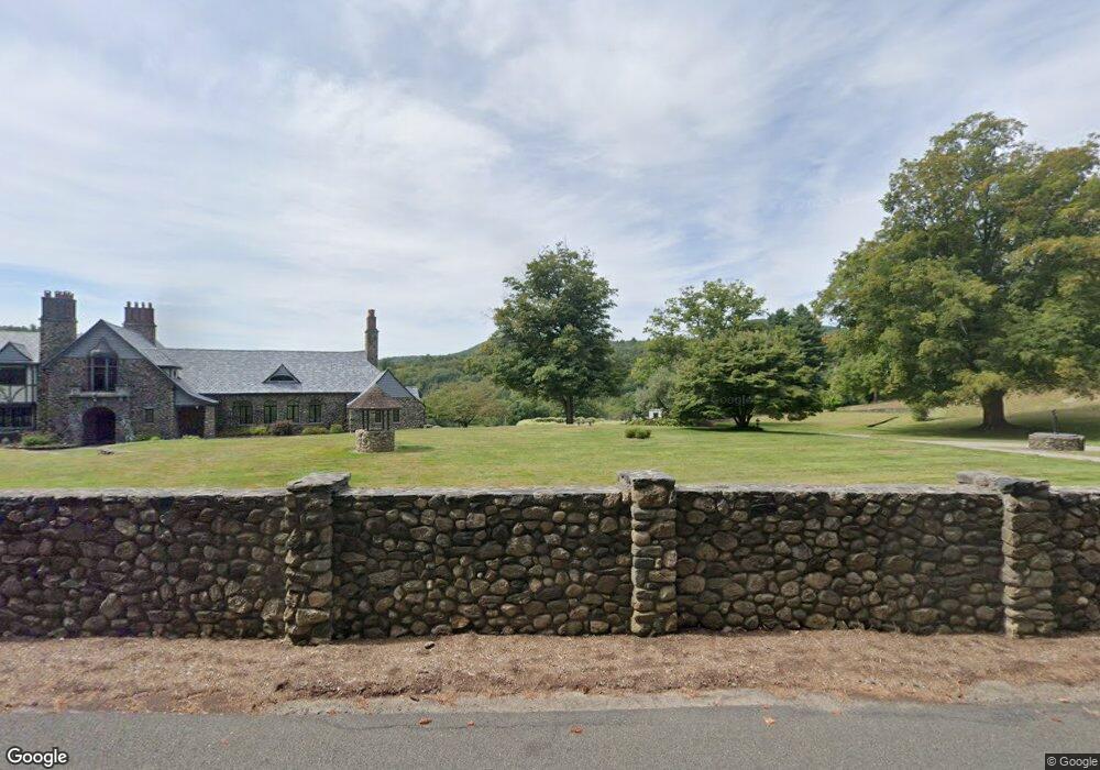
48 Stafford Rd Hampden, MA 01036
Estimated Value: $930,000 - $2,051,001
4
Beds
7
Baths
4,648
Sq Ft
$321/Sq Ft
Est. Value
About This Home
This home is located at 48 Stafford Rd, Hampden, MA 01036 and is currently estimated at $1,490,501, approximately $320 per square foot. 48 Stafford Rd is a home located in Hampden County with nearby schools including Minnechaug Regional High School.
Ownership History
Date
Name
Owned For
Owner Type
Purchase Details
Closed on
Apr 14, 2008
Sold by
Hickson Joseph
Bought by
Hickson Katherine
Current Estimated Value
Purchase Details
Closed on
Nov 17, 2006
Sold by
Cosenzi Angela A and Cosenzi Thomas E
Bought by
Hickson Joseph and Hickson Katherine
Home Financials for this Owner
Home Financials are based on the most recent Mortgage that was taken out on this home.
Original Mortgage
$1,000,050
Interest Rate
6.33%
Mortgage Type
Purchase Money Mortgage
Purchase Details
Closed on
Nov 16, 2005
Sold by
Cosenzi Thomas E and Cosenzi Angela A
Bought by
Cimmino Michael A
Purchase Details
Closed on
Nov 12, 2004
Sold by
Cimmino Michael A
Bought by
Cosenzi Angela A and Cosenzi Thomas E
Purchase Details
Closed on
Nov 4, 2004
Sold by
Cimmino Michael A
Bought by
Cosenzi Angela A and Cosenzi Thomas E
Purchase Details
Closed on
Sep 21, 2004
Sold by
Ryan Ann and Ryan Edward
Bought by
Cimmino Michael A
Create a Home Valuation Report for This Property
The Home Valuation Report is an in-depth analysis detailing your home's value as well as a comparison with similar homes in the area
Home Values in the Area
Average Home Value in this Area
Purchase History
| Date | Buyer | Sale Price | Title Company |
|---|---|---|---|
| Hickson Katherine | -- | -- | |
| Hickson Joseph | $1,650,000 | -- | |
| Cimmino Michael A | $175,000 | -- | |
| Cosenzi Angela A | -- | -- | |
| Cosenzi Angela A | $1,060,000 | -- | |
| Cimmino Michael A | $1,060,000 | -- |
Source: Public Records
Mortgage History
| Date | Status | Borrower | Loan Amount |
|---|---|---|---|
| Previous Owner | Hickson Joseph | $1,000,050 |
Source: Public Records
Tax History Compared to Growth
Tax History
| Year | Tax Paid | Tax Assessment Tax Assessment Total Assessment is a certain percentage of the fair market value that is determined by local assessors to be the total taxable value of land and additions on the property. | Land | Improvement |
|---|---|---|---|---|
| 2025 | $31,565 | $2,091,780 | $108,180 | $1,983,600 |
| 2024 | $23,867 | $1,524,050 | $98,950 | $1,425,100 |
| 2023 | $19,284 | $1,143,100 | $162,100 | $981,000 |
| 2022 | $19,920 | $1,064,100 | $162,100 | $902,000 |
| 2021 | $19,048 | $968,400 | $162,100 | $806,300 |
| 2020 | $15,429 | $765,700 | $174,100 | $591,600 |
| 2019 | $5,232 | $265,700 | $174,100 | $91,600 |
| 2018 | $4,112 | $205,600 | $174,100 | $31,500 |
| 2017 | $18,098 | $938,200 | $174,100 | $764,100 |
| 2016 | $19,821 | $1,023,800 | $177,200 | $846,600 |
| 2015 | $13,878 | $731,200 | $177,200 | $554,000 |
Source: Public Records
Map
Nearby Homes
- 59 St Germain Rd
- Lot 2R &3 Chapin Rd
- 179 Chapin Rd
- Lot D South Rd
- 8 S Ridge Rd
- 58 Rocky Dundee Rd
- 285 Lower Hampden Rd
- 0 Mountain Rd Unit 73267162
- 0 Mountain Rd Unit 72942534
- 319 Main St
- 186 Upper Hampden Rd
- Lot 16 Wood Hill Rd
- 179 Bumstead Rd
- 12 & 16 Haas Rd
- 89 Crow Hill Rd
- 41 Martin Farms Rd
- 64 Potash Hill Ln
- 190 Root Rd
- 169 Stafford Rd
- 175 Stafford Rd
- 00 Stafford Rd
- 61 Stafford Rd
- 23 Stafford Rd
- 55 Stafford Rd
- 22 Stafford Rd
- 31 Rock a Dundee Rd
- 77 Stafford Rd
- 43 Rock a Dundee Rd
- 31 Stafford Rd
- 93 Stafford Rd
- 32 Rock a Dundee Rd
- 61 Rock a Dundee Rd
- 2 Stafford Rd
- 47 Stafford Rd
- 22 Rock a Dundee Rd
- 325 Scantic Rd
- 70 Rock a Dundee Rd
- 70 Rock-A-dundee Rd
- 105 Stafford Rd
- 34 Thresher Rd