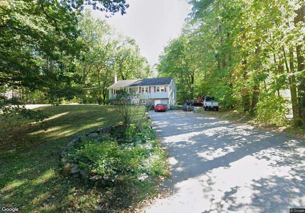
48 Whitney Rd Shirley, MA 01464
Estimated Value: $492,000 - $612,000
3
Beds
3
Baths
2,370
Sq Ft
$240/Sq Ft
Est. Value
About This Home
This home is located at 48 Whitney Rd, Shirley, MA 01464 and is currently estimated at $569,422, approximately $240 per square foot. 48 Whitney Rd is a home located in Middlesex County with nearby schools including Page Hilltop School, Lura A. White Elementary School, and Ayer Shirley Regional Middle School.
Ownership History
Date
Name
Owned For
Owner Type
Purchase Details
Closed on
Jan 16, 2001
Sold by
Albertelli David and Albertelli Linda
Bought by
Merluzzo Paula J and Kerrigan Brian M
Current Estimated Value
Home Financials for this Owner
Home Financials are based on the most recent Mortgage that was taken out on this home.
Original Mortgage
$170,900
Outstanding Balance
$63,513
Interest Rate
7.64%
Mortgage Type
Purchase Money Mortgage
Estimated Equity
$505,909
Purchase Details
Closed on
Aug 21, 1998
Sold by
Marchetti Ronald L
Bought by
Albertelli David and Albertelli Linda
Home Financials for this Owner
Home Financials are based on the most recent Mortgage that was taken out on this home.
Original Mortgage
$105,000
Interest Rate
6.86%
Mortgage Type
Purchase Money Mortgage
Create a Home Valuation Report for This Property
The Home Valuation Report is an in-depth analysis detailing your home's value as well as a comparison with similar homes in the area
Home Values in the Area
Average Home Value in this Area
Purchase History
| Date | Buyer | Sale Price | Title Company |
|---|---|---|---|
| Merluzzo Paula J | $189,900 | -- | |
| Albertelli David | $155,000 | -- |
Source: Public Records
Mortgage History
| Date | Status | Borrower | Loan Amount |
|---|---|---|---|
| Open | Albertelli David | $170,900 | |
| Previous Owner | Albertelli David | $105,000 | |
| Closed | Albertelli David | $19,000 |
Source: Public Records
Tax History Compared to Growth
Tax History
| Year | Tax Paid | Tax Assessment Tax Assessment Total Assessment is a certain percentage of the fair market value that is determined by local assessors to be the total taxable value of land and additions on the property. | Land | Improvement |
|---|---|---|---|---|
| 2025 | $54 | $414,200 | $142,400 | $271,800 |
| 2024 | $5,040 | $371,400 | $130,100 | $241,300 |
| 2023 | $4,609 | $325,000 | $130,100 | $194,900 |
| 2022 | $4,838 | $312,500 | $126,100 | $186,400 |
| 2021 | $4,926 | $298,000 | $114,100 | $183,900 |
| 2020 | $4,720 | $293,000 | $114,100 | $178,900 |
| 2019 | $4,633 | $288,100 | $114,100 | $174,000 |
| 2018 | $4,379 | $266,700 | $109,300 | $157,400 |
| 2017 | $4,264 | $258,100 | $106,100 | $152,000 |
| 2016 | $4,198 | $254,300 | $106,100 | $148,200 |
| 2015 | $3,871 | $223,600 | $104,500 | $119,100 |
Source: Public Records
Map
Nearby Homes
- 11 Longwood Dr
- 12 Hazen Rd
- 49 Parker Rd
- 61 Parker Rd
- 22 Townsend Rd
- 4 Hill Ln
- 878 Flat Hill Rd
- 2 Oakes Landing
- 45 Spring St
- 166 Elmwood Rd
- 4 Ambrose Way Unit 4
- 7 Ambrose Way Unit 5
- 6 Ambrose Way Unit 3
- 17 Ambrose Way Unit 17
- 9 Ambrose Way Unit 9
- 5 Ambrose Way Unit 5
- 3 Ambrose Way Unit 3
- 43 Longley Rd
- 110 Burrage St
- 1790 Massachusetts Ave Unit 25