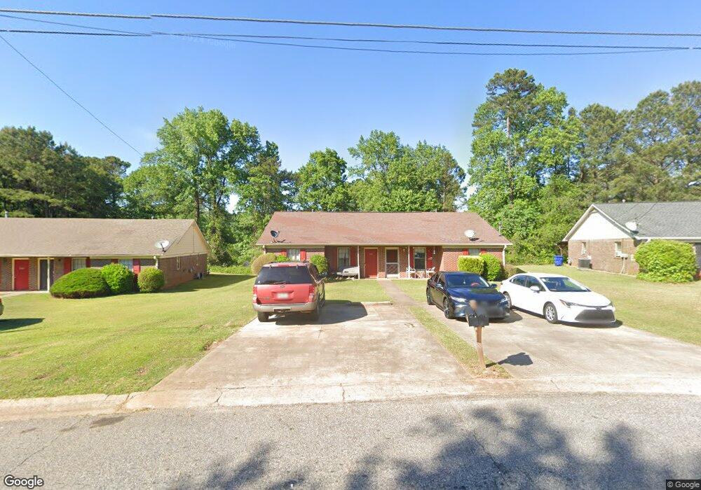
480 Charter Ct Unit 1 Lawrenceville, GA 30046
Estimated Value: $367,111 - $432,000
4
Beds
4
Baths
2,092
Sq Ft
$196/Sq Ft
Est. Value
About This Home
This home is located at 480 Charter Ct Unit 1, Lawrenceville, GA 30046 and is currently estimated at $409,028, approximately $195 per square foot. 480 Charter Ct Unit 1 is a home located in Gwinnett County with nearby schools including Margaret Winn Holt Elementary School, Moore Middle School, and Central Gwinnett High School.
Ownership History
Date
Name
Owned For
Owner Type
Purchase Details
Closed on
Sep 29, 2006
Sold by
Porras Family Trust
Bought by
Varghese Ajay
Current Estimated Value
Home Financials for this Owner
Home Financials are based on the most recent Mortgage that was taken out on this home.
Original Mortgage
$152,900
Outstanding Balance
$63,910
Interest Rate
1.37%
Mortgage Type
New Conventional
Estimated Equity
$345,118
Purchase Details
Closed on
Nov 7, 1997
Sold by
Sanders Bill G and Sanders Shirley J
Bought by
Porras Henry and Porras Elizabeth Carmen
Home Financials for this Owner
Home Financials are based on the most recent Mortgage that was taken out on this home.
Original Mortgage
$93,600
Interest Rate
7.31%
Mortgage Type
New Conventional
Create a Home Valuation Report for This Property
The Home Valuation Report is an in-depth analysis detailing your home's value as well as a comparison with similar homes in the area
Home Values in the Area
Average Home Value in this Area
Purchase History
| Date | Buyer | Sale Price | Title Company |
|---|---|---|---|
| Varghese Ajay | $169,900 | -- | |
| Porras Henry | $104,000 | -- |
Source: Public Records
Mortgage History
| Date | Status | Borrower | Loan Amount |
|---|---|---|---|
| Open | Varghese Ajay | $152,900 | |
| Previous Owner | Porras Henry | $93,600 |
Source: Public Records
Tax History Compared to Growth
Tax History
| Year | Tax Paid | Tax Assessment Tax Assessment Total Assessment is a certain percentage of the fair market value that is determined by local assessors to be the total taxable value of land and additions on the property. | Land | Improvement |
|---|---|---|---|---|
| 2024 | $3,808 | $140,000 | $20,000 | $120,000 |
| 2023 | $3,808 | $140,000 | $20,000 | $120,000 |
| 2022 | $2,677 | $83,400 | $13,200 | $70,200 |
| 2021 | $2,736 | $83,400 | $13,200 | $70,200 |
| 2020 | $2,969 | $90,360 | $13,200 | $77,160 |
| 2019 | $1,952 | $54,400 | $13,200 | $41,200 |
| 2018 | $1,900 | $54,400 | $13,200 | $41,200 |
| 2016 | $1,186 | $33,800 | $10,400 | $23,400 |
| 2015 | $1,201 | $33,800 | $7,600 | $26,200 |
| 2014 | $788 | $22,000 | $8,000 | $14,000 |
Source: Public Records
Map
Nearby Homes
- 840 Cremins Rd
- 792 Charleston Ct
- 36 Hickory Ln
- 26 Hickory Ln
- 231 Sarah Ln
- 85 Hickory Grove Ave
- 75 Hickory Grove Ave
- 35 Hickory Grove Ave
- 25 Hickory Grove Ave
- 16 Hickory Grove Ave
- 296 Grist Mill Ln
- 140 Leigh Kay Dr
- 188 Pine Forest Dr
- 267 Firecreek Ridge
- 1024 Stone Mill Run
- 707 Sherwood Dr
- 431 Thornbush Trace
- 1279 Pecan Grove Place
- 187 Old Timber Rd
- 490 Charter Ct Unit 1
- 470 Charter Ct
- 460 Charter Ct
- 391 Darnell Terrace
- 381 Darnell Terrace Unit 2
- 500 Charter Ct
- 800 Bedford Bay Trail
- 371 Darnell Terrace
- 311 Bedford Bay Ln
- 452 Charter Ct Unit 1
- 361 Darnell Terrace Unit 2
- 501 Charter Ct
- 801 Bedford Bay Trail
- 810 Bedford Bay Trail
- 321 Bedford Bay Ln
- 333 Bedford Bay Ln
- 351 Bedford Bay Ln
- 0 Darnell Terrace Unit 7194797
- 0 Darnell Terrace Unit 8207938
- 0 Darnell Terrace Unit 3253121