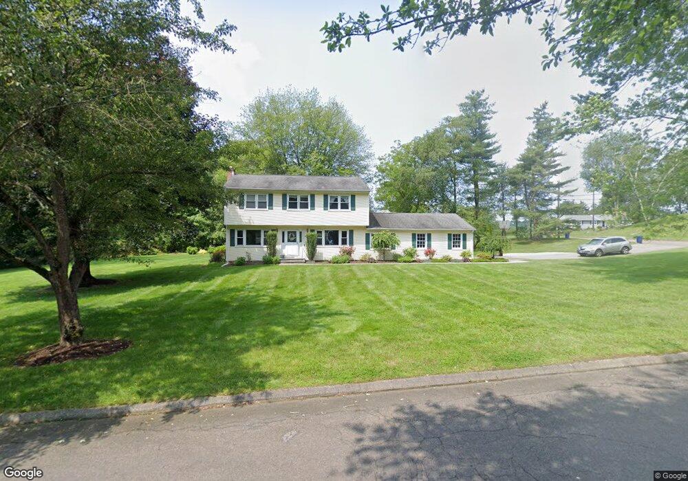
480 Clearbrook Rd Orange, CT 06477
Estimated Value: $697,000 - $720,000
4
Beds
3
Baths
2,204
Sq Ft
$321/Sq Ft
Est. Value
About This Home
This home is located at 480 Clearbrook Rd, Orange, CT 06477 and is currently estimated at $708,050, approximately $321 per square foot. 480 Clearbrook Rd is a home located in New Haven County with nearby schools including Mary L. Tracy School, Turkey Hill School, and Amity Middle School: Orange.
Ownership History
Date
Name
Owned For
Owner Type
Purchase Details
Closed on
Jul 1, 1998
Sold by
Blackwood Andrew W and Blackwood Nancy K
Bought by
Dalleave Anthony and Dalleave Diane N
Current Estimated Value
Home Financials for this Owner
Home Financials are based on the most recent Mortgage that was taken out on this home.
Original Mortgage
$176,000
Interest Rate
7.04%
Mortgage Type
Unknown
Create a Home Valuation Report for This Property
The Home Valuation Report is an in-depth analysis detailing your home's value as well as a comparison with similar homes in the area
Home Values in the Area
Average Home Value in this Area
Purchase History
| Date | Buyer | Sale Price | Title Company |
|---|---|---|---|
| Dalleave Anthony | $220,000 | -- | |
| Dalleave Anthony | $220,000 | -- |
Source: Public Records
Mortgage History
| Date | Status | Borrower | Loan Amount |
|---|---|---|---|
| Open | Dalleave Anthony | $160,000 | |
| Closed | Dalleave Anthony | $147,932 | |
| Closed | Dalleave Anthony | $176,000 |
Source: Public Records
Tax History
| Year | Tax Paid | Tax Assessment Tax Assessment Total Assessment is a certain percentage of the fair market value that is determined by local assessors to be the total taxable value of land and additions on the property. | Land | Improvement |
|---|---|---|---|---|
| 2025 | $11,774 | $404,600 | $215,300 | $189,300 |
| 2024 | $12,543 | $404,600 | $215,300 | $189,300 |
| 2023 | $9,758 | $302,000 | $157,200 | $144,800 |
| 2022 | $9,878 | $302,000 | $157,200 | $144,800 |
| 2021 | $10,042 | $302,000 | $157,200 | $144,800 |
| 2020 | $9,887 | $302,000 | $157,200 | $144,800 |
| 2019 | $9,842 | $302,000 | $157,200 | $144,800 |
| 2018 | $9,424 | $294,500 | $157,200 | $137,300 |
| 2017 | $9,488 | $285,100 | $142,700 | $142,400 |
| 2016 | $9,180 | $285,100 | $142,700 | $142,400 |
| 2015 | $8,952 | $285,100 | $142,700 | $142,400 |
| 2014 | $8,696 | $285,100 | $142,700 | $142,400 |
Source: Public Records
Map
Nearby Homes
- 463 Herbert St
- 918 Wheelers Farms Rd
- 182 Remy Ct Unit 182
- 88 Rocky Rest Rd
- 160 Kyles Way
- 158 Kyles Way
- 500 River Rd Unit 3
- 18 Ashwood Cir
- 444 Asbury Ridge
- 74 Victory St
- 807 Long Hill Ave
- 133 Rocky Rest Rd
- 249 Coram Rd
- 47 Oronoque Trail
- 4 Rivendell Dr
- 35 Mustang Dr
- 489 Derby Milford Rd
- 8 Algonkin Rd Unit A
- 35 Saginaw Trail
- 26 Bunker Hill Cir
Your Personal Tour Guide
Ask me questions while you tour the home.