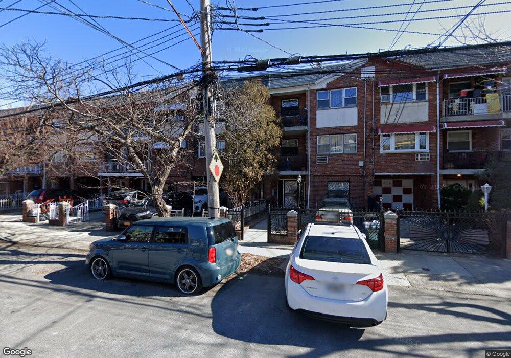
480 Commonwealth Ave Bronx, NY 10473
Clason Point NeighborhoodEstimated Value: $668,320 - $1,000,000
Studio
--
Bath
2,745
Sq Ft
$302/Sq Ft
Est. Value
About This Home
This home is located at 480 Commonwealth Ave, Bronx, NY 10473 and is currently estimated at $828,330, approximately $301 per square foot. 480 Commonwealth Ave is a home located in Bronx County with nearby schools including P.S. 069 Journey Prep School - X069 and Holy Cross Elementary School.
Ownership History
Date
Name
Owned For
Owner Type
Purchase Details
Closed on
May 25, 2017
Sold by
Estate Of Dell Pinckney
Bought by
Greenblatt Jayson
Current Estimated Value
Home Financials for this Owner
Home Financials are based on the most recent Mortgage that was taken out on this home.
Original Mortgage
$437,525
Outstanding Balance
$363,055
Interest Rate
4.02%
Mortgage Type
Purchase Money Mortgage
Estimated Equity
$465,275
Create a Home Valuation Report for This Property
The Home Valuation Report is an in-depth analysis detailing your home's value as well as a comparison with similar homes in the area
Home Values in the Area
Average Home Value in this Area
Purchase History
| Date | Buyer | Sale Price | Title Company |
|---|---|---|---|
| Greenblatt Jayson | $455,000 | -- |
Source: Public Records
Mortgage History
| Date | Status | Borrower | Loan Amount |
|---|---|---|---|
| Open | Greenblatt Jayson | $437,525 |
Source: Public Records
Tax History
| Year | Tax Paid | Tax Assessment Tax Assessment Total Assessment is a certain percentage of the fair market value that is determined by local assessors to be the total taxable value of land and additions on the property. | Land | Improvement |
|---|---|---|---|---|
| 2025 | $5,779 | $30,498 | $5,718 | $24,780 |
| 2024 | $5,779 | $28,772 | $5,382 | $23,390 |
| 2023 | $5,513 | $27,144 | $5,273 | $21,871 |
| 2022 | $5,419 | $47,820 | $9,360 | $38,460 |
| 2021 | $5,670 | $42,660 | $9,360 | $33,300 |
| 2020 | $5,380 | $39,360 | $9,360 | $30,000 |
| 2019 | $5,016 | $31,740 | $9,360 | $22,380 |
| 2018 | $4,611 | $22,620 | $9,360 | $13,260 |
| 2017 | $4,723 | $26,340 | $9,360 | $16,980 |
| 2016 | $2,214 | $28,365 | $8,885 | $19,480 |
| 2015 | $1,380 | $26,760 | $10,380 | $16,380 |
| 2014 | $1,380 | $26,760 | $10,380 | $16,380 |
Source: Public Records
Map
Nearby Homes
- 405 Saint Lawrence Ave
- 1739 Lacombe Ave Unit 1B
- 1731 Lacombe Ave Unit 1B
- 1731 Lacombe Ave Unit 4B
- 1731 Lacombe Ave Unit 4A
- 1731 Lacombe Ave Unit 3A
- 1805 Lacombe Ave
- 1727 Lacombe Ave Unit 3B
- 1727 Lacombe Ave Unit 4A
- 1727 Lacombe Ave Unit 4B
- 1723 Lacombe Ave Unit 1A
- 1715A Lacombe Ave Unit 3B
- 1715A Lacombe Ave Unit 4A
- 1815 Patterson Ave
- 351 Bronx River Ave Unit 3A
- 351 Bronx River Ave Unit 2A
- 355 Bronx River Ave Unit 1B
- 355 Bronx River Ave Unit 4B
- 355 Bronx River Ave Unit 3B
- 439 Thieriot Ave
- 482 Commonwealth Ave
- 478 Commonwealth Ave
- 476 Commonwealth Ave
- 484 Commonwealth Ave
- 486 Commonwealth Ave
- 474 Commonwealth Ave
- 488 Commonwealth Ave
- 472 Commonwealth Ave
- 445 Saint Lawrence Ave
- 443 Saint Lawrence Ave
- 447 St Lawrence Ave
- 447 Saint Lawrence Ave Unit 2
- 447 St Lawrence Ave Unit 3 Fl
- 449 Saint Lawrence Ave
- 441 Saint Lawrence Ave
- 451 Saint Lawrence Ave
- 439 Saint Lawrence Ave
- 439 Saint Lawrence Ave Unit 1
- 470 Commonwealth Ave
- 453 Saint Lawrence Ave
Your Personal Tour Guide
Ask me questions while you tour the home.