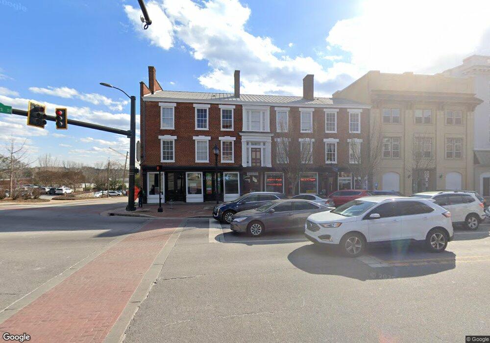
480 E Broad St Athens, GA 30601
Estimated Value: $5,587,860
--
Bed
--
Bath
18,816
Sq Ft
$297/Sq Ft
Est. Value
About This Home
This home is located at 480 E Broad St, Athens, GA 30601 and is currently priced at $5,587,860, approximately $296 per square foot. 480 E Broad St is a home located in Clarke County with nearby schools including Barrow Elementary School, Clarke Middle School, and Clarke Central High School.
Ownership History
Date
Name
Owned For
Owner Type
Purchase Details
Closed on
Jun 30, 2015
Sold by
Franklin House Inc
Bought by
Wsdk Properties Llc
Current Estimated Value
Home Financials for this Owner
Home Financials are based on the most recent Mortgage that was taken out on this home.
Original Mortgage
$2,175,000
Interest Rate
3.92%
Mortgage Type
Commercial
Purchase Details
Closed on
Feb 15, 1994
Sold by
Liberty Savings Bank Fsb
Bought by
Franklin House Inc
Create a Home Valuation Report for This Property
The Home Valuation Report is an in-depth analysis detailing your home's value as well as a comparison with similar homes in the area
Home Values in the Area
Average Home Value in this Area
Purchase History
| Date | Buyer | Sale Price | Title Company |
|---|---|---|---|
| Wsdk Properties Llc | $2,900,000 | -- | |
| Franklin House Inc | $607,500 | -- |
Source: Public Records
Mortgage History
| Date | Status | Borrower | Loan Amount |
|---|---|---|---|
| Closed | Wsdk Properties Llc | $2,175,000 |
Source: Public Records
Tax History Compared to Growth
Tax History
| Year | Tax Paid | Tax Assessment Tax Assessment Total Assessment is a certain percentage of the fair market value that is determined by local assessors to be the total taxable value of land and additions on the property. | Land | Improvement |
|---|---|---|---|---|
| 2024 | $45,873 | $1,422,409 | $413,470 | $1,008,939 |
| 2023 | $45,873 | $1,422,410 | $413,470 | $1,008,939 |
| 2022 | $46,797 | $1,422,409 | $413,470 | $1,008,939 |
| 2021 | $44,732 | $1,289,112 | $371,063 | $918,049 |
| 2020 | $43,585 | $1,256,056 | $339,258 | $916,798 |
| 2019 | $41,633 | $1,191,218 | $339,258 | $851,960 |
| 2018 | $40,425 | $1,156,664 | $296,850 | $859,814 |
| 2017 | $36,681 | $1,049,532 | $296,850 | $752,682 |
| 2016 | $36,506 | $1,044,524 | $296,850 | $747,673 |
| 2015 | $26,385 | $753,854 | $269,864 | $483,990 |
| 2014 | -- | $763,164 | $269,864 | $493,300 |
Source: Public Records
Map
Nearby Homes
- 131 E Broad St Unit 901
- 150 Mitchell St
- 269 N Hull St Unit 212
- 198 Flint St
- 225 Oak St Unit 65
- 178 First St
- 185 First St
- 1295 E Broad St Unit C1
- 1295 E Broad St Unit C-1
- 191 First St
- 559 Pulaski St
- 132 N Poplar St
- 600 Pulaski St
- 239 Madison Heights
- 249 Fifth St
- 250 Little St Unit D205
- 250 Little St Unit D105
- 250 Little St Unit A 105
- 250 Little St Unit B 110
- 250 Little St Unit A105
- 480 E Broad St Unit 101
- 480 E Broad St Unit 13
- 145 South St Unit 2
- 145 South St Unit 1
- 145 South St Unit 3
- 145 South St
- 458 E Clayton St
- 400 E Clayton St Unit 11
- 400 E Clayton St Unit A
- 400 E Clayton St
- 430 E Clayton St
- 311 E Broad St
- 138 N Jackson St
- 138 N Jackson St Unit Suite 1
- 138 N Jackson St Unit Suite 2
- 142 N Jackson St
- 123 N Jackson St
- 110 Foundry St
- 283 E Broad St
- 269 E Broad St