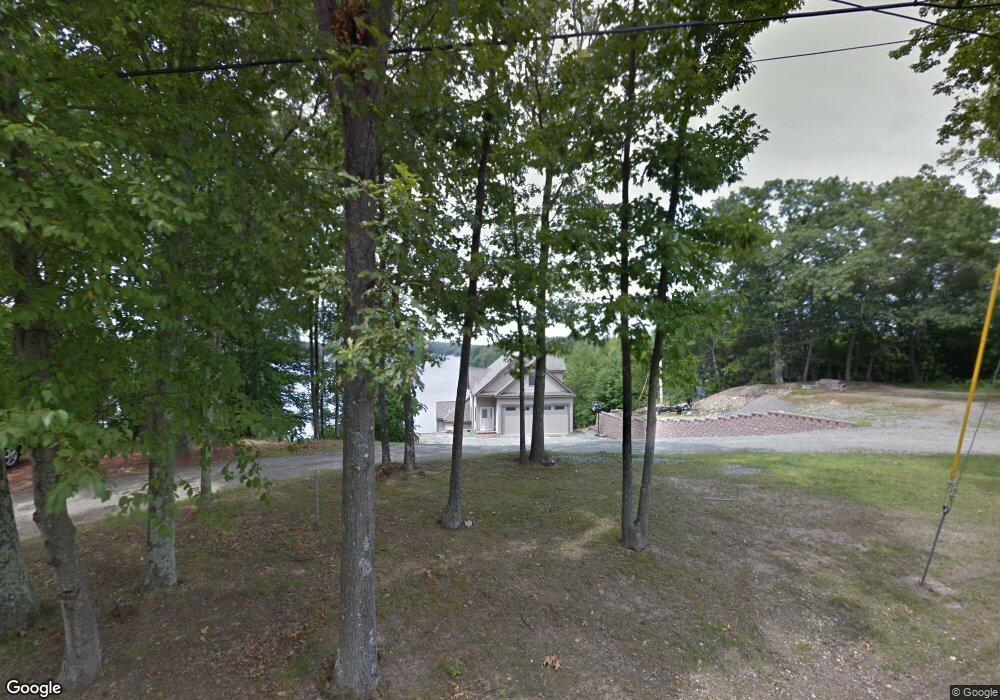
480 Eastside Rd Wrentham, MA 02093
Estimated Value: $898,406 - $1,075,000
2
Beds
4
Baths
1,976
Sq Ft
$491/Sq Ft
Est. Value
About This Home
This home is located at 480 Eastside Rd, Wrentham, MA 02093 and is currently estimated at $971,102, approximately $491 per square foot. 480 Eastside Rd is a home located in Norfolk County with nearby schools including Delaney Elementary School and Charles E Roderick.
Ownership History
Date
Name
Owned For
Owner Type
Purchase Details
Closed on
Jan 27, 2012
Sold by
Bianchi George and Bianchi Carolyn
Bought by
Rea Rt
Current Estimated Value
Home Financials for this Owner
Home Financials are based on the most recent Mortgage that was taken out on this home.
Original Mortgage
$224,000
Interest Rate
3.94%
Mortgage Type
New Conventional
Purchase Details
Closed on
Apr 20, 1994
Sold by
E L Comeau Inc
Bought by
Anderson Richard E
Create a Home Valuation Report for This Property
The Home Valuation Report is an in-depth analysis detailing your home's value as well as a comparison with similar homes in the area
Purchase History
| Date | Buyer | Sale Price | Title Company |
|---|---|---|---|
| Rea Rt | -- | -- | |
| Anderson Richard E | $28,500 | -- |
Source: Public Records
Mortgage History
| Date | Status | Borrower | Loan Amount |
|---|---|---|---|
| Open | Anderson Richard E | $379,000 | |
| Closed | Anderson Richard E | $224,000 | |
| Previous Owner | Anderson Richard E | $224,000 | |
| Previous Owner | Anderson Richard E | $225,000 |
Source: Public Records
Tax History
| Year | Tax Paid | Tax Assessment Tax Assessment Total Assessment is a certain percentage of the fair market value that is determined by local assessors to be the total taxable value of land and additions on the property. | Land | Improvement |
|---|---|---|---|---|
| 2025 | $10,402 | $897,500 | $436,200 | $461,300 |
| 2024 | $10,618 | $884,800 | $436,200 | $448,600 |
| 2023 | $10,288 | $815,200 | $367,900 | $447,300 |
| 2022 | $8,151 | $596,300 | $302,500 | $293,800 |
| 2021 | $9,617 | $683,500 | $334,400 | $349,100 |
| 2020 | $9,928 | $696,700 | $340,300 | $356,400 |
| 2019 | $10,265 | $727,000 | $352,500 | $374,500 |
| 2018 | $9,361 | $657,400 | $396,500 | $260,900 |
| 2017 | $9,139 | $641,300 | $388,900 | $252,400 |
| 2016 | $8,968 | $628,000 | $377,600 | $250,400 |
| 2015 | $8,975 | $599,100 | $363,000 | $236,100 |
| 2014 | $8,869 | $579,300 | $349,200 | $230,100 |
Source: Public Records
Map
Nearby Homes
- 12 Earle Stewart Ln
- Loty 3-14 Earle Stewart Ln
- 11 Earle Stewart Ln
- Lot 1 - Blueberry 2 Car Plan at King Philip Estates
- Lot 8 - Blueberry 2 Car Plan at King Philip Estates
- Lot 5 - Hughes 2 car Plan at King Philip Estates
- Lot 6 - Blueberry 3 Car Plan at King Philip Estates
- 10 Earle Stewart Ln Unit Lot 5
- Lot 2 - Camden 2 Car Plan at King Philip Estates
- Lot 7 - Cedar Plan at King Philip Estates
- Lot 4 - Hemingway 2 Car Plan at King Philip Estates
- Lot 3 - Blueberry 2 Car Plan at King Philip Estates
- 500 Franklin St
- 10 Nature View Dr
- 15 Nature View Dr
- 319 Taunton St
- 287 Park St
- 155 Clark Rd Unit 155
- 50 Reed Fulton Ave Unit Lot 61
- 440 Chestnut St
- 490 Eastside Rd
- 460 Eastside Rd
- 450 Eastside Rd
- 500 Eastside Rd
- 440 Eastside Rd
- 440 Eastside Rd Unit 440
- 430 Eastside Rd
- 420 Eastside Rd
- 410 Eastside Rd
- 400 Eastside Rd
- 260 Eastside Rd
- 245 Eastside Rd
- 250 Eastside Rd
- 240 Eastside Rd
- 240 Eastside Rd
- 230 Eastside Rd
- 230 Eastside Rd
- 230 Eastside Rd Unit 230
- 330 Eastside Rd
- 310 Eastside Rd
Your Personal Tour Guide
Ask me questions while you tour the home.