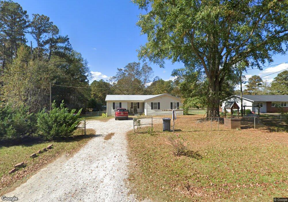
480 Fling Rd Lagrange, GA 30240
Estimated Value: $168,958 - $201,000
3
Beds
2
Baths
1,134
Sq Ft
$159/Sq Ft
Est. Value
About This Home
This home is located at 480 Fling Rd, Lagrange, GA 30240 and is currently estimated at $180,240, approximately $158 per square foot. 480 Fling Rd is a home located in Troup County with nearby schools including Berta Weathersbee Elementary School, Long Cane Elementary School, and Whitesville Road Elementary School.
Ownership History
Date
Name
Owned For
Owner Type
Purchase Details
Closed on
Mar 12, 2020
Sold by
Williamson Deborah
Bought by
Slaughter Randy W
Current Estimated Value
Home Financials for this Owner
Home Financials are based on the most recent Mortgage that was taken out on this home.
Original Mortgage
$104,080
Outstanding Balance
$92,386
Interest Rate
3.62%
Mortgage Type
FHA
Estimated Equity
$87,854
Purchase Details
Closed on
Jun 27, 2014
Sold by
Gasaway Philip W
Bought by
Williamson Deborah
Home Financials for this Owner
Home Financials are based on the most recent Mortgage that was taken out on this home.
Original Mortgage
$70,300
Interest Rate
4.17%
Mortgage Type
New Conventional
Purchase Details
Closed on
Mar 27, 2013
Sold by
Ward Jeffrey
Bought by
Gasaway Philip W and Gasaway Linda M
Purchase Details
Closed on
Jan 6, 2004
Sold by
Angela M Harris
Bought by
Ward Jeffrey
Purchase Details
Closed on
Apr 20, 1995
Sold by
Mary S Manzies By Ex
Bought by
Angela M Harris
Purchase Details
Closed on
Apr 19, 1995
Sold by
Jimmy D Boyd
Bought by
Mary S Manzies By Ex
Purchase Details
Closed on
Apr 1, 1995
Sold by
Gloria L Sievert
Bought by
Jimmy D Boyd
Purchase Details
Closed on
Mar 16, 1990
Sold by
Harold G Menzies
Bought by
Gloria L Sievert
Purchase Details
Closed on
Feb 1, 1984
Bought by
Harold G Menzies
Purchase Details
Closed on
Jan 1, 1973
Purchase Details
Closed on
Jan 1, 1964
Purchase Details
Closed on
Jan 1, 1961
Create a Home Valuation Report for This Property
The Home Valuation Report is an in-depth analysis detailing your home's value as well as a comparison with similar homes in the area
Home Values in the Area
Average Home Value in this Area
Purchase History
| Date | Buyer | Sale Price | Title Company |
|---|---|---|---|
| Slaughter Randy W | $106,000 | -- | |
| Williamson Deborah | $74,000 | -- | |
| Gasaway Philip W | $65,000 | -- | |
| Ward Jeffrey | $60,000 | -- | |
| Angela M Harris | $45,000 | -- | |
| Mary S Manzies By Ex | -- | -- | |
| Jimmy D Boyd | -- | -- | |
| Gloria L Sievert | -- | -- | |
| Harold G Menzies | $35,000 | -- | |
| -- | -- | -- | |
| -- | -- | -- | |
| -- | -- | -- |
Source: Public Records
Mortgage History
| Date | Status | Borrower | Loan Amount |
|---|---|---|---|
| Open | Slaughter Randy W | $104,080 | |
| Previous Owner | Williamson Deborah | $70,300 |
Source: Public Records
Tax History Compared to Growth
Tax History
| Year | Tax Paid | Tax Assessment Tax Assessment Total Assessment is a certain percentage of the fair market value that is determined by local assessors to be the total taxable value of land and additions on the property. | Land | Improvement |
|---|---|---|---|---|
| 2024 | $1,235 | $45,300 | $10,000 | $35,300 |
| 2023 | $1,178 | $43,180 | $8,000 | $35,180 |
| 2022 | $1,126 | $40,340 | $8,000 | $32,340 |
| 2021 | $1,151 | $38,160 | $8,000 | $30,160 |
| 2020 | $1,091 | $38,160 | $8,000 | $30,160 |
| 2019 | $668 | $24,136 | $4,320 | $19,816 |
| 2018 | $640 | $23,216 | $4,320 | $18,896 |
| 2017 | $640 | $23,216 | $4,320 | $18,896 |
| 2016 | $672 | $24,264 | $4,320 | $19,944 |
| 2015 | $702 | $25,200 | $5,256 | $19,944 |
| 2014 | $734 | $24,251 | $5,256 | $18,995 |
| 2013 | -- | $19,532 | $5,096 | $14,436 |
Source: Public Records
Map
Nearby Homes
- 37 Overbrook Dr
- 509 Connie Dr
- 808 S Fling Rd
- 0 Bradfield Dr Unit 10568803
- 190 Hill Rd
- 124 Foxdale Dr
- 110 Hawthorne Cir
- 103 Hawthorne Cir
- 146 Whitaker Rd
- 141 Avery Dr
- 105 Hawthorne Cir
- 61 Freeman Rd
- 100 Huntcliff Ct
- 22 Freeman Rd
- 0 Unit 10514554
- 223 Pinehaven Dr
- 117 Brookwood Dr
- 135 Planters Ridge Dr
- LOT 4 Angela Dr
- E Angela Dr