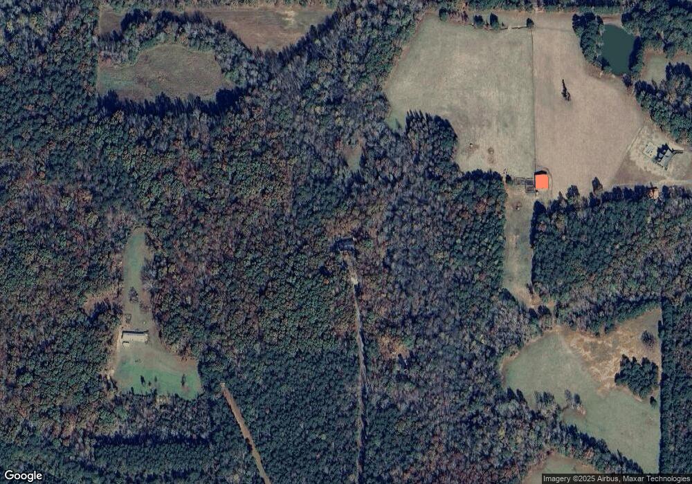
480 Joseph Alver Ln Warm Springs, GA 31830
Estimated Value: $314,000 - $368,761
3
Beds
3
Baths
2,574
Sq Ft
$135/Sq Ft
Est. Value
About This Home
This home is located at 480 Joseph Alver Ln, Warm Springs, GA 31830 and is currently estimated at $346,587, approximately $134 per square foot. 480 Joseph Alver Ln is a home located in Meriwether County with nearby schools including Mountain View Elementary School, Manchester Middle School, and Manchester High School.
Ownership History
Date
Name
Owned For
Owner Type
Purchase Details
Closed on
Mar 12, 2024
Sold by
Frater Jesslyn
Bought by
Lane Carol
Current Estimated Value
Purchase Details
Closed on
Aug 14, 2002
Sold by
Garrett Carol L
Bought by
Lane Carol
Purchase Details
Closed on
Jan 1, 1993
Sold by
Garrett John W
Bought by
Garrett Carol L
Purchase Details
Closed on
Jul 1, 1991
Bought by
Garrett John W
Create a Home Valuation Report for This Property
The Home Valuation Report is an in-depth analysis detailing your home's value as well as a comparison with similar homes in the area
Home Values in the Area
Average Home Value in this Area
Purchase History
| Date | Buyer | Sale Price | Title Company |
|---|---|---|---|
| Lane Carol | -- | -- | |
| Lane Carol | -- | -- | |
| Garrett Carol L | -- | -- | |
| Garrett John W | -- | -- |
Source: Public Records
Tax History Compared to Growth
Tax History
| Year | Tax Paid | Tax Assessment Tax Assessment Total Assessment is a certain percentage of the fair market value that is determined by local assessors to be the total taxable value of land and additions on the property. | Land | Improvement |
|---|---|---|---|---|
| 2024 | $1,663 | $124,012 | $10,360 | $113,652 |
| 2023 | $1,623 | $83,612 | $10,360 | $73,252 |
| 2022 | $1,623 | $83,612 | $10,360 | $73,252 |
| 2021 | $1,649 | $83,612 | $10,360 | $73,252 |
| 2020 | $1,662 | $83,612 | $10,360 | $73,252 |
| 2019 | $1,588 | $83,612 | $10,360 | $73,252 |
| 2018 | $1,681 | $83,612 | $10,360 | $73,252 |
| 2017 | $1,698 | $83,612 | $10,360 | $73,252 |
| 2016 | $1,428 | $83,612 | $10,360 | $73,252 |
| 2015 | $1,432 | $83,612 | $10,360 | $73,252 |
| 2014 | $1,434 | $83,612 | $10,360 | $73,252 |
| 2013 | -- | $83,612 | $10,360 | $73,252 |
Source: Public Records
Map
Nearby Homes
- 0 Durand Hwy Unit 24120903
- 0 Durand Hwy Unit 10561757
- 514 Phillips Rd
- 0 County Line Church Rd Unit 10583557
- 353 Parham Rd
- 0 Roosevelt Hwy Unit 10548840
- 5100 Durand Hwy
- 75 ACRES Roosevelt Hwy
- 71 ACRES Roosevelt Hwy
- 146 ACRES Roosevelt Hwy
- 3688 Whitehouse Pkwy
- 188 Hidden Lakes Rd
- 243 Pine Knoll Dr
- 101 Leverett St
- 116 Green St
- 0 Spring St
- 261 Green St
- 33 Mill St
- 0 Whitehouse Pkwy Unit 10593573
- 79 Minnie Mill Ln
- 465 Joseph Alver Ln
- 364 Joseph Alver Ln
- 185 Joseph Alver Ln
- 687 Dunn Rd
- 66 Joseph Alver Ln
- 141 Joseph Alver Ln
- 62 Joseph Alver Ln
- 898 Dunn Rd
- 1134 Dunn Rd
- 0 Dunn Rd Unit 8075988
- 0 Dunn Rd Unit 8513226
- 0 Dunn Rd
- 667 Dunn Rd
- 1690 Phillips Rd
- 1000 Dunn Rd
- 1522 Ward Rd
- 1506 Phillips Rd
- 1795 Phillips Rd
- 1627 Phillips Rd
- 639 Dunn Rd
