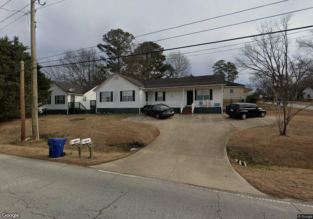
480 Main St Dallas, GA 30132
Estimated Value: $513,761 - $540,000
8
Beds
8
Baths
3,264
Sq Ft
$160/Sq Ft
Est. Value
About This Home
This home is located at 480 Main St, Dallas, GA 30132 and is currently estimated at $522,587, approximately $160 per square foot. 480 Main St is a home located in Paulding County with nearby schools including Dallas Elementary School, Herschel Jones Middle School, and Paulding County High School.
Ownership History
Date
Name
Owned For
Owner Type
Purchase Details
Closed on
Mar 14, 2022
Sold by
Hill Michael Lamar
Bought by
Hill Dora Faye
Current Estimated Value
Purchase Details
Closed on
Jun 8, 2020
Sold by
Holmes Leon
Bought by
Hill Michael Lamar
Purchase Details
Closed on
Nov 30, 2019
Sold by
Brown Timothy Scott
Bought by
Brown Properties Ii Llc and C/O Brown Jerry
Purchase Details
Closed on
Aug 3, 2006
Sold by
Jackson Timothy O
Bought by
Brown Timothy S
Home Financials for this Owner
Home Financials are based on the most recent Mortgage that was taken out on this home.
Original Mortgage
$110,000
Interest Rate
6.71%
Mortgage Type
New Conventional
Create a Home Valuation Report for This Property
The Home Valuation Report is an in-depth analysis detailing your home's value as well as a comparison with similar homes in the area
Home Values in the Area
Average Home Value in this Area
Purchase History
| Date | Buyer | Sale Price | Title Company |
|---|---|---|---|
| Hill Dora Faye | -- | -- | |
| Hill Michael Lamar | $236,500 | -- | |
| Brown Properties Ii Llc | -- | -- | |
| Brown Timothy S | $137,600 | -- |
Source: Public Records
Mortgage History
| Date | Status | Borrower | Loan Amount |
|---|---|---|---|
| Previous Owner | Brown Timothy S | $110,000 |
Source: Public Records
Tax History Compared to Growth
Tax History
| Year | Tax Paid | Tax Assessment Tax Assessment Total Assessment is a certain percentage of the fair market value that is determined by local assessors to be the total taxable value of land and additions on the property. | Land | Improvement |
|---|---|---|---|---|
| 2024 | $7,328 | $234,832 | $20,440 | $214,392 |
| 2023 | $6,786 | $224,400 | $19,720 | $204,680 |
| 2022 | $5,030 | $192,960 | $18,800 | $174,160 |
| 2021 | $3,313 | $114,000 | $24,690 | $89,310 |
| 2020 | $3,861 | $114,000 | $24,690 | $89,310 |
| 2019 | $4,451 | $129,760 | $30,560 | $99,200 |
| 2018 | $2,959 | $98,200 | $23,520 | $74,680 |
| 2017 | $3,479 | $100,200 | $23,520 | $76,680 |
| 2016 | $3,155 | $92,080 | $23,520 | $68,560 |
| 2015 | $2,738 | $88,960 | $23,520 | $65,440 |
| 2014 | $1,648 | $52,200 | $23,520 | $28,680 |
| 2013 | -- | $43,680 | $23,520 | $20,160 |
Source: Public Records
Map
Nearby Homes
- 216 Hardee St
- 208 Park St Unit 114
- 353 Spring Ridge Path
- 199 Highland Ave
- 217 Victory Dr
- 0 Jimmy Campbell Pkwy Unit 10556704
- 0 Jimmy Campbell Pkwy Unit 7607737
- 0 Merchants Dr Unit 7658248
- 0 Merchants Dr Unit 10615716
- 234 E Memorial Dr
- 207 Confederate Ave
- 201 Oak View Ln
- 210 N Johnston St
- 119 Mcbee St
- 414 Oak View Ln
- 416 Oak View Ln
- 156 Hampton Dr
- 193 Hampton Dr
- 220 Confederate Ave
- 482 Main St
- 108 Foster Ave W
- 460 Main St
- 112 Foster Ave W
- 103 McTyre Dr
- 107 Foster Ave W
- 109 McTyre Dr
- 113 McTyre Dr
- 114 Foster Ave W
- 106 McTyre Dr
- 108 McTyre Dr
- 240 First Ave
- 106 Highland Ave
- 440 Main St
- 119 Foster Ave W
- 149 S Main St
- 108 Highland Ave
- 102 Highland Ave
- 230 First Ave
- 114 Highland Ave