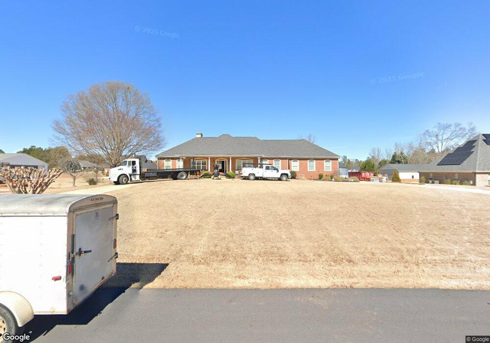
480 Mallard Ln Locust Grove, GA 30248
Estimated Value: $610,000 - $699,000
3
Beds
3
Baths
2,800
Sq Ft
$236/Sq Ft
Est. Value
About This Home
This home is located at 480 Mallard Ln, Locust Grove, GA 30248 and is currently estimated at $661,561, approximately $236 per square foot. 480 Mallard Ln is a home located in Henry County with nearby schools including Bethlehem Elementary School, Luella Middle School, and Luella High School.
Ownership History
Date
Name
Owned For
Owner Type
Purchase Details
Closed on
Mar 22, 2024
Sold by
Dean Richard L
Bought by
Milligan David and Milligan Elizabeth Gustafson
Current Estimated Value
Home Financials for this Owner
Home Financials are based on the most recent Mortgage that was taken out on this home.
Original Mortgage
$554,000
Outstanding Balance
$544,889
Interest Rate
6.69%
Mortgage Type
New Conventional
Estimated Equity
$116,672
Purchase Details
Closed on
Sep 7, 2017
Sold by
Zubrod John W
Bought by
Dean Richard L and Dean Norma J
Home Financials for this Owner
Home Financials are based on the most recent Mortgage that was taken out on this home.
Original Mortgage
$294,115
Interest Rate
3.9%
Mortgage Type
New Conventional
Purchase Details
Closed on
Apr 4, 2005
Sold by
Zubrod Donald E
Bought by
Zubrod Donald E
Purchase Details
Closed on
Oct 2, 2003
Sold by
Vanloon John T
Bought by
Zubrod Donald E and Zubrod Donna
Create a Home Valuation Report for This Property
The Home Valuation Report is an in-depth analysis detailing your home's value as well as a comparison with similar homes in the area
Home Values in the Area
Average Home Value in this Area
Purchase History
| Date | Buyer | Sale Price | Title Company |
|---|---|---|---|
| Milligan David | $694,000 | -- | |
| Dean Richard L | $303,211 | -- | |
| Zubrod Donald E | -- | -- | |
| Zubrod Donald E | $84,900 | -- |
Source: Public Records
Mortgage History
| Date | Status | Borrower | Loan Amount |
|---|---|---|---|
| Open | Milligan David | $554,000 | |
| Previous Owner | Dean Richard L | $294,115 |
Source: Public Records
Tax History Compared to Growth
Tax History
| Year | Tax Paid | Tax Assessment Tax Assessment Total Assessment is a certain percentage of the fair market value that is determined by local assessors to be the total taxable value of land and additions on the property. | Land | Improvement |
|---|---|---|---|---|
| 2024 | $8,027 | $251,160 | $30,000 | $221,160 |
| 2023 | $7,407 | $246,160 | $30,000 | $216,160 |
| 2022 | $6,996 | $205,720 | $30,000 | $175,720 |
| 2021 | $6,948 | $202,280 | $30,000 | $172,280 |
| 2020 | $5,600 | $163,120 | $30,000 | $133,120 |
| 2019 | $5,602 | $163,200 | $30,000 | $133,200 |
| 2018 | $4,423 | $121,320 | $21,716 | $99,604 |
| 2016 | $4,780 | $123,560 | $26,000 | $97,560 |
| 2015 | $5,153 | $129,280 | $26,000 | $103,280 |
| 2014 | $4,692 | $116,240 | $24,000 | $92,240 |
Source: Public Records
Map
Nearby Homes
- 167 Pintail Way
- 369 Canvasback Trail
- 0 Mallard Ln Unit LOT 51 10565157
- 305 Canvasback Trail
- 335 Canvasback Trail
- 2234 Golden Eagle Dr
- 2200 Golden Eagle Dr
- 1004 Linford Ct
- Wagener Plan at Kingston
- 302 Linford Dr
- Wynwood Plan at Kingston
- Rainier Plan at Kingston
- Rosemary II Plan at Kingston
- Clarity Plan at Kingston
- Lauren II Plan at Kingston
- Henry II Plan at Kingston
- Meridian II Plan at Kingston
- 242 Linford Dr
- 238 Linford Dr
- 460 Mallard Ln
- 500 Mallard Ln
- 107 Pintail Way
- 485 Mallard Ln
- 143 Pintail Way
- 465 Mallard Ln
- 505 Mallard Ln
- 450 Mallard Ln
- N/A Pintail Way
- 445 Mallard Ln
- 85 Pintail Way
- 525 Mallard Ln
- 550 Mallard Ln Unit 50
- 550 Mallard Ln
- 155 Pintail Way
- 0 Pintail Way Unit 66 7128801
- 0 Pintail Way Unit 66
- 0 Pintail Way Unit 66 7544700
- 0 Pintail Way Unit 8953502
- 0 Pintail Way Unit 8837341