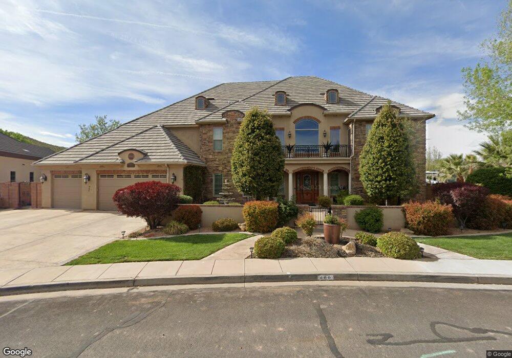
480 Michael Cir Santa Clara, UT 84765
Estimated Value: $1,446,000 - $1,852,173
5
Beds
4
Baths
6,499
Sq Ft
$258/Sq Ft
Est. Value
About This Home
This home is located at 480 Michael Cir, Santa Clara, UT 84765 and is currently estimated at $1,674,543, approximately $257 per square foot. 480 Michael Cir is a home located in Washington County with nearby schools including Arrowhead School, Snow Canyon Middle School, and Lava Ridge Intermediate School.
Ownership History
Date
Name
Owned For
Owner Type
Purchase Details
Closed on
Mar 19, 2026
Sold by
Kory Randall
Bought by
Sellers Kory and Sellers Kirby
Current Estimated Value
Purchase Details
Closed on
May 19, 2025
Sold by
Sellers Diane
Bought by
Sellers Kory Randall
Purchase Details
Closed on
Aug 13, 2014
Sold by
Davis Matthew L and Davis Therese A
Bought by
Davis Revocable Trust and Davis Therese A
Purchase Details
Closed on
May 1, 2013
Sold by
Isladay Llc
Bought by
Davis Matthew L and Davis Therese A
Purchase Details
Closed on
Feb 25, 2013
Sold by
Anderson Ryan
Bought by
Isladay Llc
Purchase Details
Closed on
Apr 2, 2012
Sold by
Callahan Dennis N and Callahan Lisa W
Bought by
Anderson Ryan
Create a Home Valuation Report for This Property
The Home Valuation Report is an in-depth analysis detailing your home's value as well as a comparison with similar homes in the area
Purchase History
| Date | Buyer | Sale Price | Title Company |
|---|---|---|---|
| Sellers Kory | -- | Accommodation/Courtesy Recordi | |
| Sellers Kory Randall | -- | -- | |
| Davis Revocable Trust | -- | None Available | |
| Davis Matthew L | -- | Southern Utah Title | |
| Isladay Llc | -- | Southern Utah Title | |
| Anderson Ryan | -- | Dixie Title Co |
Source: Public Records
Tax History
| Year | Tax Paid | Tax Assessment Tax Assessment Total Assessment is a certain percentage of the fair market value that is determined by local assessors to be the total taxable value of land and additions on the property. | Land | Improvement |
|---|---|---|---|---|
| 2025 | $5,748 | $899,415 | $247,500 | $651,915 |
| 2023 | $5,497 | $805,145 | $192,500 | $612,645 |
| 2022 | $5,232 | $720,005 | $137,500 | $582,505 |
| 2021 | $5,647 | $1,155,400 | $170,000 | $985,400 |
| 2020 | $5,128 | $1,027,300 | $170,000 | $857,300 |
| 2019 | $4,442 | $836,300 | $130,000 | $706,300 |
| 2018 | $4,522 | $439,120 | $0 | $0 |
| 2017 | $4,879 | $459,855 | $0 | $0 |
| 2016 | $4,943 | $430,980 | $0 | $0 |
| 2015 | $5,235 | $437,855 | $0 | $0 |
| 2014 | $5,106 | $431,090 | $0 | $0 |
Source: Public Records
Map
Nearby Homes
- 754 Swiss Haven Cir
- 319 Lost Creek Dr W
- 2368 Covey Ln
- 2360 W Chardonnay Ln
- 409 N Country Ln Unit 39
- 409 N Country Ln Unit 1
- 409 N Country Ln Unit 31
- 2679 W Emeraud Dr
- 2286 Malaga Ave
- 2497 River Cir
- 2420 Sage Dr Unit 37
- 2263 Malaga Ave
- 875 Country Ln
- 874 Lugano Ln
- 2204 W Courtyard Dr
- 1594 W Sunset Blvd Unit 3
- 2428 E Santa Clara Dr
- 470 N Country Ln Unit 6
- 470 N Country Ln Unit 11
- 221 Emeraud Dr Unit 11
- LOT 4 Phase 4
- 0 Michael Cir
- LOT 5 Phase 4
- 440 Michael Cir
- 619 Marion Ct
- 625 Marion Ct
- 510 Claude Dr
- 455 Michael Cir
- 455 Michael Cir Unit LOT 9
- 488 Claude Dr
- 620 Claude Dr
- 0 Marion Ct
- 299 Claude Dr
- 637 Marion Ct
- 395 Michael Cir
- 395 Michael Dr
- 460 Claude Dr
- 644 Claude Dr
- Lot #2 Vineyards - Ph 10
- 646 Marion Ct
Your Personal Tour Guide
Ask me questions while you tour the home.