Estimated Value: $262,942 - $379,000
2
Beds
1
Bath
883
Sq Ft
$365/Sq Ft
Est. Value
About This Home
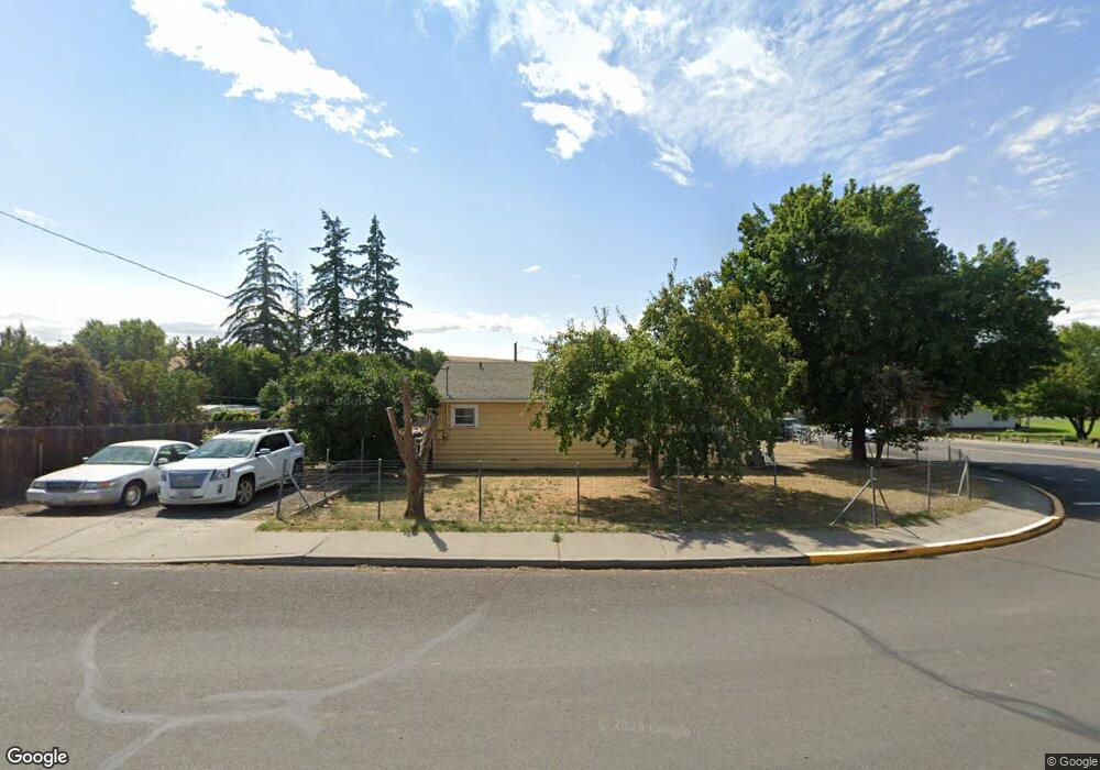
This home is located at 480 NW Main St, Dufur, OR 97021 and is currently estimated at $321,986, approximately $364 per square foot. 480 NW Main St is a home located in Wasco County with nearby schools including Dufur School.
Ownership History
Date
Name
Owned For
Owner Type
Purchase Details
Closed on
Jul 24, 2007
Sold by
Krein Robert A
Bought by
Krein Jenny R and Offel Keith A
Current Estimated Value
Home Financials for this Owner
Home Financials are based on the most recent Mortgage that was taken out on this home.
Original Mortgage
$108,000
Outstanding Balance
$68,310
Interest Rate
6.73%
Mortgage Type
New Conventional
Estimated Equity
$253,676
Purchase Details
Closed on
Sep 6, 2005
Sold by
Ward Michael W
Bought by
Krein Robert A
Home Financials for this Owner
Home Financials are based on the most recent Mortgage that was taken out on this home.
Original Mortgage
$45,000
Interest Rate
5.7%
Mortgage Type
New Conventional
Create a Home Valuation Report for This Property
The Home Valuation Report is an in-depth analysis detailing your home's value as well as a comparison with similar homes in the area
Home Values in the Area
Average Home Value in this Area
Purchase History
| Date | Buyer | Sale Price | Title Company |
|---|---|---|---|
| Krein Jenny R | $135,000 | -- | |
| Krein Robert A | $50,000 | -- |
Source: Public Records
Mortgage History
| Date | Status | Borrower | Loan Amount |
|---|---|---|---|
| Open | Krein Jenny R | $108,000 | |
| Closed | Krein Robert A | $45,000 |
Source: Public Records
Tax History Compared to Growth
Tax History
| Year | Tax Paid | Tax Assessment Tax Assessment Total Assessment is a certain percentage of the fair market value that is determined by local assessors to be the total taxable value of land and additions on the property. | Land | Improvement |
|---|---|---|---|---|
| 2024 | $1,613 | $102,900 | -- | -- |
| 2023 | $1,566 | $99,903 | $0 | $0 |
| 2022 | $1,524 | $12,672 | $0 | $0 |
| 2021 | $1,457 | $12,303 | $0 | $0 |
| 2020 | $1,450 | $11,945 | $0 | $0 |
| 2019 | $1,398 | $11,597 | $0 | $0 |
| 2018 | $1,211 | $86,177 | $0 | $0 |
| 2017 | $1,326 | $83,667 | $0 | $0 |
| 2016 | $1,336 | $81,230 | $0 | $0 |
Source: Public Records
Map
Nearby Homes
- 381 NW Main St
- 552 Williams St
- 211 NW Heisler St
- 315 NE 3rd St
- 340 NE 7th St
- 520 NE 6th St
- 426 Hogans Alley
- 910 Toll Rd
- 10 NE Klinger St
- 0 Burtner Rd
- 5331 Dolan Rd
- 5401 Upper Five Mile Rd
- 80357 S Valley Rd
- 80165 Ridgetop Rd
- 2018 Steele Rd
- 0 Friend Rd Unit 23907473
- 0 Friend Rd Unit 23907475
- 0 Friend Rd Unit 735468339
- 0 Friend Rd Unit 375267035
- 0 Friend Rd Unit 11518394