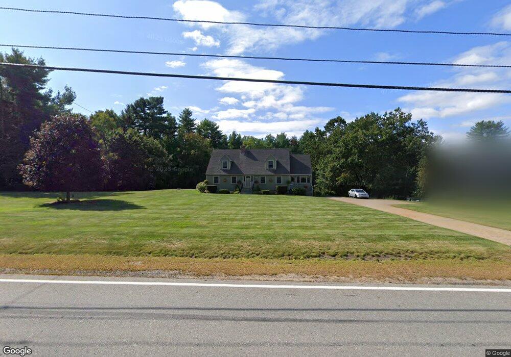
480 Pleasant St Dunstable, MA 01827
Estimated Value: $644,000 - $744,000
3
Beds
2
Baths
2,300
Sq Ft
$302/Sq Ft
Est. Value
About This Home
This home is located at 480 Pleasant St, Dunstable, MA 01827 and is currently estimated at $694,314, approximately $301 per square foot. 480 Pleasant St is a home located in Middlesex County with nearby schools including Groton Dunstable Regional High School and Maple Dene & Moppet School.
Ownership History
Date
Name
Owned For
Owner Type
Purchase Details
Closed on
Mar 29, 1996
Sold by
Goss Charles and Goss Suzanne
Bought by
Cormier Normand and Mersicano Marjorie
Current Estimated Value
Home Financials for this Owner
Home Financials are based on the most recent Mortgage that was taken out on this home.
Original Mortgage
$160,550
Outstanding Balance
$7,234
Interest Rate
6.9%
Mortgage Type
Purchase Money Mortgage
Estimated Equity
$687,080
Create a Home Valuation Report for This Property
The Home Valuation Report is an in-depth analysis detailing your home's value as well as a comparison with similar homes in the area
Home Values in the Area
Average Home Value in this Area
Purchase History
| Date | Buyer | Sale Price | Title Company |
|---|---|---|---|
| Cormier Normand | $169,000 | -- |
Source: Public Records
Mortgage History
| Date | Status | Borrower | Loan Amount |
|---|---|---|---|
| Open | Cormier Normand | $160,550 |
Source: Public Records
Tax History Compared to Growth
Tax History
| Year | Tax Paid | Tax Assessment Tax Assessment Total Assessment is a certain percentage of the fair market value that is determined by local assessors to be the total taxable value of land and additions on the property. | Land | Improvement |
|---|---|---|---|---|
| 2025 | $7,312 | $531,800 | $221,100 | $310,700 |
| 2024 | $7,002 | $501,600 | $202,800 | $298,800 |
| 2023 | $6,795 | $453,900 | $202,800 | $251,100 |
| 2022 | $6,763 | $443,500 | $202,800 | $240,700 |
| 2021 | $6,429 | $391,800 | $185,500 | $206,300 |
| 2020 | $6,456 | $383,400 | $185,500 | $197,900 |
| 2019 | $6,067 | $372,900 | $185,500 | $187,400 |
| 2018 | $11,931 | $346,600 | $184,400 | $162,200 |
| 2017 | $5,828 | $342,400 | $184,400 | $158,000 |
| 2016 | $5,370 | $324,500 | $176,200 | $148,300 |
| 2015 | $5,230 | $312,600 | $148,500 | $164,100 |
| 2014 | $4,854 | $307,800 | $148,500 | $159,300 |
Source: Public Records
Map
Nearby Homes
- 319 Pleasant St
- 62 Brook St
- 153 Off Pond St
- 24 Unkety Brook Way
- 208 North St
- 660 Old Dunstable Rd
- 4 Thorndike St
- 446 Westford St
- 2 Wildflower Ln
- 14 Hadley Dr
- 3 Woodbury Dr
- 169 Nashua Rd
- 38 Tarbell St Unit 5B
- 38 Tarbell St Unit 1D
- 29 Tarbell St
- 33 Overlook Dr
- 121 Cherrywood Dr
- 3 Testament Cir Unit 11
- 0 Old Dunstable Rd
- 0 Lowell St
- 500 Pleasant St
- 485 Pleasant St
- 460 Pleasant St
- 461 Pleasant St
- 473 Pleasant St
- 322 Depot St
- 446 Pleasant St
- 443 Pleasant St
- 493 Pleasant St
- 314 Depot St
- 433 Pleasant St
- 306 Depot St
- 436 Pleasant St
- 423 Pleasant St
- 302 Depot St
- 290 Depot St
- 300 Depot St
- 411 Pleasant St
- 411 Pleasant St Unit rear
- 33 Pleasant Street Extension