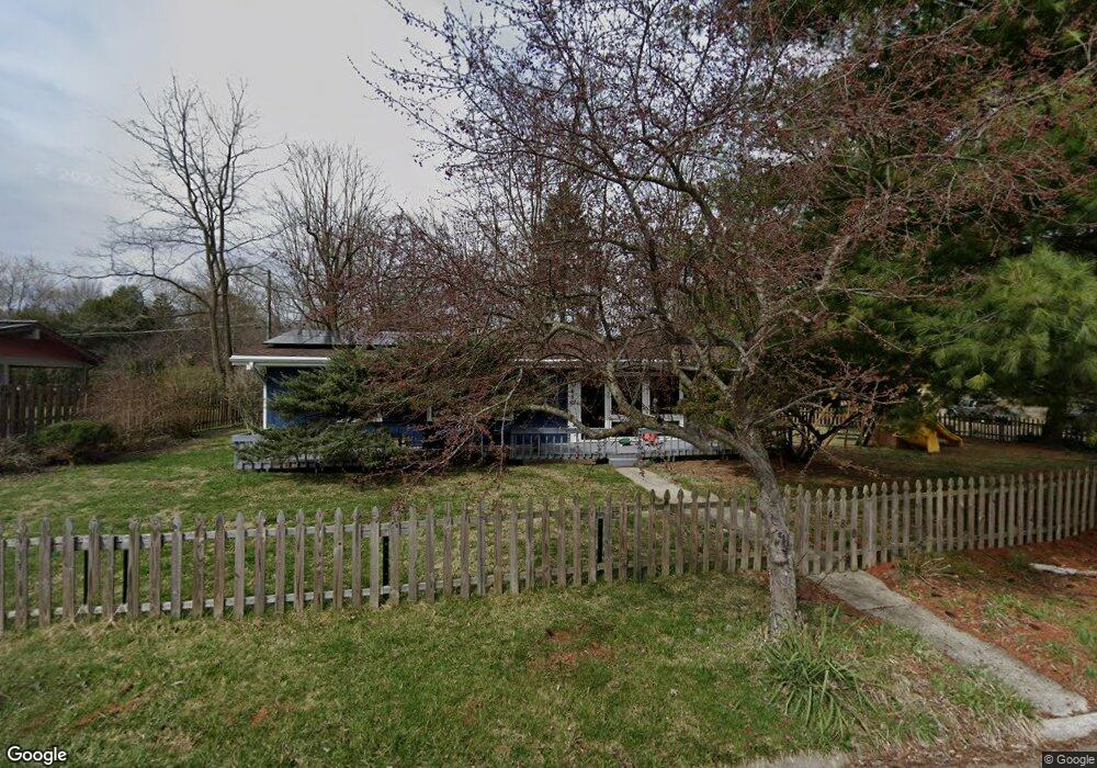
480 Polecat Rd Yellow Springs, OH 45387
Estimated Value: $296,000 - $337,000
3
Beds
2
Baths
1,695
Sq Ft
$188/Sq Ft
Est. Value
About This Home
This home is located at 480 Polecat Rd, Yellow Springs, OH 45387 and is currently estimated at $319,116, approximately $188 per square foot. 480 Polecat Rd is a home located in Greene County with nearby schools including Mills Lawn Elementary School, Yellow Springs High School & McKinney Middle School, and The Antioch School.
Ownership History
Date
Name
Owned For
Owner Type
Purchase Details
Closed on
Aug 13, 2021
Sold by
Saber Sammy M and Bouquet Dorothee M
Bought by
Saber Sammy M and Bouquet Dorothee M
Current Estimated Value
Purchase Details
Closed on
May 13, 2020
Sold by
Saber Sammy M and Bouquet Dorothee M
Bought by
Saber Sammy M and Bouquet Dorothee M
Purchase Details
Closed on
Jan 8, 2015
Sold by
Piatt Steven L and Minton Cynthia A
Bought by
Bouquet Dorothee M and Saber Sammy M
Purchase Details
Closed on
Feb 22, 2008
Sold by
Minton Cynthia A
Bought by
Piatt Steven L and Minton Cynthia A
Purchase Details
Closed on
Nov 1, 1988
Bought by
Piatt Steven L and Piatt Piatt
Create a Home Valuation Report for This Property
The Home Valuation Report is an in-depth analysis detailing your home's value as well as a comparison with similar homes in the area
Home Values in the Area
Average Home Value in this Area
Purchase History
| Date | Buyer | Sale Price | Title Company |
|---|---|---|---|
| Saber Sammy M | -- | None Available | |
| Saber Sammy M | -- | None Available | |
| Bouquet Dorothee M | $162,000 | None Available | |
| Piatt Steven L | -- | Attorney | |
| Piatt Steven L | $57,000 | -- |
Source: Public Records
Tax History Compared to Growth
Tax History
| Year | Tax Paid | Tax Assessment Tax Assessment Total Assessment is a certain percentage of the fair market value that is determined by local assessors to be the total taxable value of land and additions on the property. | Land | Improvement |
|---|---|---|---|---|
| 2024 | $4,913 | $86,280 | $18,150 | $68,130 |
| 2023 | $4,913 | $86,280 | $18,150 | $68,130 |
| 2022 | $4,053 | $67,400 | $15,640 | $51,760 |
| 2021 | $3,803 | $67,400 | $15,640 | $51,760 |
| 2020 | $3,816 | $67,400 | $15,640 | $51,760 |
| 2019 | $3,595 | $57,790 | $13,690 | $44,100 |
| 2018 | $3,585 | $57,790 | $13,690 | $44,100 |
| 2017 | $2,812 | $57,790 | $13,690 | $44,100 |
| 2016 | $2,813 | $46,010 | $13,130 | $32,880 |
| 2015 | $2,937 | $46,010 | $13,130 | $32,880 |
| 2014 | $1,418 | $46,010 | $13,130 | $32,880 |
Source: Public Records
Map
Nearby Homes
- 235 Northwood Dr
- 0 Xenia Ave Unit 934833
- 0 Xenia Ave Unit 1038888
- 602 Keystone Ct
- 4410 Us Route 68 N
- 425 Snowdrop Dr
- 513 Lincoln Ct
- 260 King St
- 504 Phillips St
- 414 S High St
- 125 Park Meadows Dr
- 404 Snowdrop Dr
- Danville Plan at Spring Meadows - Maple Street Collection
- Beacon Plan at Spring Meadows - Maple Street Collection
- DaVinci Plan at Spring Meadows - Maple Street Collection
- Cumberland Plan at Spring Meadows - Maple Street Collection
- Greenbriar Plan at Spring Meadows - Maple Street Collection
- Wesley Plan at Spring Meadows - Maple Street Collection
- Jensen Plan at Spring Meadows - Maple Street Collection
- Fairfax Plan at Spring Meadows - Maple Street Collection
- 205 Northwood Dr
- 470 Polecat Rd
- 209 Whitehall Dr
- 203 Whitehall Dr
- 202 Northwood Dr
- 460 Polecat Rd
- 206 Northwood Dr
- 440 Polecat Rd
- 219 Whitehall Dr
- 202 Whitehall Dr
- 206 Whitehall Dr
- 210 Whitehall Dr
- 210 Northwood Dr
- 214 Whitehall Dr
- 430 Polecat Rd
- 223 Northwood Dr
- 223 Whitehall Dr
- 218 Whitehall Dr
- 214 Northwood Dr
- 227 Northwood Dr