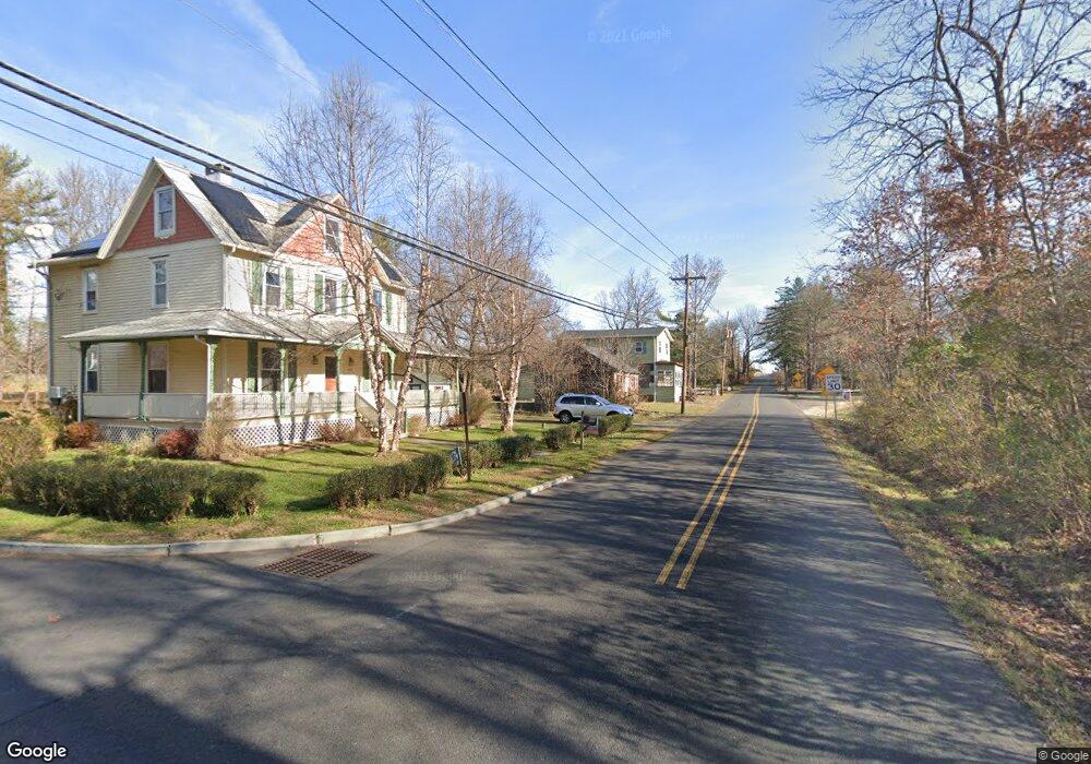
480 Route 518 Skillman, NJ 08558
Estimated Value: $508,699 - $829,000
Studio
--
Bath
2,498
Sq Ft
$291/Sq Ft
Est. Value
About This Home
This home is located at 480 Route 518, Skillman, NJ 08558 and is currently estimated at $726,675, approximately $290 per square foot. 480 Route 518 is a home located in Somerset County with nearby schools including Orchard Hill Elementary School, Village Elementary School, and Montgomery Lower Mid School.
Ownership History
Date
Name
Owned For
Owner Type
Purchase Details
Closed on
Dec 5, 2023
Sold by
John R George Living Trust
Bought by
George And Allen Irrevocable Trust and George
Current Estimated Value
Purchase Details
Closed on
Oct 12, 2015
Sold by
George John R
Bought by
George John R and John R George Living Trust
Home Financials for this Owner
Home Financials are based on the most recent Mortgage that was taken out on this home.
Original Mortgage
$376,000
Interest Rate
4.07%
Mortgage Type
New Conventional
Purchase Details
Closed on
Aug 21, 2015
Sold by
Knorr Throckmorton Courtney and Knorr Throckmorton Barbara
Bought by
George John R
Home Financials for this Owner
Home Financials are based on the most recent Mortgage that was taken out on this home.
Original Mortgage
$376,000
Interest Rate
4.07%
Mortgage Type
New Conventional
Create a Home Valuation Report for This Property
The Home Valuation Report is an in-depth analysis detailing your home's value as well as a comparison with similar homes in the area
Home Values in the Area
Average Home Value in this Area
Purchase History
| Date | Buyer | Sale Price | Title Company |
|---|---|---|---|
| George And Allen Irrevocable Trust | -- | None Listed On Document | |
| George John R | -- | Attorney | |
| George John R | $470,000 | First American Title |
Source: Public Records
Mortgage History
| Date | Status | Borrower | Loan Amount |
|---|---|---|---|
| Previous Owner | George John R | $376,000 |
Source: Public Records
Tax History
| Year | Tax Paid | Tax Assessment Tax Assessment Total Assessment is a certain percentage of the fair market value that is determined by local assessors to be the total taxable value of land and additions on the property. | Land | Improvement |
|---|---|---|---|---|
| 2025 | $9,770 | $285,000 | $150,000 | $135,000 |
| 2024 | $9,770 | $285,000 | $150,000 | $135,000 |
| 2023 | $9,756 | $285,000 | $150,000 | $135,000 |
| 2022 | $9,186 | $285,000 | $150,000 | $135,000 |
| 2021 | $9,090 | $285,000 | $150,000 | $135,000 |
| 2020 | $9,029 | $285,000 | $150,000 | $135,000 |
| 2019 | $8,966 | $285,000 | $150,000 | $135,000 |
| 2018 | $8,755 | $285,000 | $150,000 | $135,000 |
| 2017 | $8,621 | $285,000 | $150,000 | $135,000 |
| 2016 | $8,470 | $285,000 | $150,000 | $135,000 |
| 2015 | $8,282 | $285,000 | $150,000 | $135,000 |
| 2014 | $8,182 | $285,000 | $150,000 | $135,000 |
Source: Public Records
Map
Nearby Homes
- 0 Mountain View Rd
- 206 Van Zandt Rd
- 17 Spyglass Rd
- 47 Van Zandt Rd
- 272 Skillman Rd
- 1015 Cherry Hill Rd
- 957 Cherry Hill Rd
- 947 Cherry Hill Rd
- 9 Winged Foot Ct
- 48 Fairview Rd
- 45 Camp Meeting Ave
- 16 Dorland Farm Ct
- 1 Interlachen Ct
- 77 Meadow Run Dr
- 122 Bedens Brook Rd
- 15 Dublin Rd
- 42 Stouts Rd
- 1330 Great Rd
- 64 Bedford Dr
- 6 Betsy Ross Ct
- 476 Route 518
- 400 Mountain View Rd
- 468 County Road 518
- 468 Route 518
- 477 Route 518
- 494 Route 518
- 396 Mountain View Rd
- 466 Route 518
- 485 Route 518
- 98 Wild Azalea Ln
- 392 Mountain View Rd
- 110 Wild Azalea Ln
- 491 Route 518
- 498 Route 518
- 460 Route 518
- 86 Wild Azalea Ln
- 460 Georgetown and Franklin Turnpike
- 495 Route 518
- 72 Wild Azalea Ln
- 389 Mountain View Rd
Your Personal Tour Guide
Ask me questions while you tour the home.